Great American Eclipse wanderlust, days 12 and 13
Day 11 may be found here.
I sleep late, and conclude that I am not going to drive to Monticello today as originally planned. Extending my vacation by a day shouldn’t be much of a problem. and it seems prudent.
I do need some exercise, and I toy with the idea of driving up to Antelope Island and its interesting Precambrian beds. These include glacial conglomerates from the Huronian glaciation, the worst ice age Earth has ever experienced. But it’s a long drive and won’t exactly rest me up for the longer drive home tomorrow. I decide to get my exercise by walking in the general direction of Rock Canyon. Antelope Island can wait until a later trip.
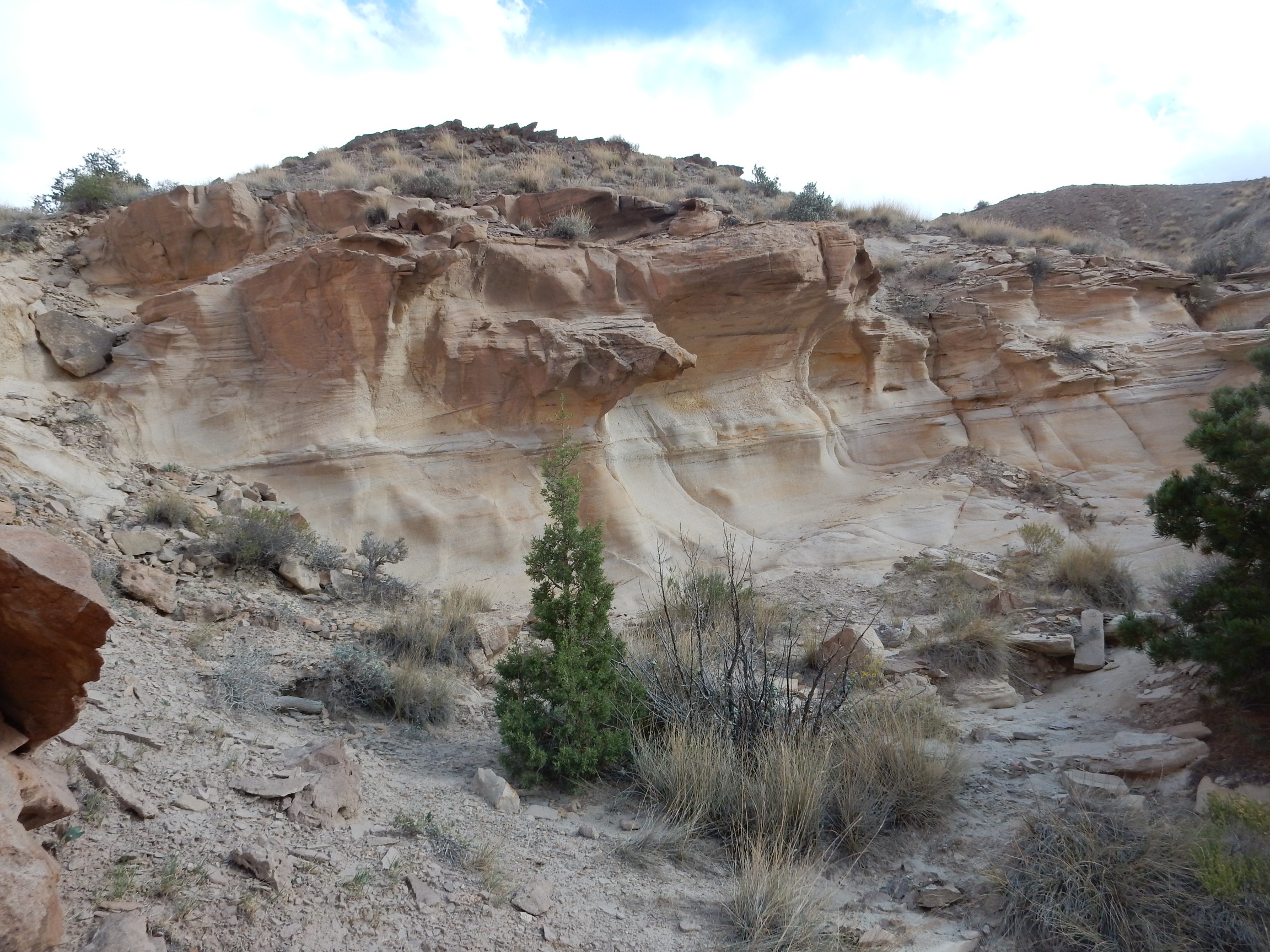
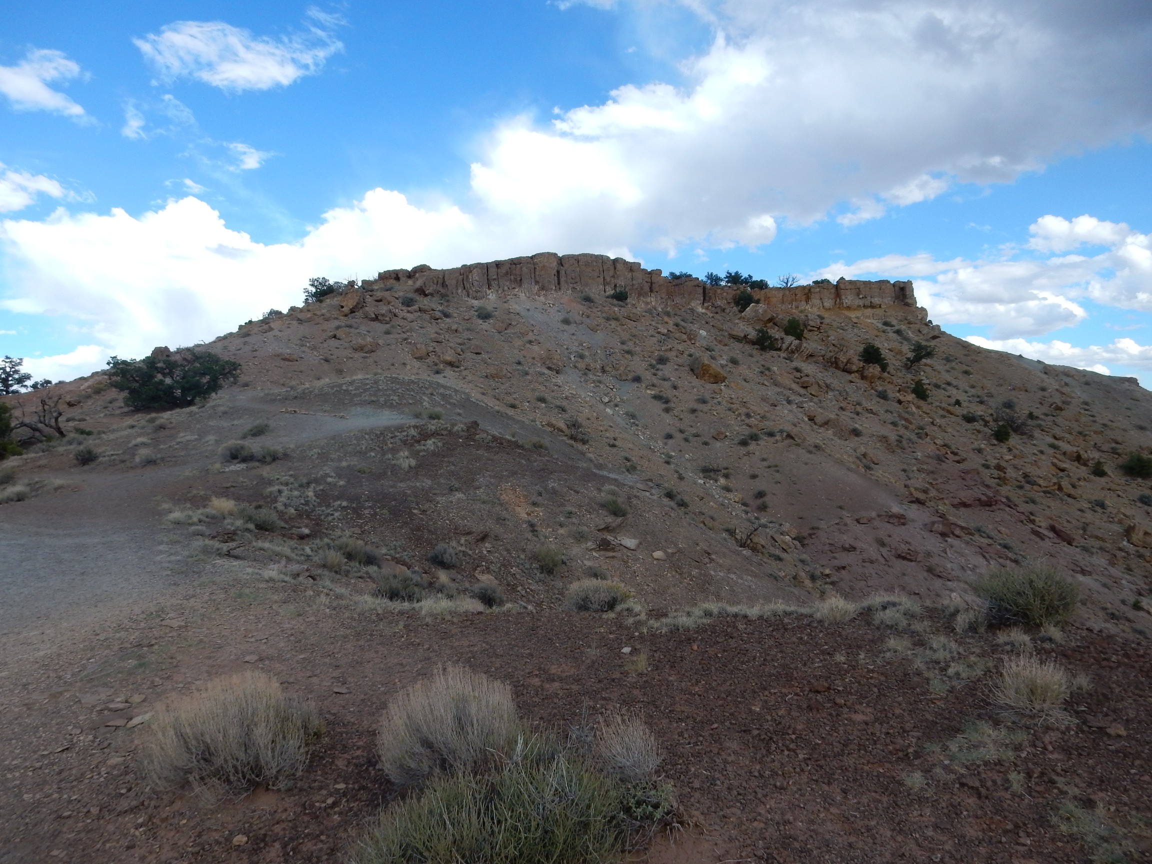
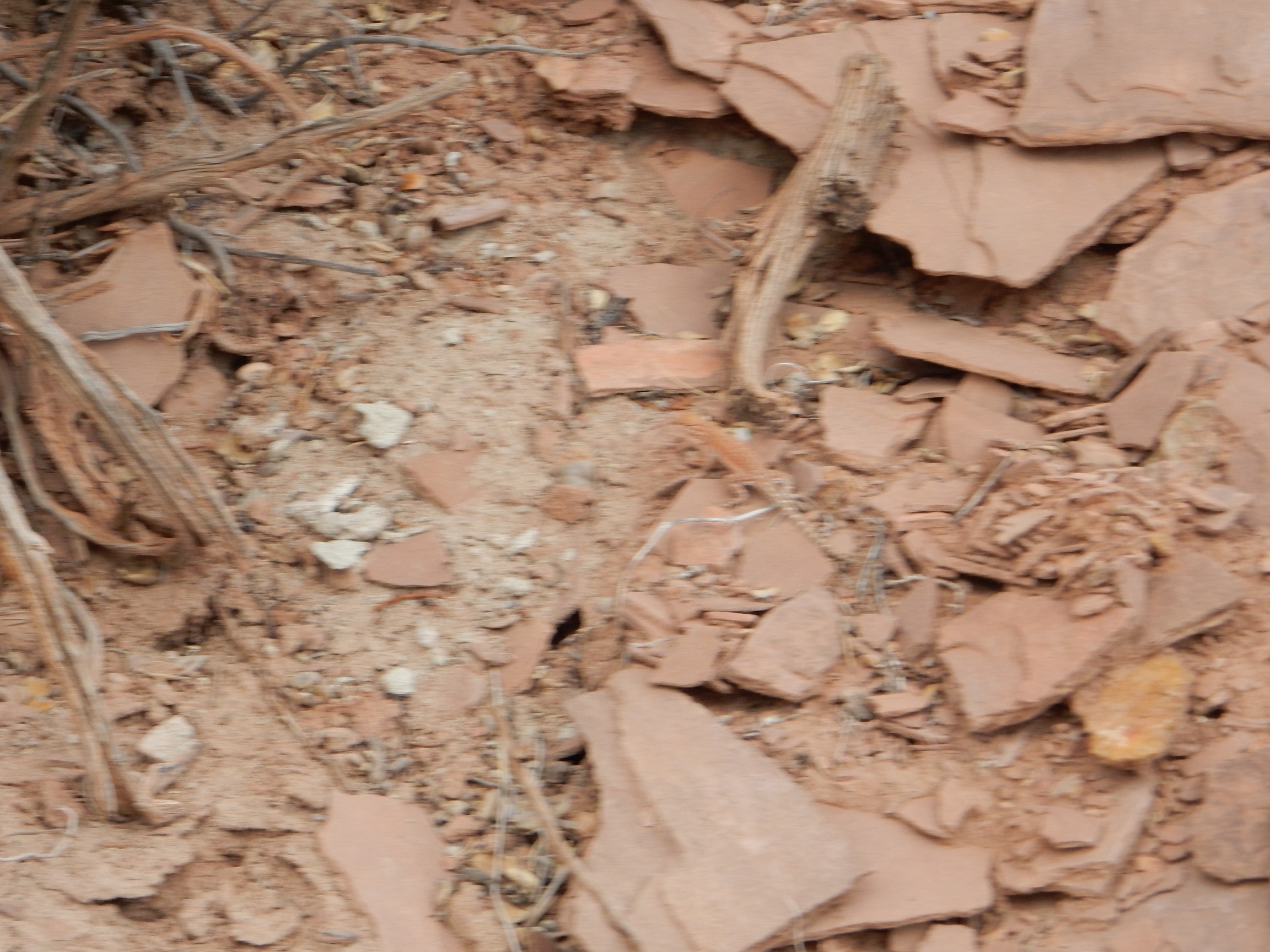
I don’t make it to the actual canyon — the walk is longer than it looks — but I do at least make it to the beach.
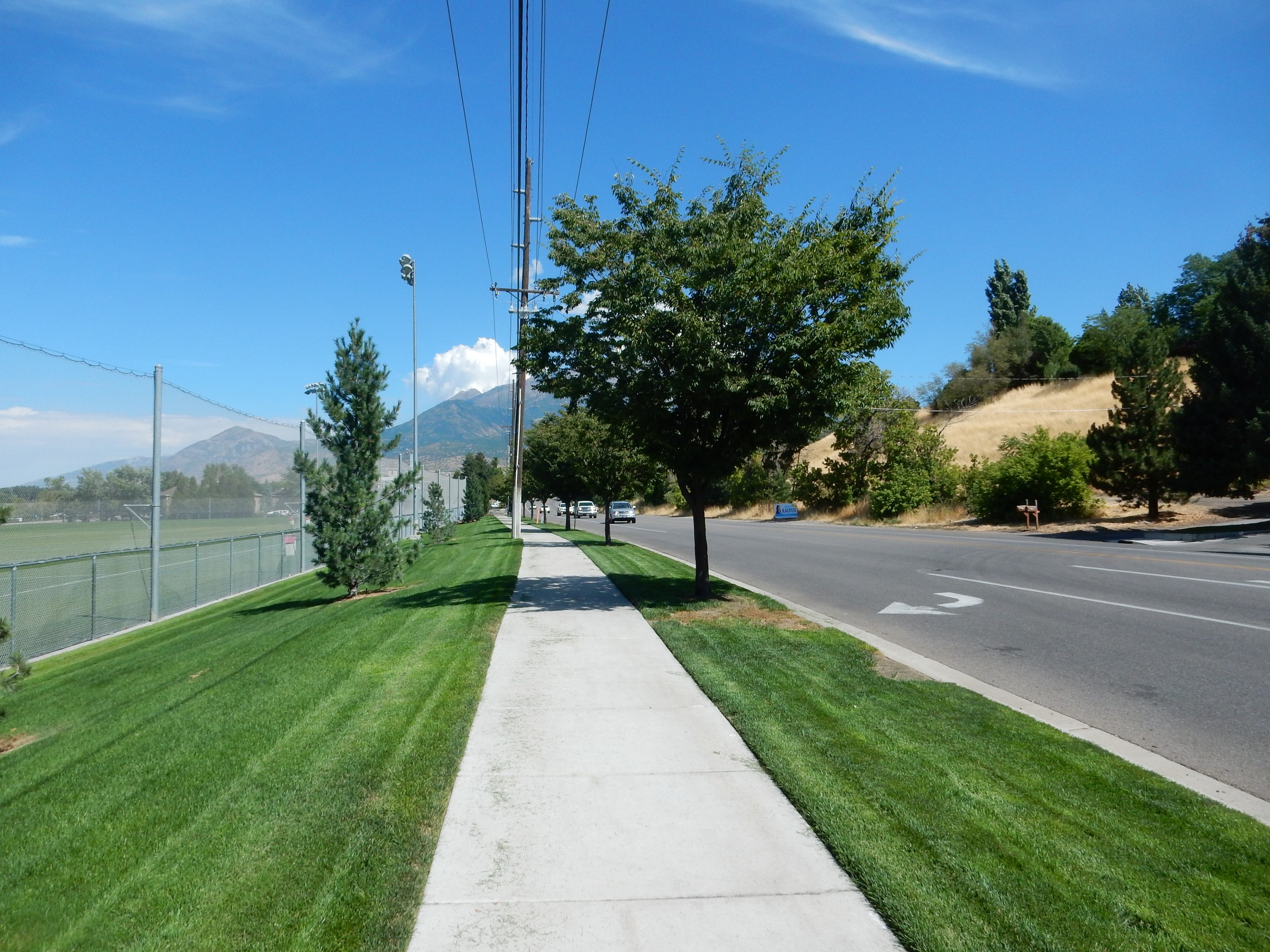
However, the tide has been out for some tens of thousands of years. The hill at right is a beach deposit from the Provo stand of Lake Bonneville, the freshwater lake ancestral to today’s Great Salt Lake.
On my return, I try to log on to my mother’s computer and change my reservation for the camp site in Monticello. Alas, my password wallet service won’t give me my passwords until I verify it’s really me, because I’m at a strange IP address. I’m suppose to verify using my Oracle email account. Alas, that, too, won’t let me on until I verify it’s really me by entering a verification code mailed to my alternate email. And my alternate email requires a password stored in my password wallet. I decide I’m going to have to bite the bullet, and change my security settings to use my rarely-carried cell phone as my verification device. After I get home, my services recognize me, and lets me log in to make the change to my verification settings …
I can neither cancel my old reservation nor get a new one. Well, it’s only $10, and the campground I usually use is rarely full to capacity. I’ll just have to wing it.
I visit with Mom the rest of the afternoon, and, that evening, we have dinner with my sister, Lori, and her husband and daughter. I get to meet my niece’s fiance. Lori was in Wyoming for the eclipse and we trade observations. Lori is remarkably patient with my obsessions; she even has me show her all the pictures I’ve taken so far on this trip.
I get up the next morning at a reasonable hour, have a final breakfast with Mom, and depart for Monticello. I have decided to go by way of the Hite crossing of the Colorado River, which is historically significant as the only crossing between Moab and Lees Ferry. (There is now an engineered crossing at Page, over the Glenn Canyon Dam, but that’s still a big interval of river uncrossed.)
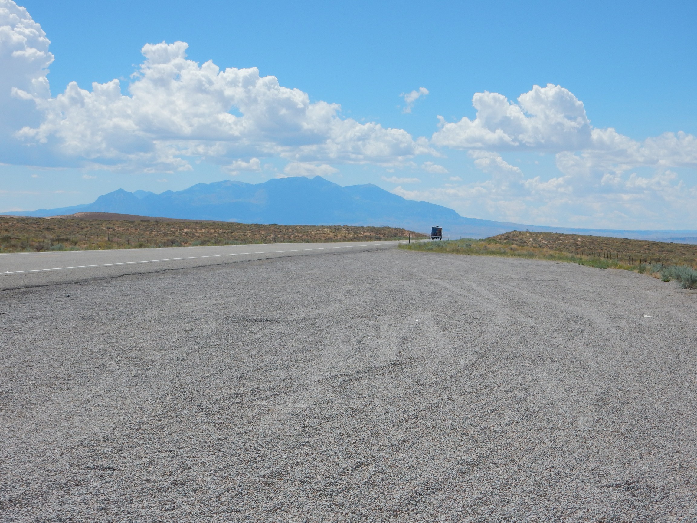
I try to get a good shot of the fault escarpment at the base of the Wasatch Mountains.
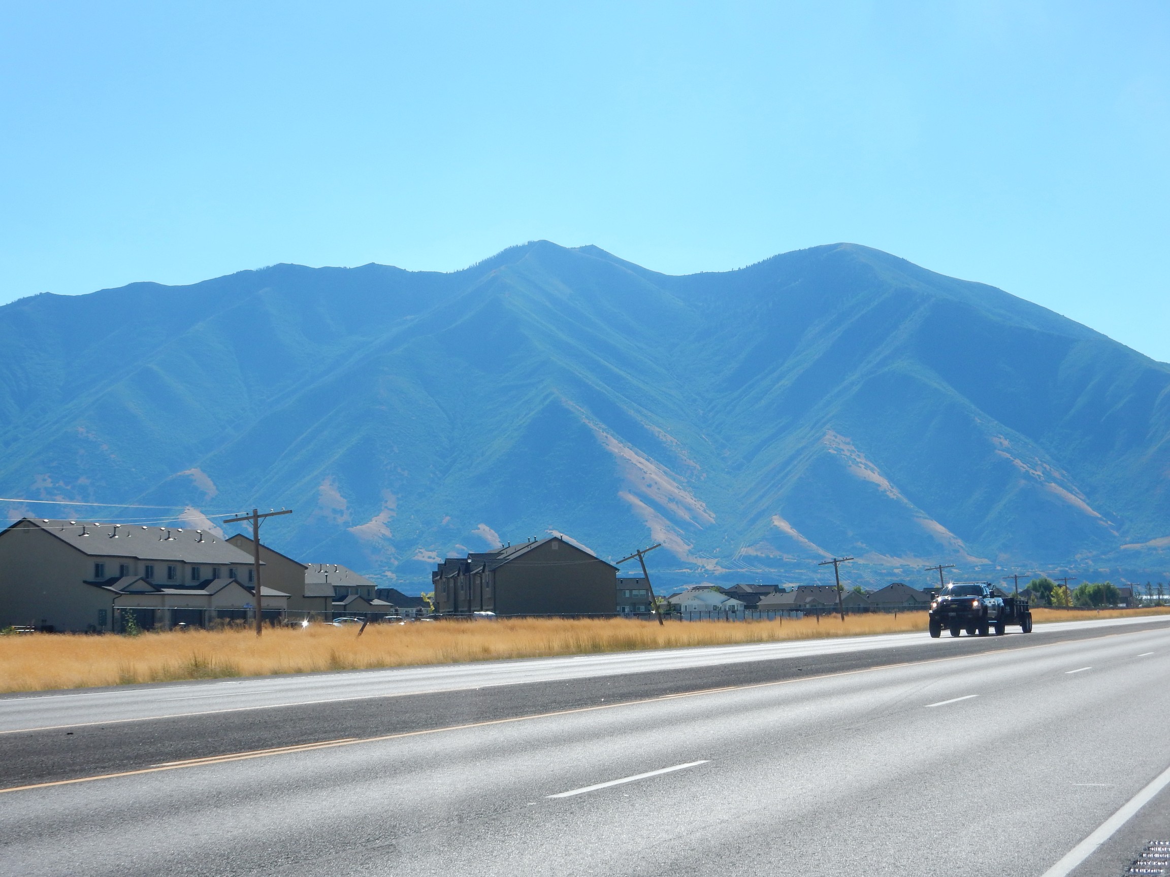
Meh, too much city in the way. The fault produces characteristic triangular facets at the base of the mountains, not too clearly visible here.
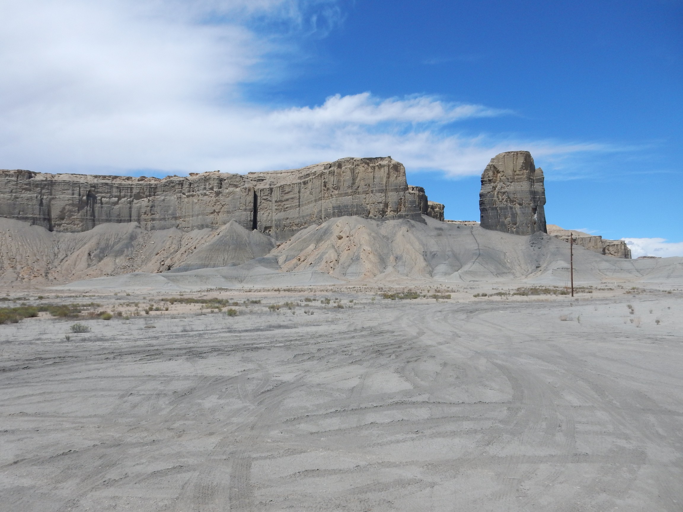
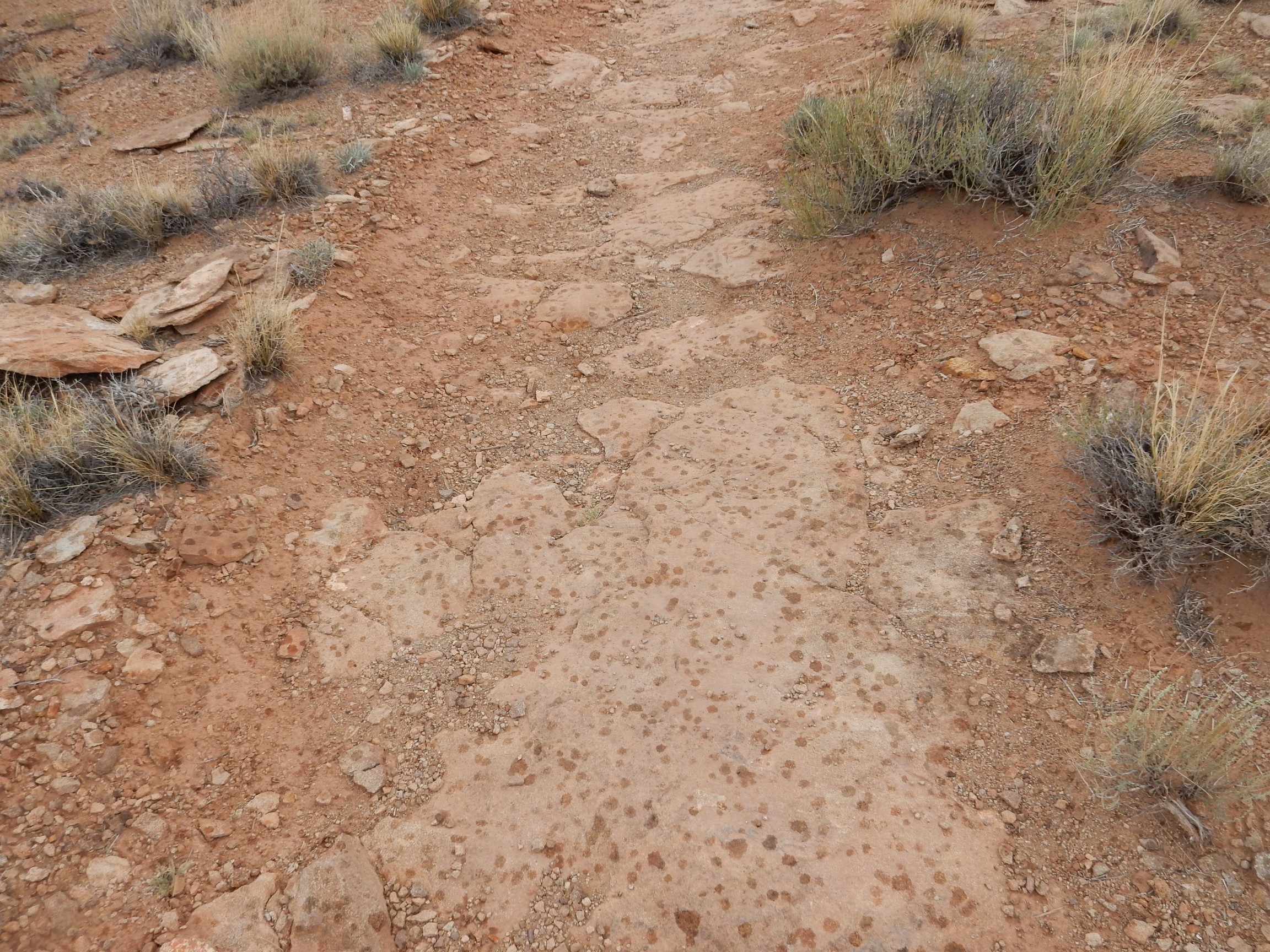
On the other hand, I get a very nice photo of a pediment surface between Price and Green River.
My camera was having trouble locking onto GPS again, but about here. Pediment surfaces form at the base of an eroding escarpment in an arid climate. The gravel covering the surface is calicified (cemented by calcium carbonate in groundwater) to form a surprisingly durable surface. If subsequent regional uplift cranks up erosion, the pediment surface endures as a flat cap on high ground.
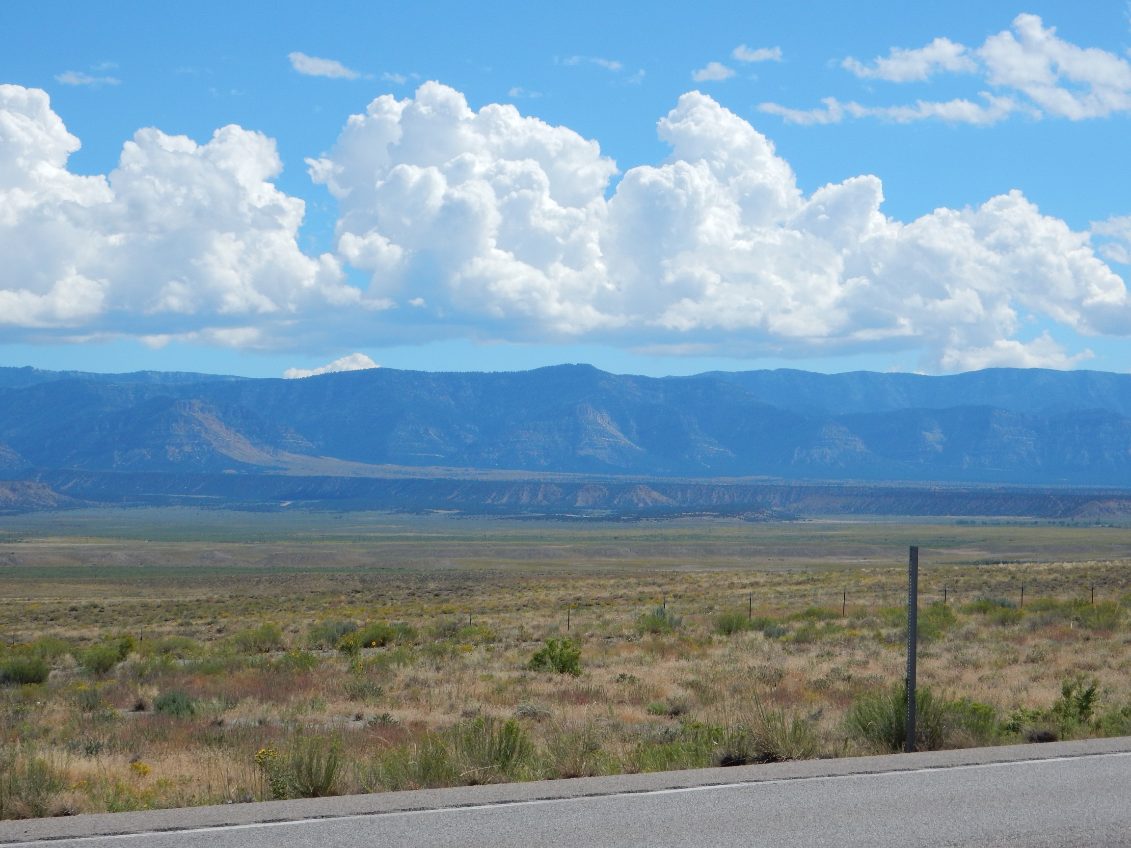
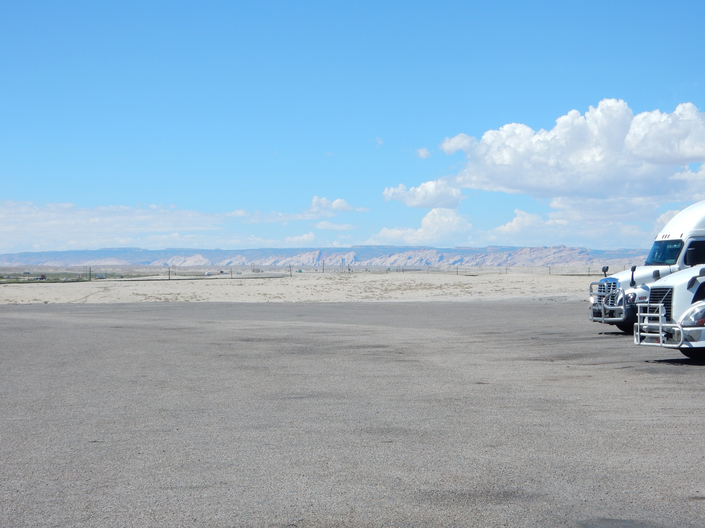
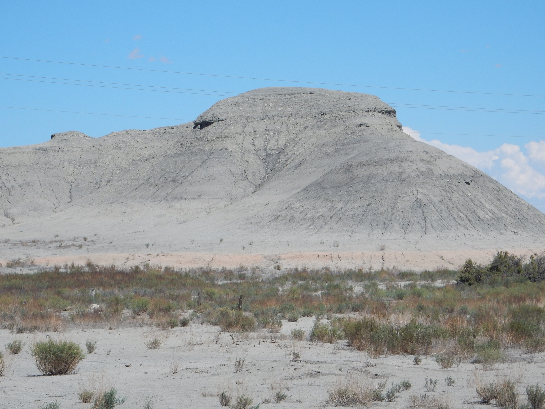
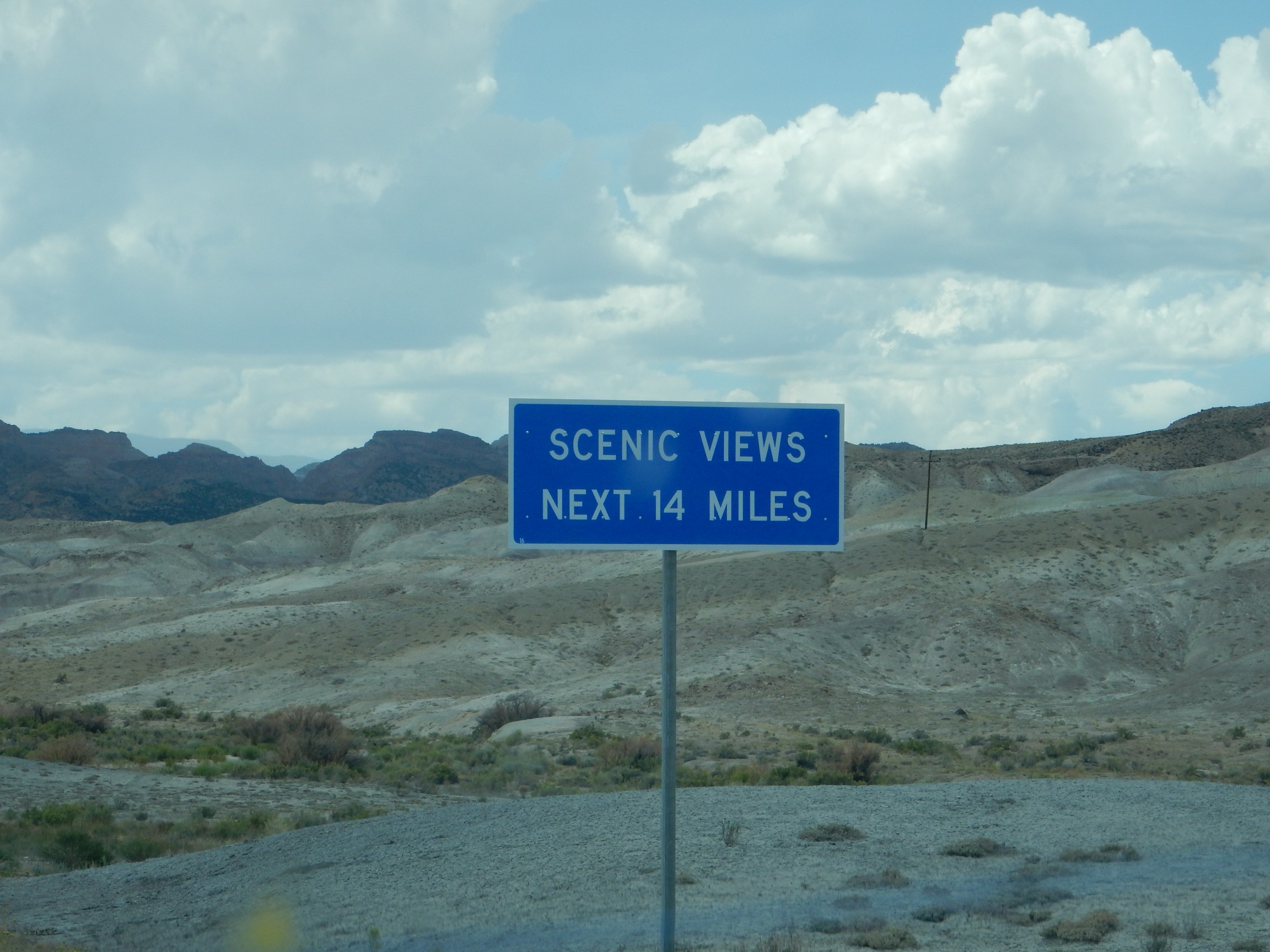
Gas stop in Green River. A monsoon thunderstorm has already blossomed to the north.
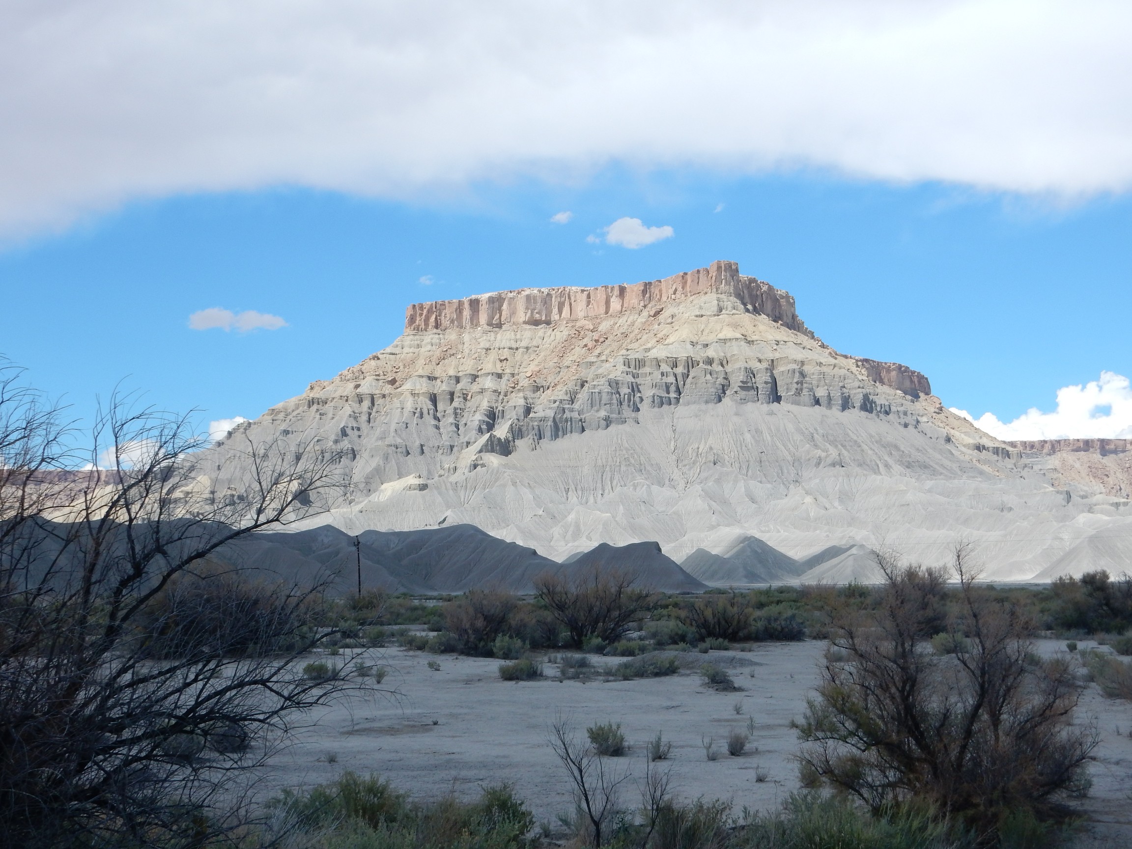
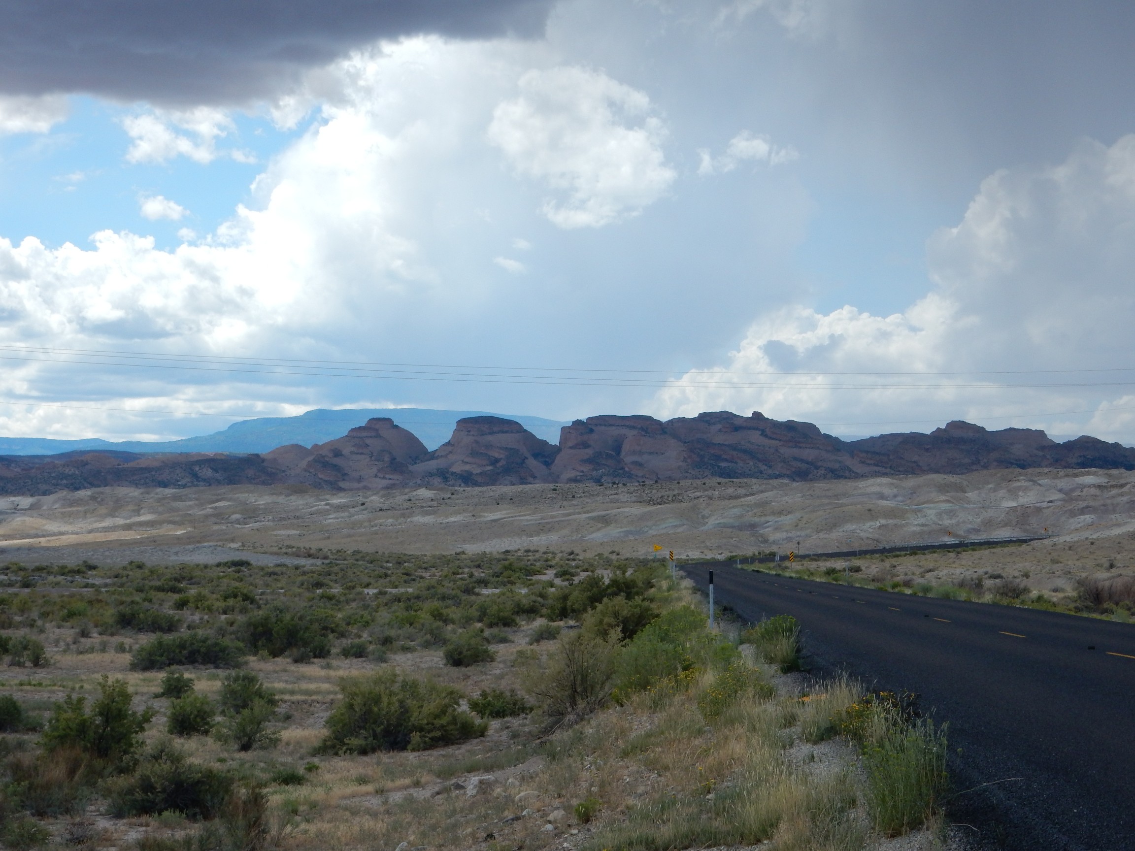
To the west is the San Rafael Reef.
The early settlers in the West gave the name of “reef” to rock formations like these that posed a serious barrier to travel by wagon. This was by analogy to reefs at sea, through which ships must carefully pick their way. A very few are actually fossil reefs. (Not this one.)
I take the road to Hite. Nearby are impressive beds of Jurassic Morrison Formation sediments.
The multi-hued lower beds are Brushy Basin Member. The cap may be Cretaceous Cedar Mesa Formation; I don’t know the area well enough to be certain. These beds mark the transition of this area from a fluvial environment (river plain) to a shore environment, as the sea began to creep across western North America some 90 million years ago. This came from a combination of rising sea levels worldwide and the weight of the growing Sierra Nevada to the west pushing down the Earth’s crust further inland.

Jurassic Summerville Formation capped with the Salt Wash Member of the Morrison Formation.
The view back down the road.
This, too, is Summerville Formation.
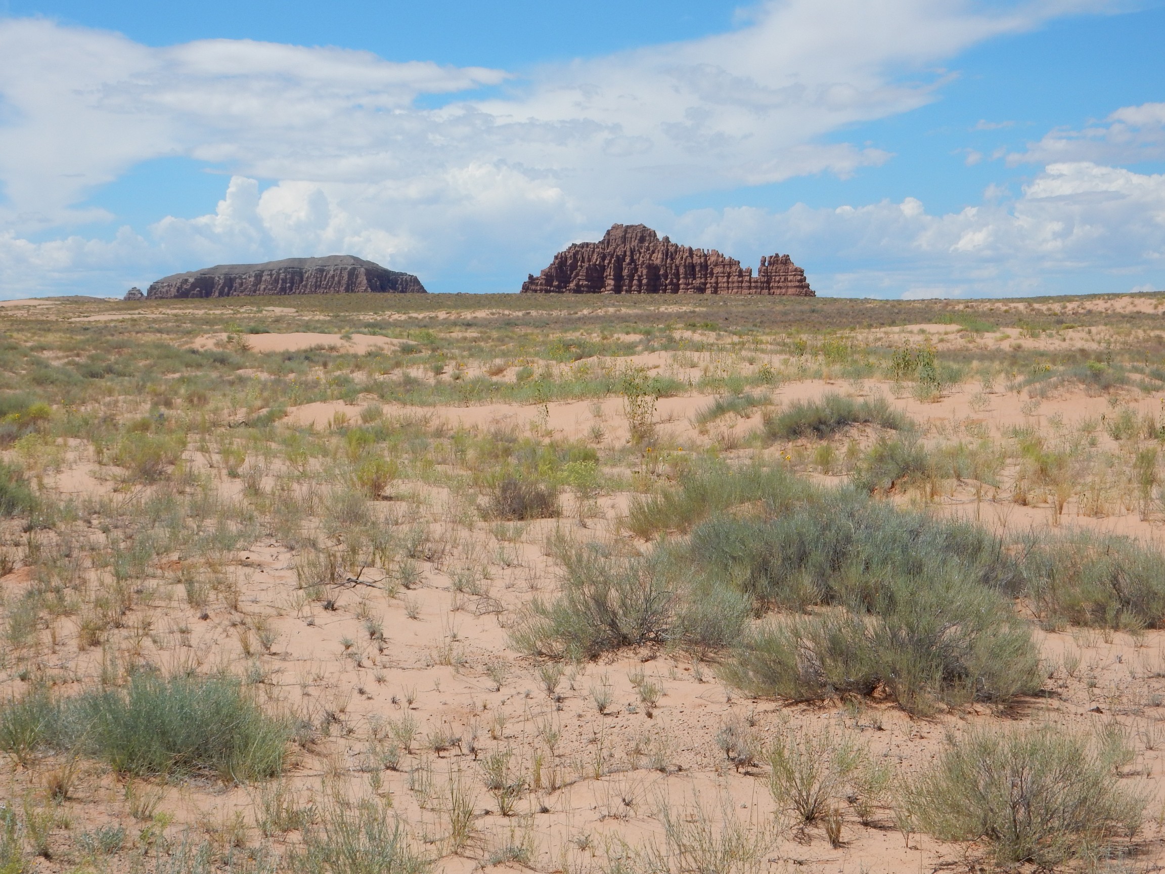
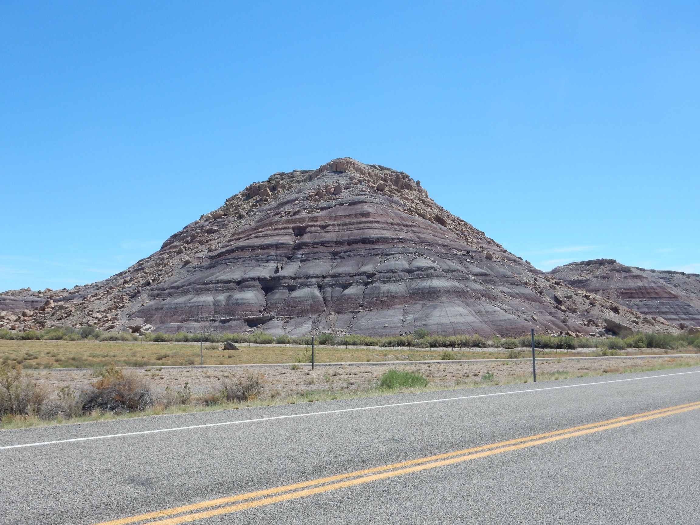
The one on the left is Gilson Butte. The one on the right, which is quite a bit closer, is Little Gilson Butte. Both are carved out of the Middle Jurassic Entrada Formation, which also supplies most of the sand in the foreground dunes. This is the San Rafael Desert.

Carved out of the early Triassic Wingate Sandstone. My geologic map informs me that there are collapse features around this mountain, from dissolution of Permian limestone beds beneath. I’ll have to come back (sometime when I have someone with me; it’s somewhat out of the way.)
To the south are the Henry Mountains.
Like the Abajo and La Sal Mountains, these are laccoliths emplaced around 25 million years ago.
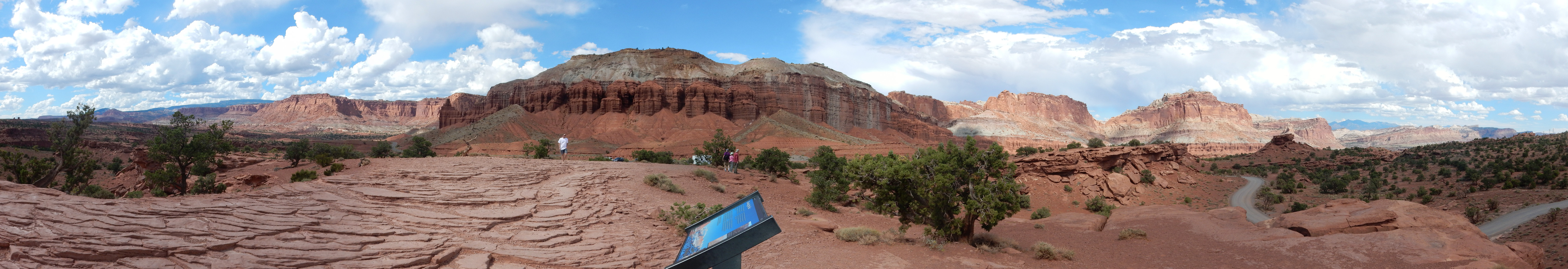
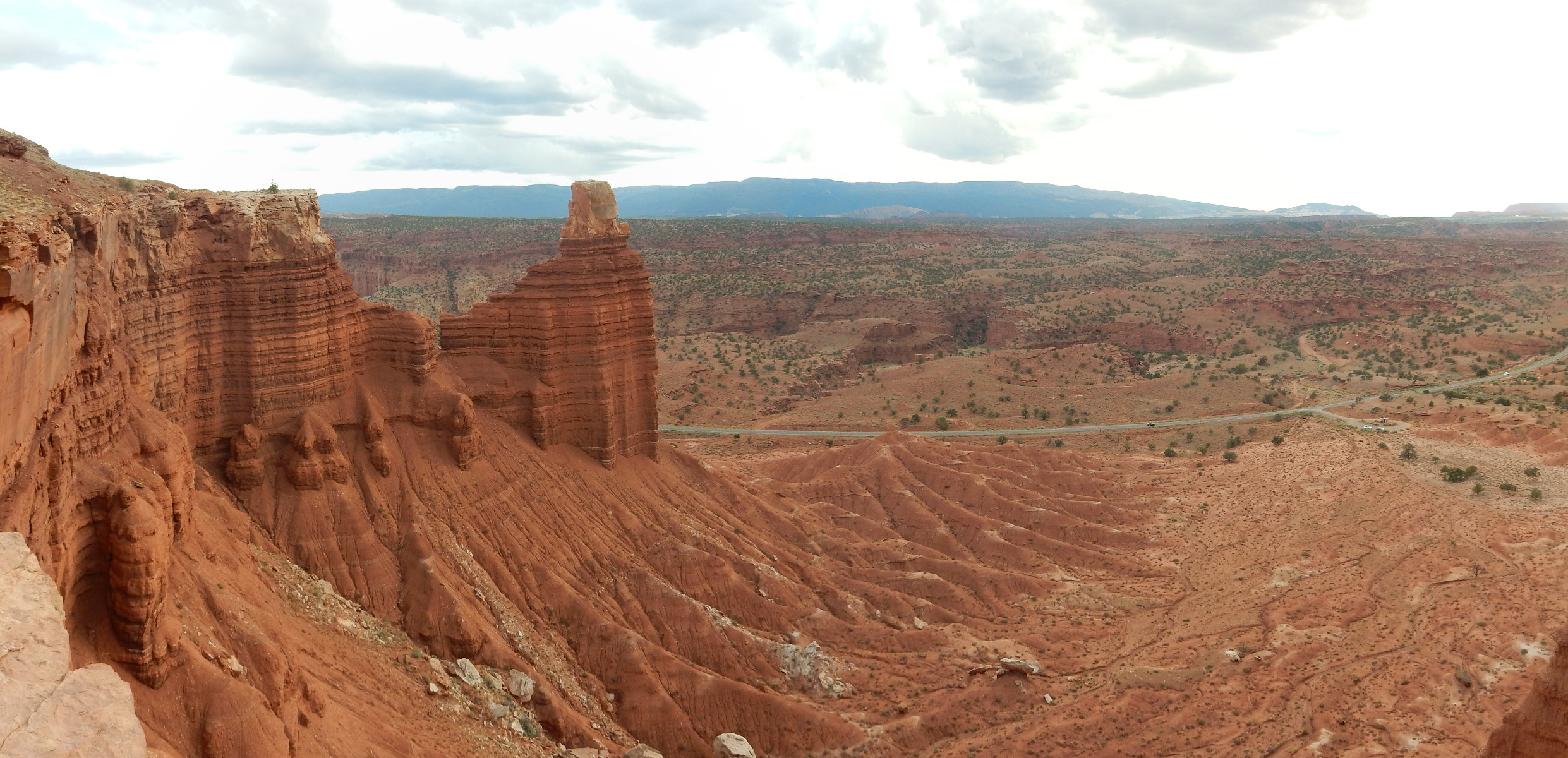
This seems like a good place for a panorama.
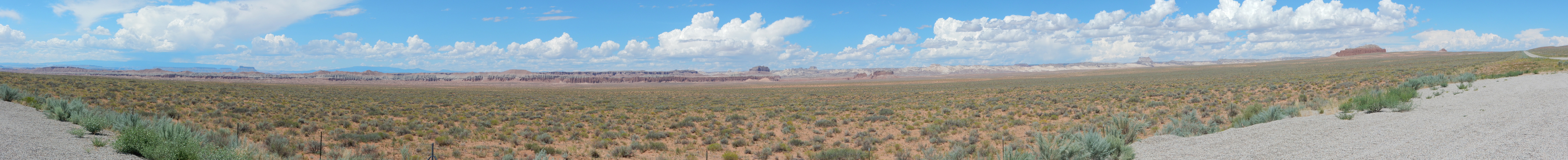
The gray beds in the nearby bluffs are Curtis Formation resting on the Entrada Formation, with Summerville Formation on top.
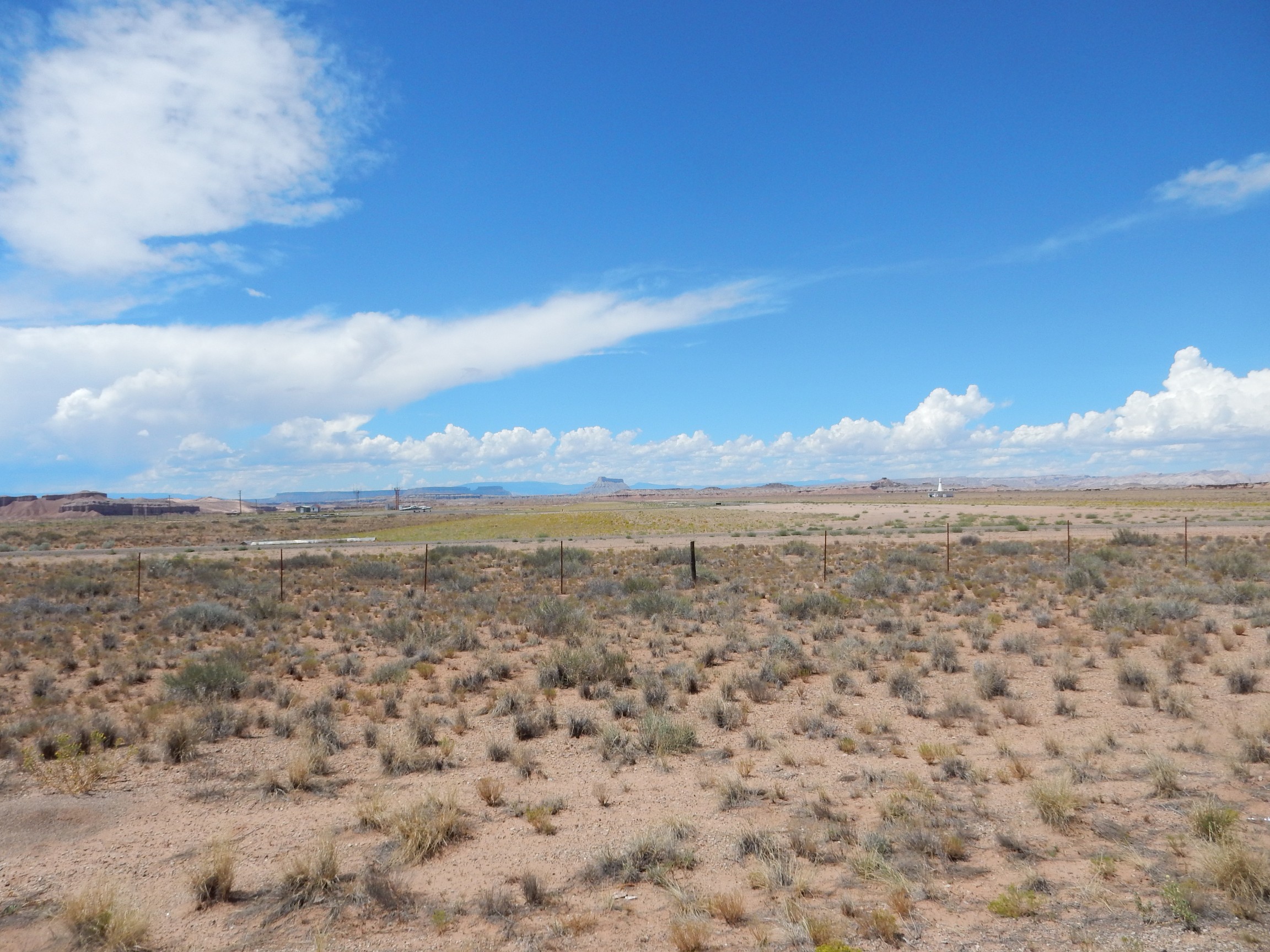
Desert air strip, complete with giant bowling pin. (Actually a regional radar.)
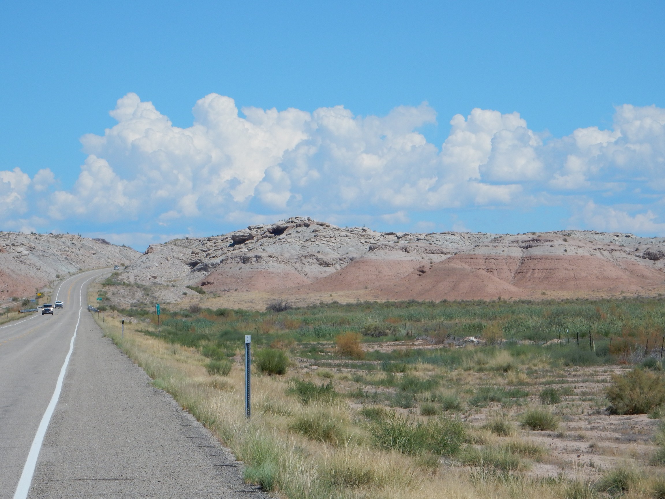
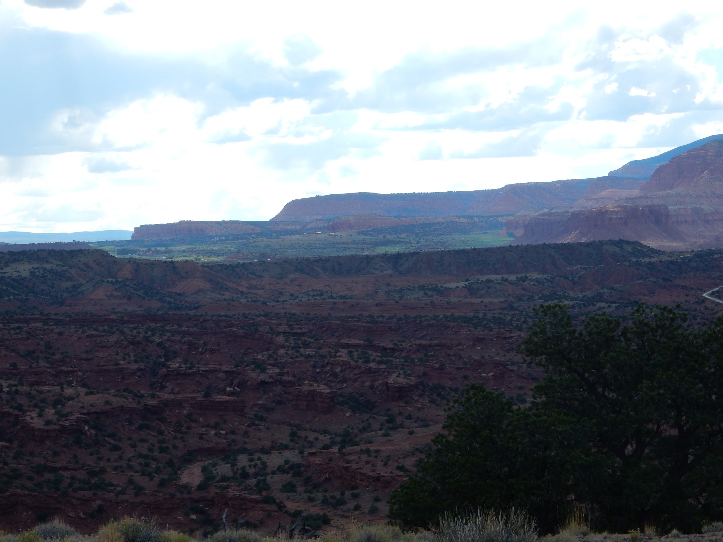
The road crosses over a hill and into Hanksburg, a green oasis on the Fremont River.
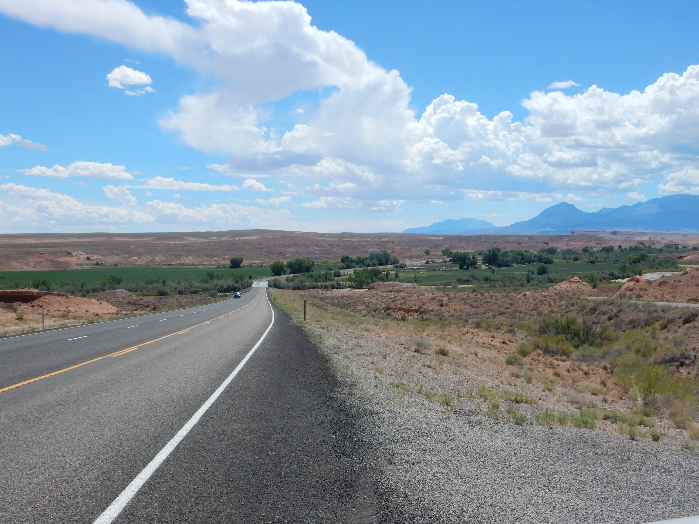
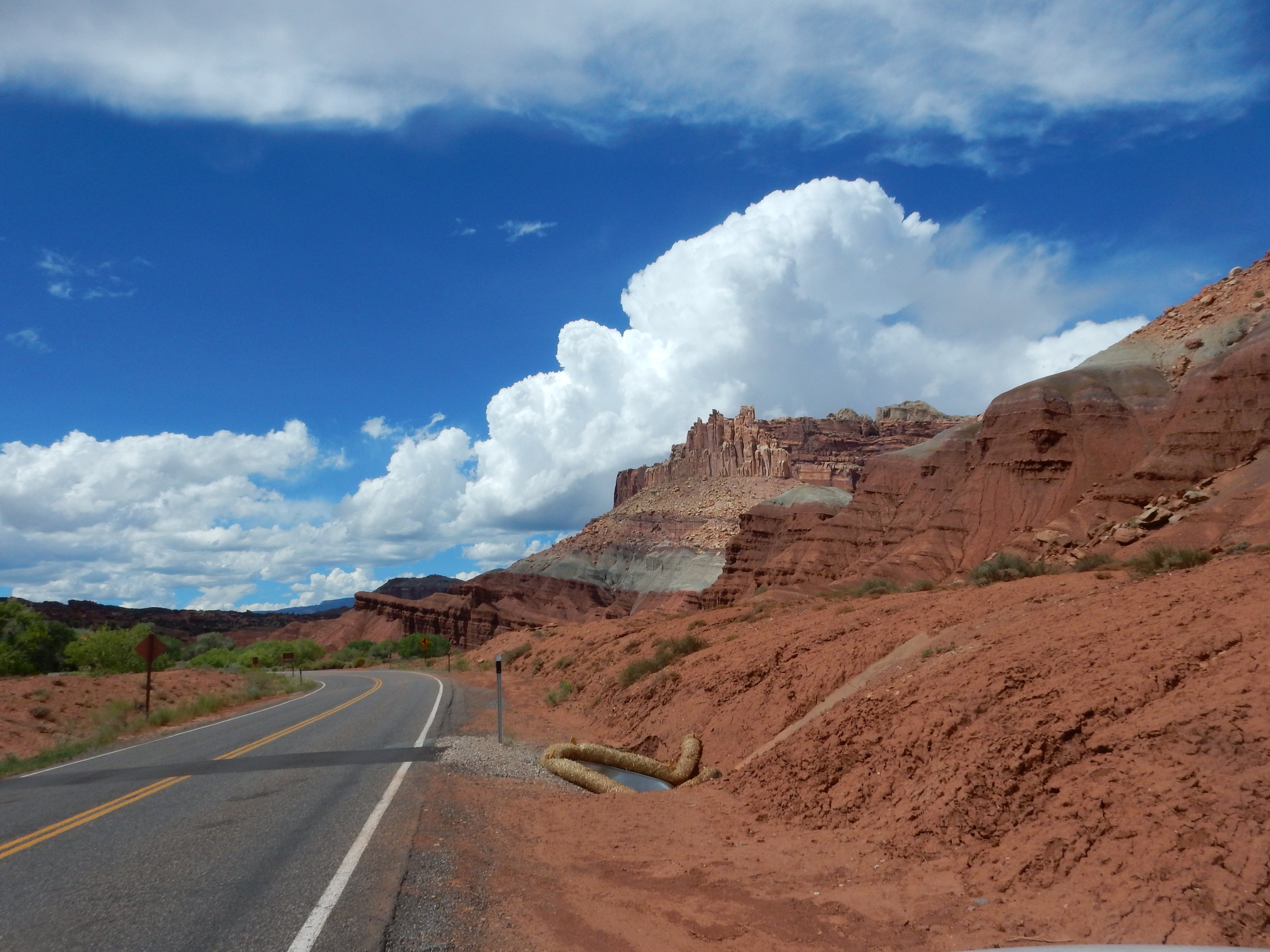
To the west is Capitol Reef National Monument. I had been thinking about it, and now decide that I will visit the monument. This turns out to be an excellent decision.
A spectacular road cut in the Summerville Formation.
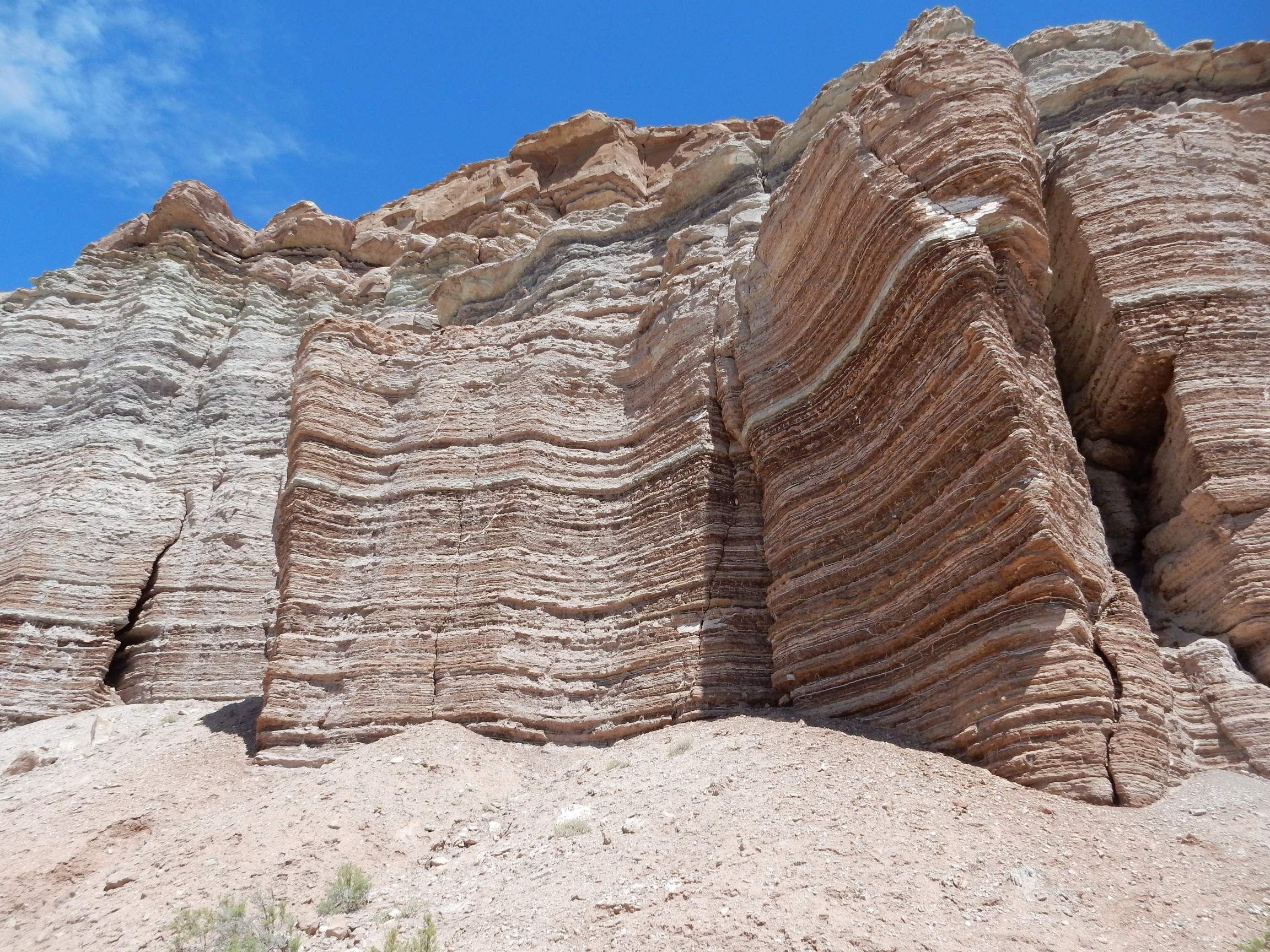
Thinly bedded siltstone, with beds of gypsum.
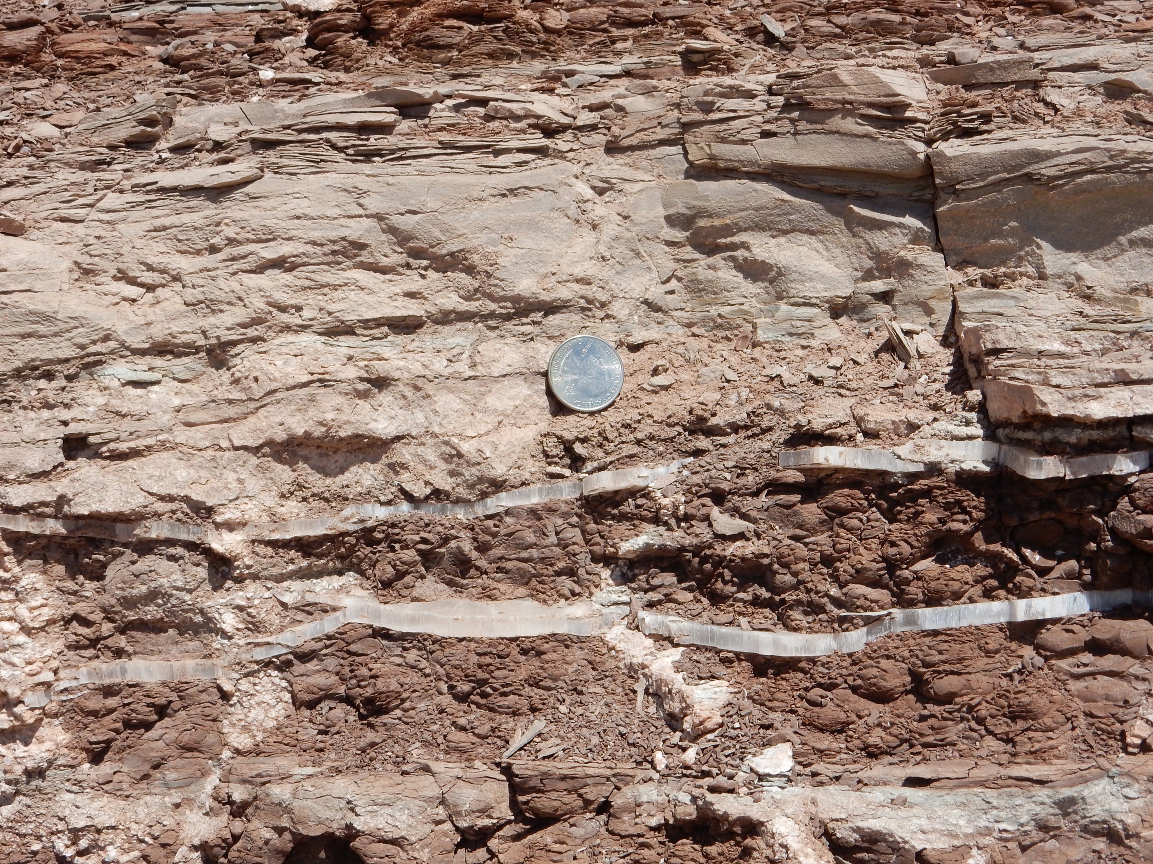
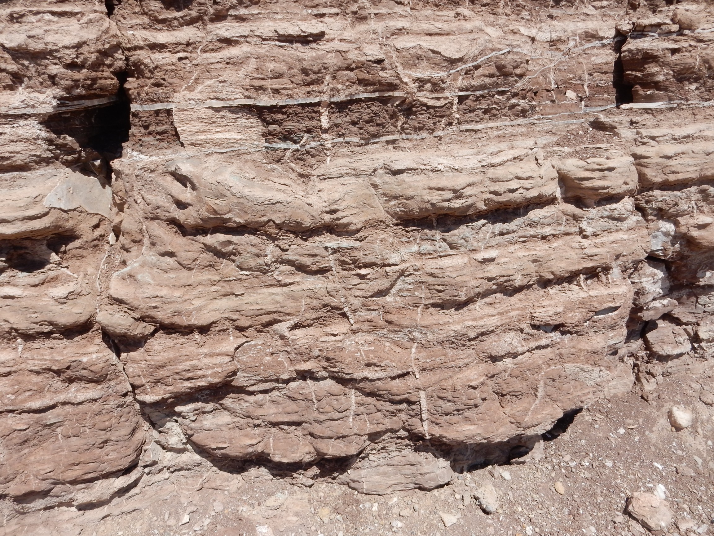
I was not yet within the monument; I took some beautiful gypsum samples. The presence of gypsum suggests this was laid down in a salt flat environment, as does the presence of dessication cracks:
Further down the road, if my map is to believed, we’re looking at sandstone of the Cretaceous Dakota Formation over multicolored mudstone of the Cedar Mesa Formation.
These are younger beds than the Summerville. I’m driving into a shallow syncline, a downwards warp in the earth’s crust, where younger rocks are present on the axis of the syncline than are exposed on its edges.
Further down, my map is a little vague, but this is one of the sandier members of the Cretaceous Mancos Formation.

The Mancos Formation is enormous, present in much of the western United States and over a thousand feet thick in some places. It was laid down in a shallow sea, the Western Interior Seaway, that covered most of the Basin and Range, Rocky Mountains, and High Plains of today. This was then a low-lying area, pushed down by the weight of the young Sierra Nevada to the west. Various members of the Mancos Formation will dominate the scenery for several miles.
It looks from my map like this is the Ferron Member of the Mancos Shale, a sandy layer corresponding to a brief retreat of the sea that left beach deposits. It’s more resistant to erosion and so caps the mesas hereabouts.
Nearby is what I take for a pioneer structure.


Sandstone blocks. I find myself wondering what formation they were quarried from. Dakota?
A contact at the base of a hill.
The pink later at bottom. Probably a contact between members of the Mancos Shale.
A bluff, North Caineville Mesa, underlain by Blue Gate Member capped with Emery Sandstone Member.
That’s if I’m interpreting my map correctly. This is the youngest rock mapped in this syncline, showing I’m close to its axis.
A closer look at the Ferron Sandstone Member in a water gap through the Caineville Reef.

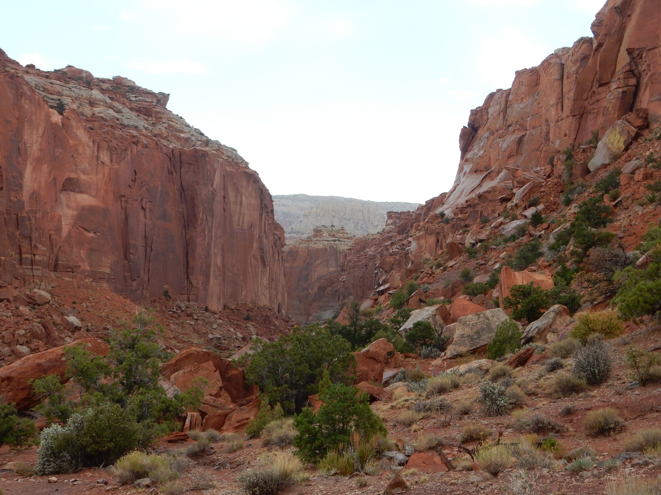
I’ve now passed through the shallow syncline I mentioned earlier, and the rock beds are now dipping to the east. I will drive through progressively older beds as I enter and drive through Capitol Reef National Monument, which is located along the most spectacular part of a monocline, an area of rock beds dipping in one direction. This monocline cuts across some twenty distinct formations, making Capitol Reef National Monument one of the finest geology playgrounds on the planet.
It is also, I am later informed, the second least-visited National Park System unit in Utah. Go figure.
Caineville Reef: Because the Ferron Member is unusually resistant, its exposure at the surface in this monocline forms a long north-south ridge that was a significant barrier to travel by pioneer wagon. The road here passes through a gap in this ridge cut by Caineville Wash, a small intermittent stream. (It was probably more substantial 20,000 years ago, during the last glaciation.) A water gap is a gap in the reef carved by a waterway; it was the natural place to route the highway I’m on.
I’d say this next one is my Ansel Adams moment for the day, but this will turn into a day full of Ansel Adams moments. My decision to divert this way was probably the best single decision of this trip. Jupiter, I’m having fun.
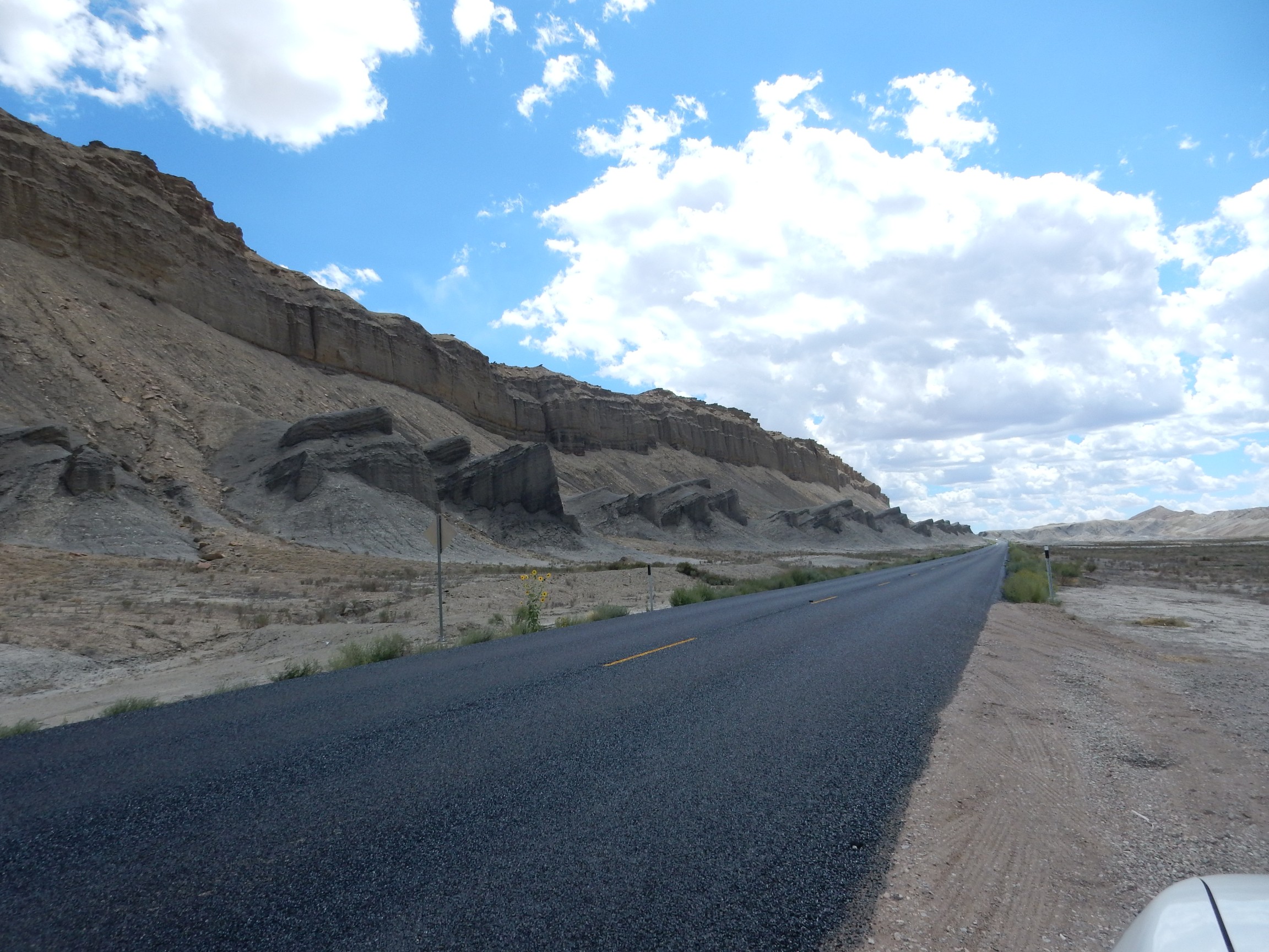
A brief digression prompted by the sight of this freshly repaved highway:
It is a longstanding joke in the western United States that the Utah state flower is Viaconc aurantiaco, the orange highway cone. I’ve never been in a state that is more constantly repairing its highways. The down side is obvious; it’s probably worth acknowledging the up side, which is that Utah highways (when not closed for construction) are uniformly some of the best in the country.
I’m now looking down Caineville Reef to the south. The reef is capped with the Ferron Member, but there is another shelf of somewhat resistant beds beneath. I have now driven into an area for which I have a superb geologic map, but even this map does not distinguish features this fine. My guess, from reading the local unit descriptions, is that we are seeing an example here of intertonguing members. Both of the resistant beds are part of the Ferron Member; the soft stuff between and below is Tununk Shale Member, which in this area alternates with the more resistant beds, probably indicating fluctuations in sea level in this part of the Western Interior Seaway.
Looking west, and I’m guessing I understand now why it’s called Capitol Reef.
Hard to be sure at this distance, but that’s likely Navajo Sandstone. Darned if some of these features do look like capitol domes, particularly left of center.
Road hazard warning:
Don’t laugh. The only speeding ticket I’ve ever gotten was a result of being distracted by beautiful geology and failing to see a speed limit sign.
Continuing west, the highway cuts through the early Jurassic Navajo Sandstone.

The Navajo Sandstone is a very distinctive formation, with its light color, high resistance, and cross bedding. Cross bedding refers to smaller layers at an angle to the main beds of the formation. You can see some examples in this photograph. Cross bedding usually means deposition in a strong current, which in this case was almost certainly steady trade winds in a dune field.
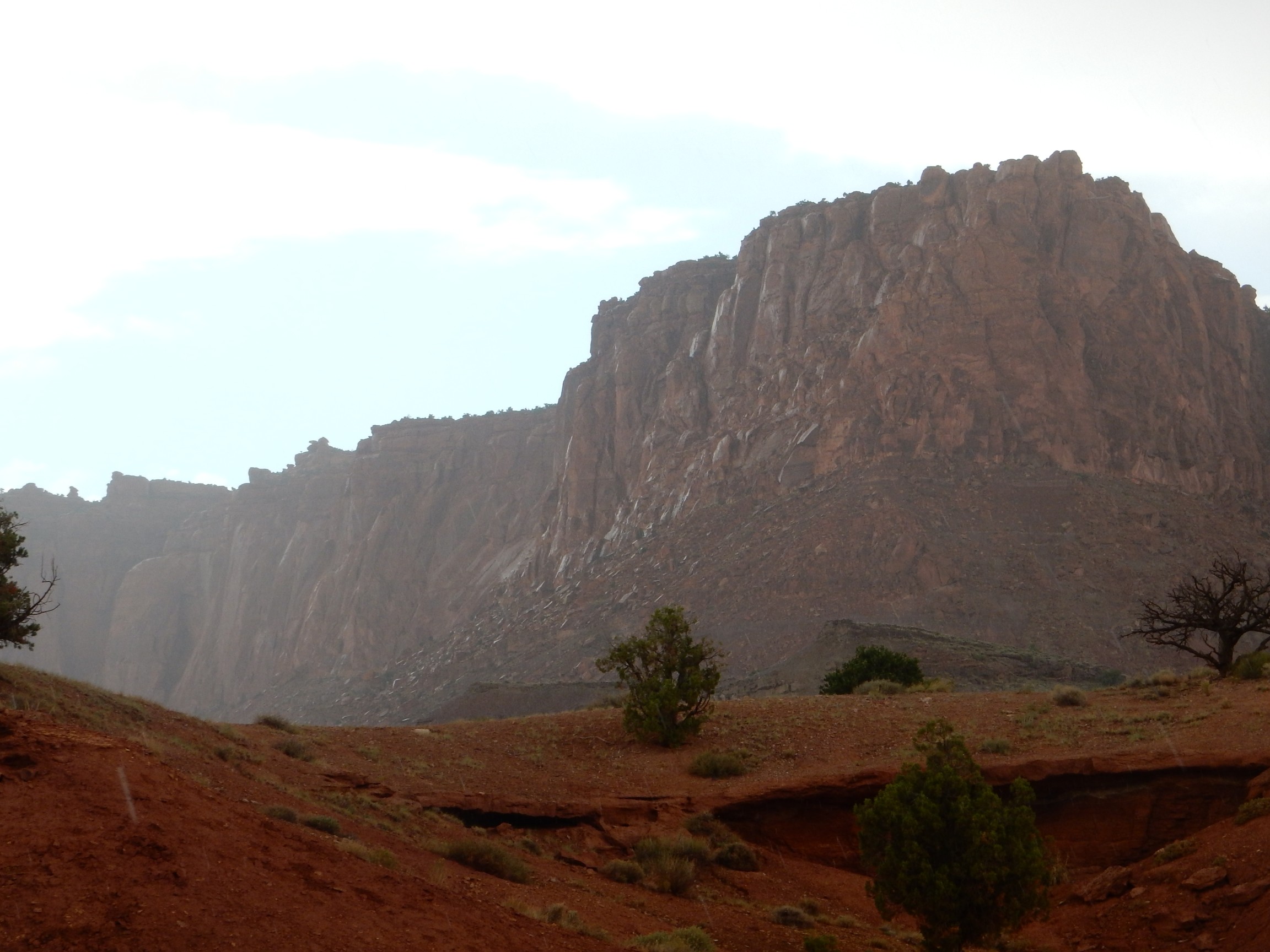
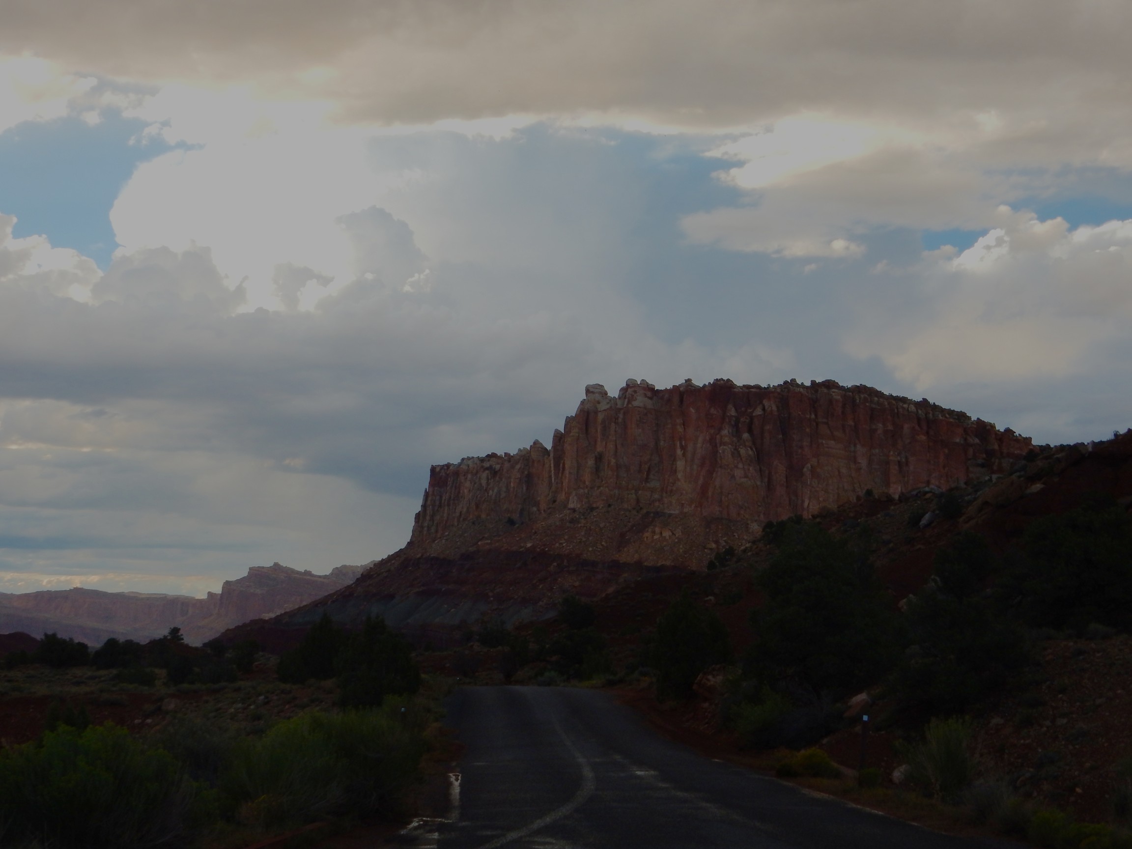
Soon I’m in classic red rock desert.
I have entered the Waterpocket Fold of the Capitol Reef monocline. The lowest formation visible here is the Triassic Moenkopi Formation. The gray beds above this are the Petrified Forest Member of the Triassic Chinle Formation, then the Owl Rock Member and Church Rock Member of the Chinle Formation, then cliffs of earliest Jurassic Wingate Sandstone.
The visitor’s center is just beyond. I pull in and park. The museum is the usual Park Service quality, meaning, there’s a big table model of the park with labeled points of interest. and the explanations in the exhibits assume you’re not an idiot. (They also assume you’re not a Ph.D., which is reasonable given the visitor demographics.) In other words, fairly good quality. The bookstore is also very nice. I am rapidly falling in love with this place, and decide to invest in a geologic map of the monument, which is also high quality.
I find myself thinking that is is as good a place as any to camp for the night. Sure, it will add two hours or more to my drive in the morning, but I like this place. The ranger chuckles when I ask if there is any room in the campground; only later do I learn that this is the second least-visited unit of the National Park system in Utah. I drive to the campground and there is no difficulty about finding a spot. On the other hand, the fee is $20 and I have only $19 in cash in my wallet. Back to the headquarters: Do you have an ATM? The bookstore proprietor chuckles. Can you give me $20 off my credit card? Sorry, no. Even if I buy something? Wish I could help. The rangers may take your card if you’re needing the money to pay for a camp spot, though. And they do. I head back to the campground, pick a spot, put my credit card receipt in place of cash in the self-pay envelope (as instructed) and tag my spot. Then I set up my tent and try to call Cindy.
No dice. The phone can’t get a signal.
Back to the visitors’ center. Hey, is there anywhere in the park I can get a cell phone signal? The only possible spot is Panorama Point. If that doesn’t work, you can drive in to Torrey where you’re pretty certain to get a connection.
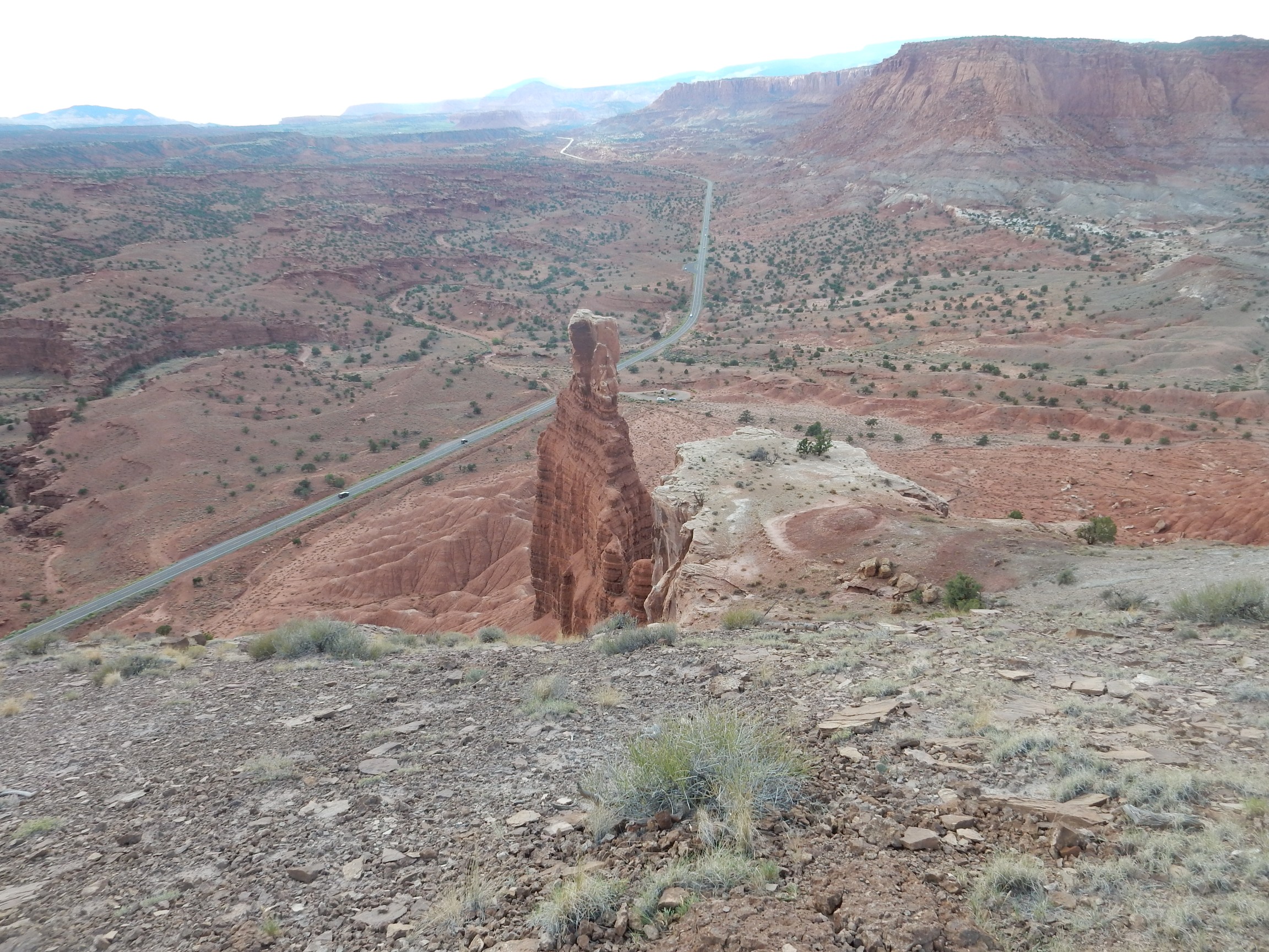
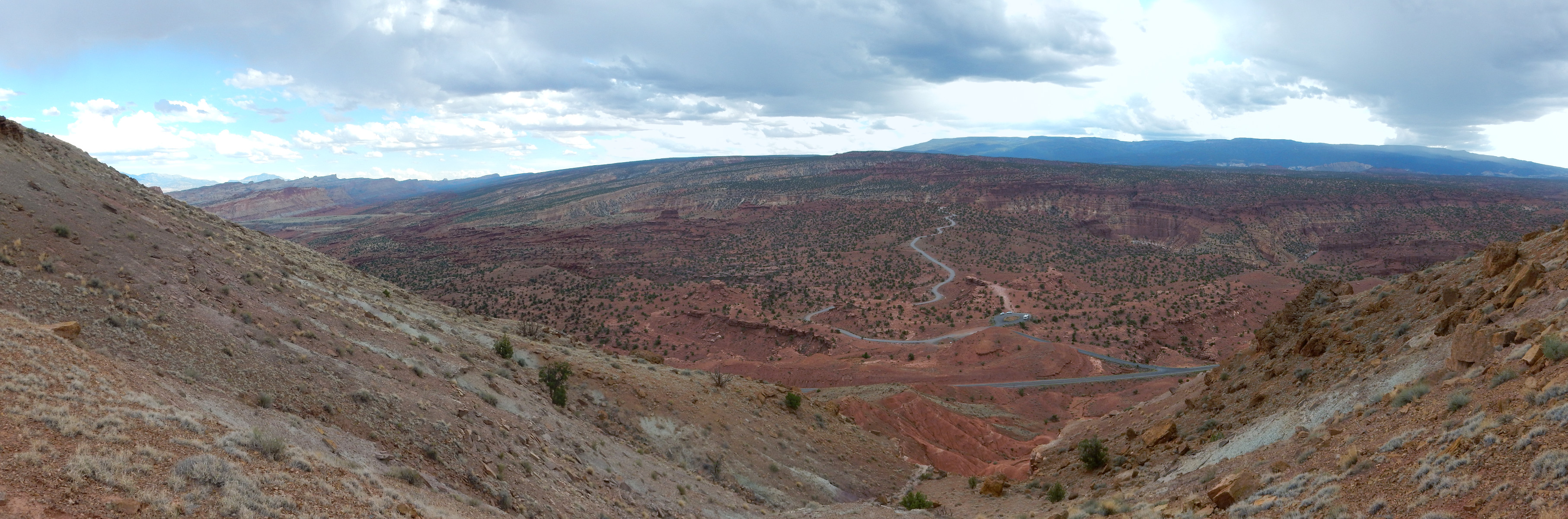
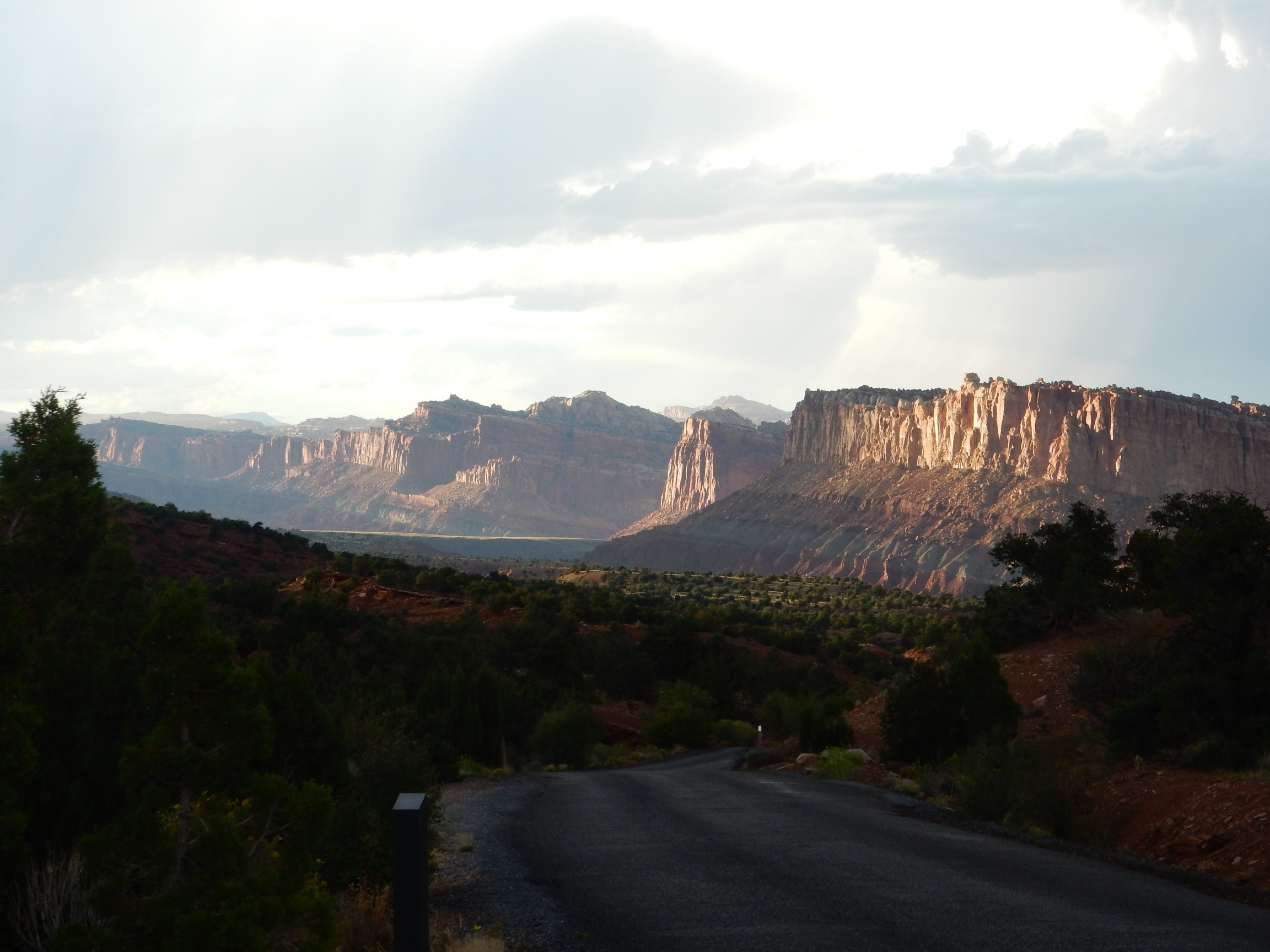
I drive to Panorama Point, which is well-named.
This gives a very nice view along the Waterpocket Fold, with Thousand Lake Mountain forming the distant skyline to the northwest at left and the Henry Mountains forming the distant skyline to the southeast at right. The bluff just across the road to the north shows nicely bedded Moenkopi Formation with a cap of Shinarump Member of the Chinle Formation.
My phone is able to get a weak signal here, enough to call Cindy and let her know what’s up.
I’m looking for a good hike for my evening exercise. The ranger suggests a canyon hike, but when I arrive at the trail head, I pause to read the information sheet for the park and find that the Chimney Rock trail is about the right length and difficulty and is particularly recommended at sunset. It’s late afternoon. I decide to go with that one.
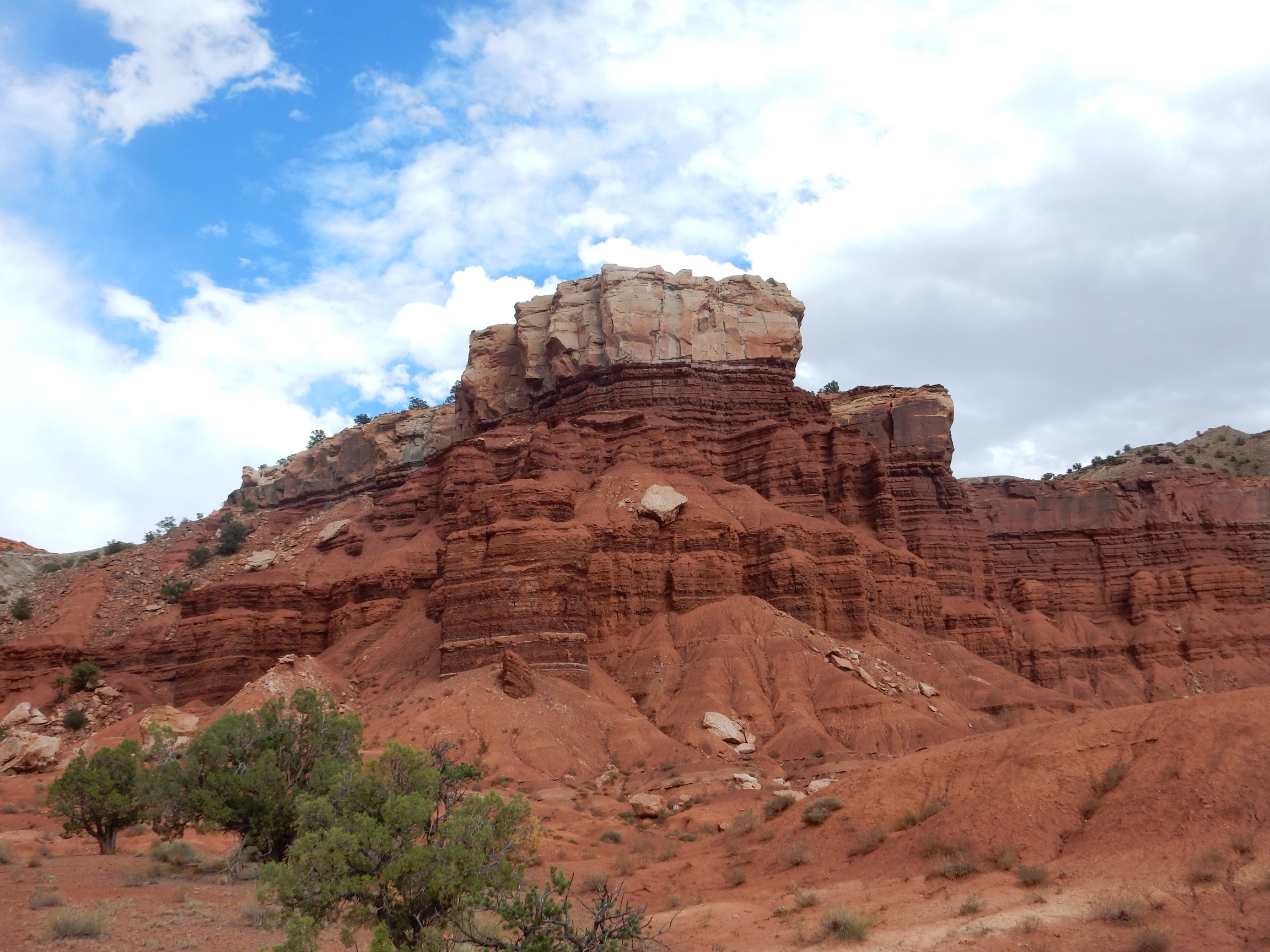
The thin beds are Moenkopi Formation and the cap is Shinarump Conglomerate Member of the Chinle Formation.
The Moenkopi Formation dates back about 240 million years and is basically mud flat deposits laid down on what was then the Pacific coastal plain. It’s widespread and is also found in the Jemez, but back home it’s fairly thin while it’s very thick in this area.
The Chinle Formation was laid down by a river system extending from the Appalachians to Nevada that was comparable in size to the modern Mississippi watershed. The Shinarump Conglomerate at its base represented an early energetic phase of the river.
The trail takes me towards a fault zone.
The fault throws down the beds to the north here, so that the gray Petrified Forest Member is near ground level.
Shinarump caprock over Moenkopi Formation to the south of the fault. The Petrified Forest Member and younger beds have mostly been eroded off the Shinarump Member here.

The fault runs on the right side of the light outcropping at center. The outcropping itself is fault gouge, crushed rock filling the immediate fault zone, which here seems mostly derived from the Petrified Forest Formation.
(Evil Kent, channeling Gary Larson: “Petrified Forest Formation. I wonder what frightened the trees so badly?”)
The trail climbs to the right above the fault. Some nice outcrops of Shinarump Member:


Shale forms in very quiet water from suspended clay. The flakes of clay settle out gradually enough to lie flat, producing the very thin layered structure here.
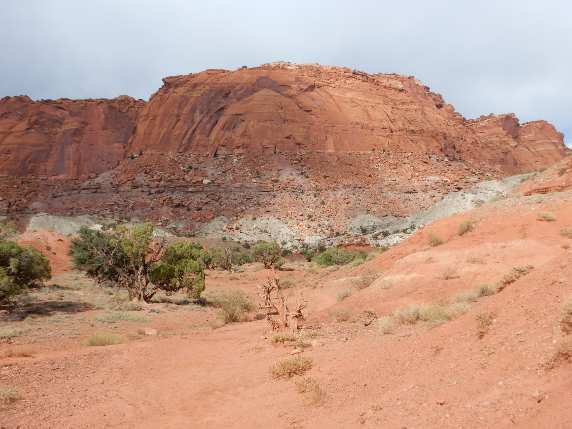
Looking back along the cliffs.
You can see the Shinarump Member forming a ledge at the base of the cliffs.
More Shinarump Member.

I’m not sure what the reddish cross-cutting structures are. Dessication cracks? But I wouldn’t expect those in sandstone; more a mudstone thing. They look planar, so probably not root fossils. I find myself thinking this rock looks a lot like the rock used to build the pioneer building from earlier in the day. But then one sandstone looks a lot like another, and it’s tough to pick them out once they’re out of their stratigraphic position. Unless there are good fossils, which is not common in clean sandstones.
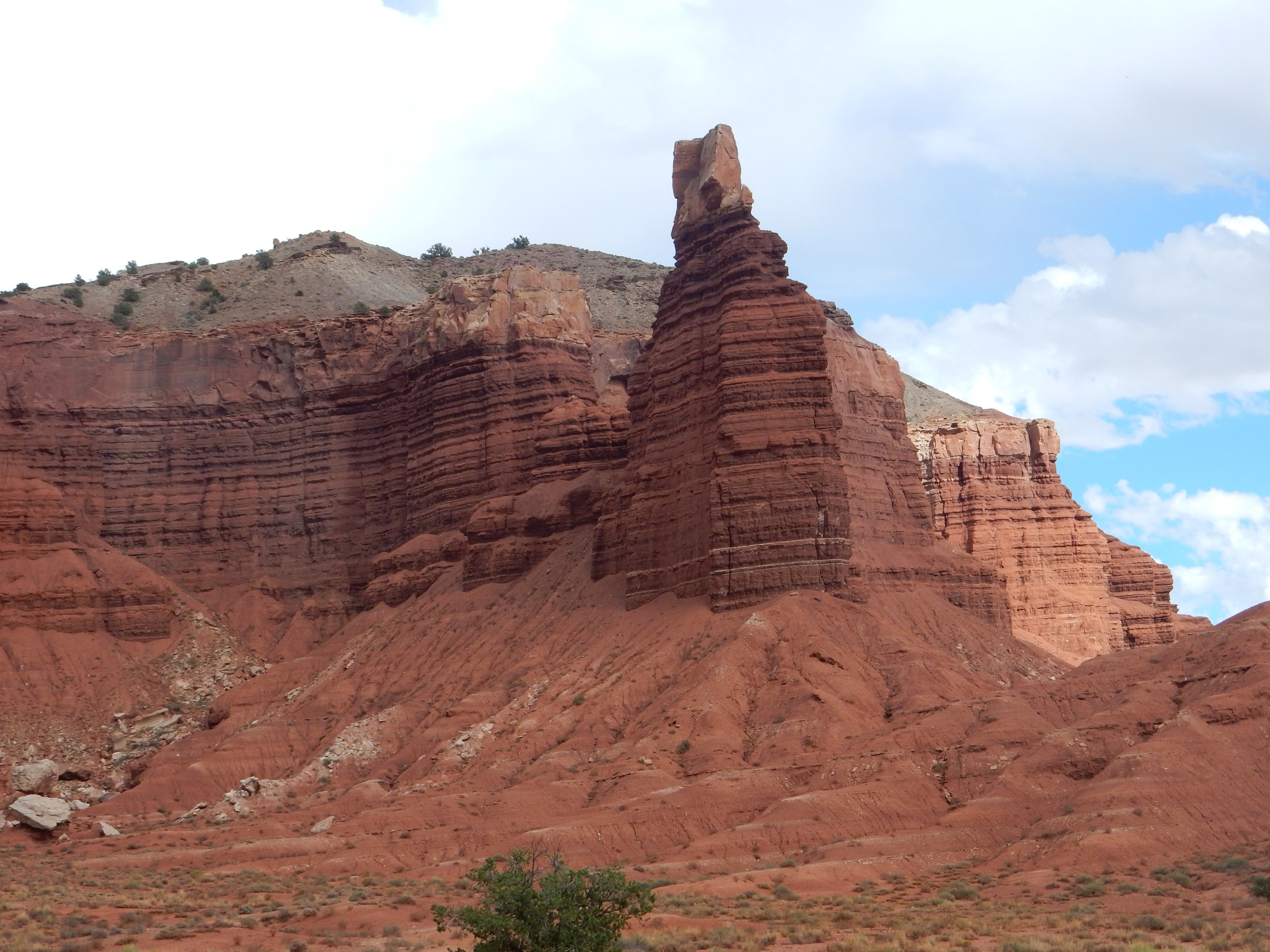
I reach the top of the mesa, which affords a great view of Chimney Rock.
Distant oasis.
A different angle on Chimney Rock.
My map shows this area as all Chinle Formation, without distinguishing members. This looks like a second sandstone bed, slightly younger than the Shinarump.
I continue east on the trail. I’m now beginning to feel a certain sense of urgency: Something I ate didn’t agree with me, and I fear that Montezuma may be plotting his revenge.
Black rock on the trail:
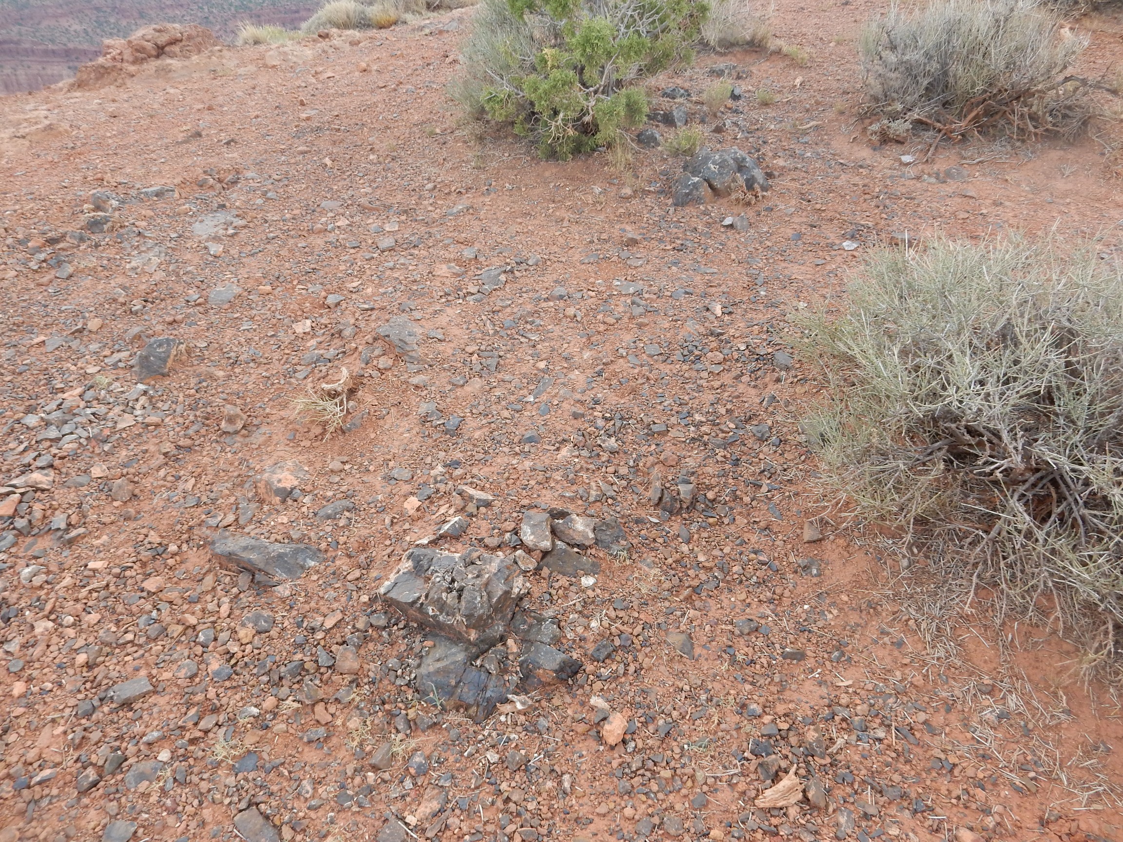
Young Kent: “Oil shale!”
Wise Kent: “That would be way cool, but very unlikely. Pick up a fragment and smell it.”
Young Kent: *sniffs* “No smell.”
Wise Kent: “Oil shale would smell like petroleum. This is probably chert.”
Young Kent: “Awwwww.”
Wise Kent: “Well, chert is still pretty cool.”
Young Kent: “Ahhhh.”
Yeah, I talk to myself on the trail. Not usually out loud, though.
Chert is not uncommon in limestone beds, but it’s a little unusual in a sandstone and mudstone area.
The trail ahead:

With my tummy growing increasingly unhappy, I wonder if I should turn back. But it’s looking like rain, and I’d have to cross a high mesa top in the teeth of a possible thunderstorm. I decide to press on … quickly.
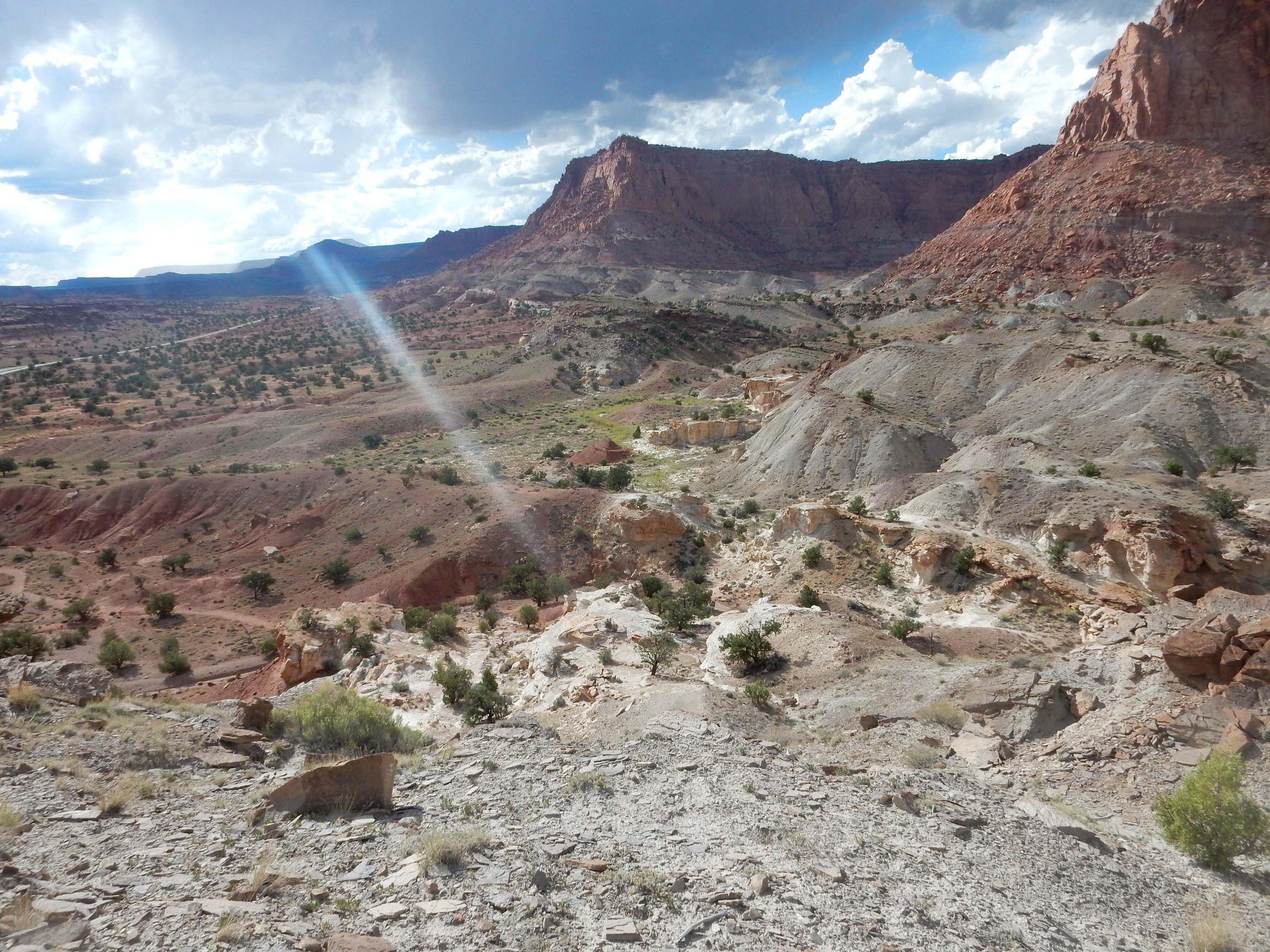
The view south is wonderful.
You can see that the beds are more or less level at right, but start to dip into the Capital Reef monocline to the left.
So what creates a monocline? In this case, it’s thought that a north-south fault displaces the brittle crystalline rocks deep underground. The more ductile sedimentary beds closer to the surface folded rather than broke; the displacement took place gradually and sedimentary rock can very slowly flow, over geologic time scales.
The view further down is even more spectacular.
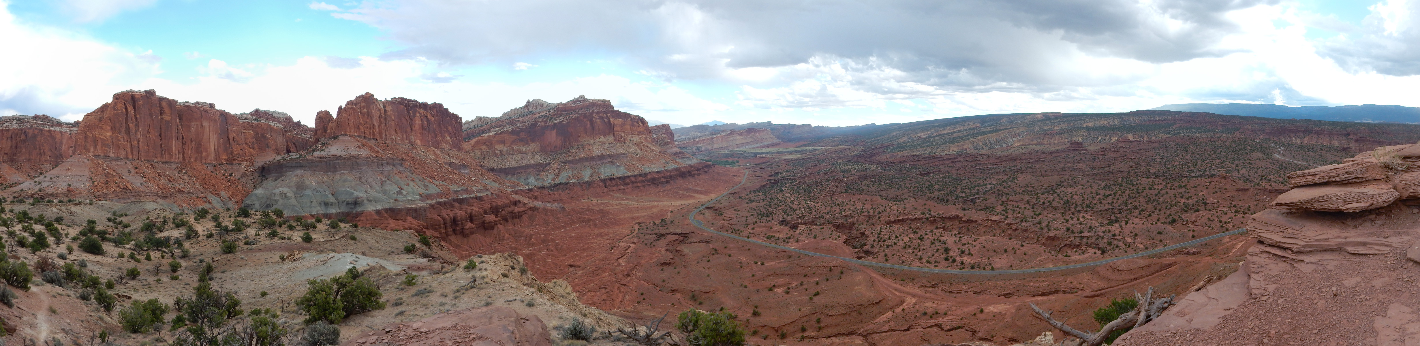
Here we are looking east southeast into the Waterpocket Fold. Again, the lowermost beds of the cliffs at left are Moenkopi Formation, above which is the Chinle Formation beginning with the shelf of the Shinarump Member below the gray beds of the Petrified Forest Member, then the massive cliffs of the Wingate Sandstone.
You may be thinking: You’re about to get rained on. Why, yes. Yes, I am. Together with my unhappy tummy, this is making me a little desperate to finish the hike. Alas, I am now at the farthest point of the loop trail from the trail head.
Just before the storm hits, I get a snap of a lizard crossing the trail.
Blurry, but he’s there. A reddish lizard, blending in well with the rocks — as fine an example of protective coloration as I’ve seen.
The rain starts coming down.
I’m hurrying down the trail. But I can’t help stopping for crossbeds as magnificent as these:
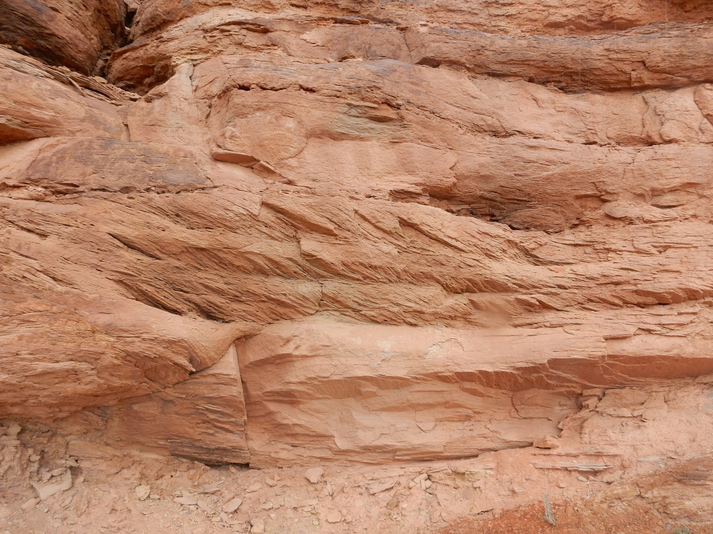
Since the Shinarump is thought to be fluvial, these crossbeds must have been laid down in a deep and swift river channel.
This is odd.
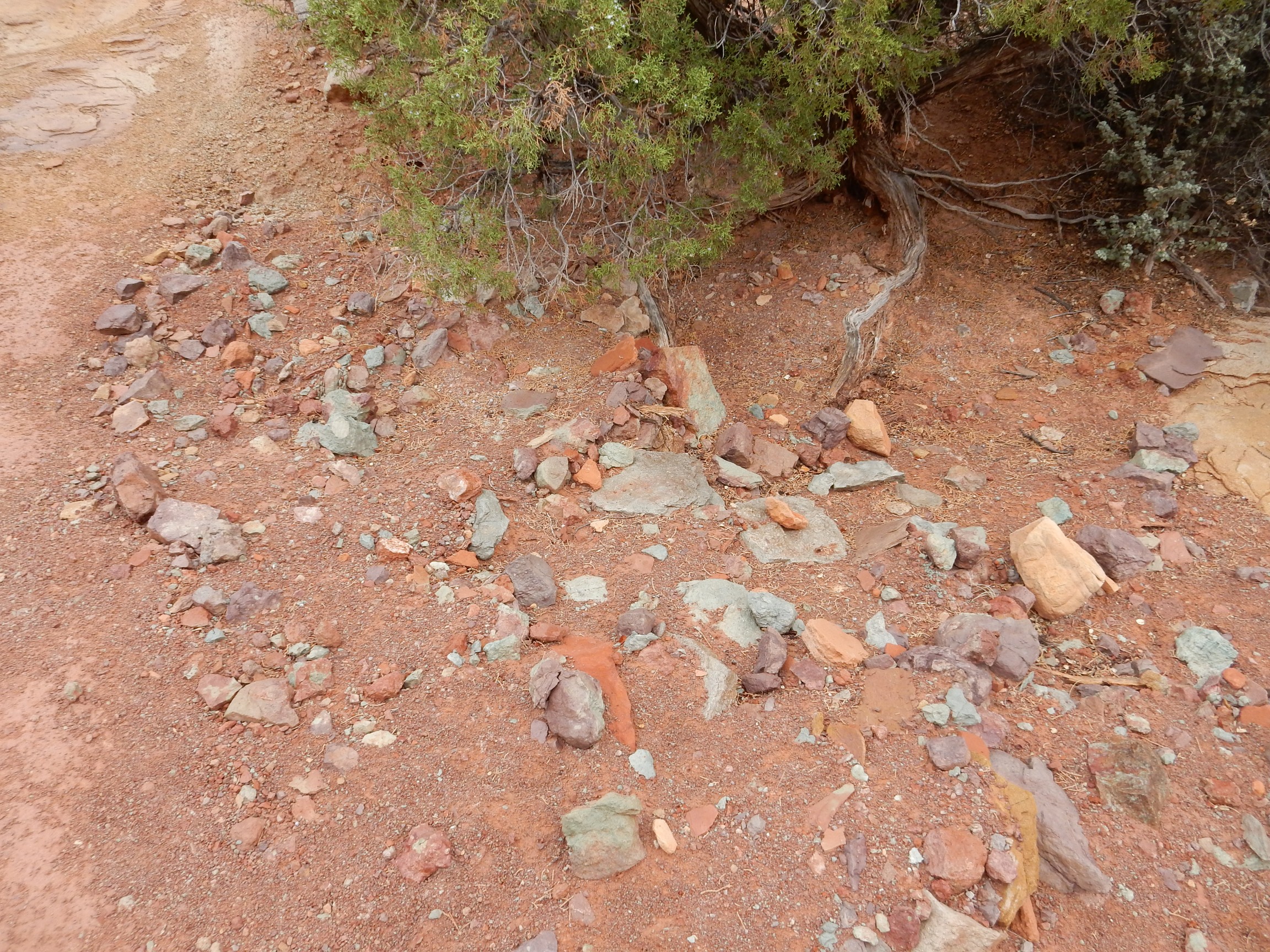
It looks like hikers have been tossing pebbles onto this shelf. And the rain is pouring down. And I’m waddling along as fast as I can without losing control of my bowels.
Fortunately, the trail is now headed west. And even in my current state, I can’t help pausing for a bed of gray sandstone.
Yeah. I’m now on a shelf of gray sandstone of the Petrified Forest Member.
The rain makes for some nice scenes.
Almost makes up for being soaked. Well, not too soaked; my hat and my backpack were taking up a lot of the moisture.
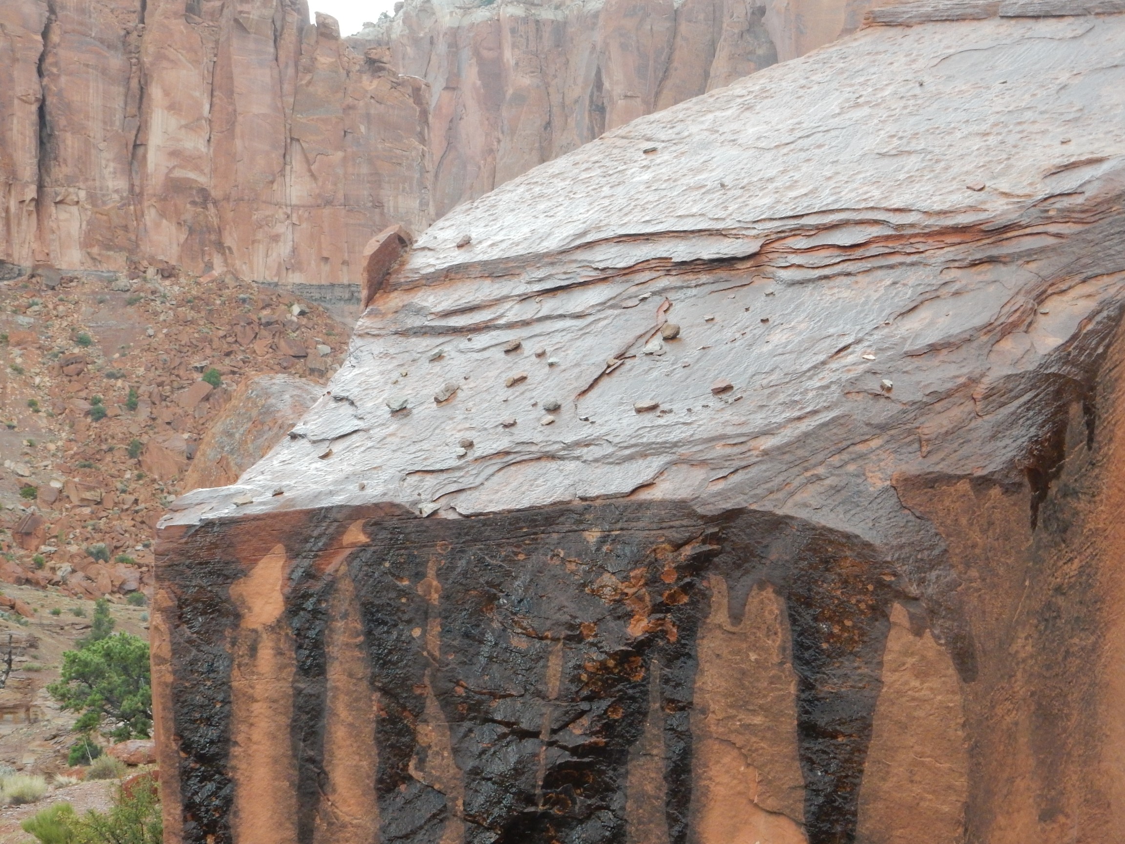
A bed rather different than anything I’ve seen so far.
Nodular limestone of the Chinle Formation.
I meet a couple coming the other way. How much further? Not far. Say, you did the whole loop? Um, yeah. Not far, maybe a mile or two. Crep.
I am almost there. However, desperate as I am to get back to the trail head (and its restroom), I can’t resist taking this shot.
I’m at the trail head and the restroom. O blessed re…crep. The restroom is locked.
The torrent of rain is nearly matched by the torrent of naughty words I’m biting my tongue to avoid saying out loud.
I pile in my car and race back to the visitor’s center. I head for the restrooms there. “Restrooms close after hours.” More naughty words have to be choked down.
I race to the campground and the restroom there, and finally get some relief.
The rain has stopped. There is still some daylight. I decide to drive down the road past the campground and see what I see.
Which includes a feature my map identifies as (ahem) Ferns Nipple:

Sculped by erosion from the Navajo Formation.
I find myself reflecting on the fact that this feature is located just south of Cohab Canyon.
The setting sun makes for some wonderful views. However, the camera is failing to GPS lock again; I’m not sure where this was. Grand Wash, perhaps, judging from the presence of Ferns Nipple just beyond.
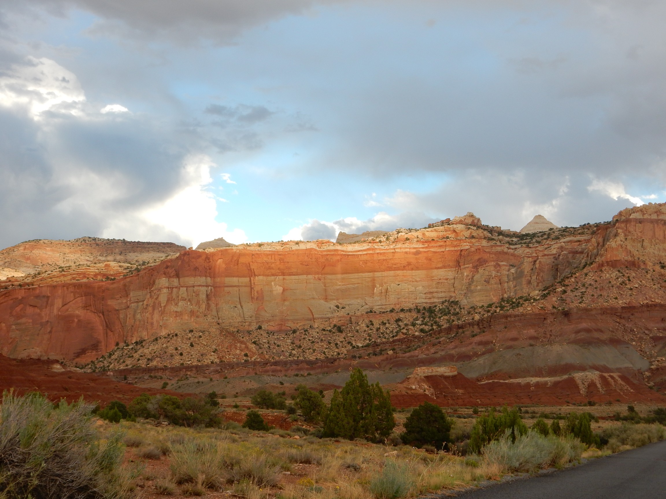
I reach a pullout. A drop-dead-gorgeous blonde has popped out of her car and is smiling in my direction. I know better, look behind me to see what she’s smiling at, and wow.
Pretty soon there are three or four cars in the pullout, with all of us clicking away with our cameras.
I reach the end of the paved section of road. It seems imprudent to continue on the gravel road, given the weather and time of day.
On the way back, I see a scene that I’m pretty sure I can’t capture adequately with my camera. There is a distant thunderhead shining brightly in the setting sun, and in the foreground is a mesa glowing faintly in the twilight. I doubt my camera can do justice given the lighting contrast. And it can’t.
Other than stitching frames together for panoramas, I don’t digitally manipulate my images. This is the only exception in this series of posts:
I’ve tried to adjust to capture both the brilliance of the thunderhead and the soft glow of the mesa. I’m not sure this is all that great a job.
I pull into camp. My tent is wet but not terribly so. I eat another camp dinner and turn in for the night.
Next: The last day
Pingback: Great American Eclipse wanderlust, day 11: The big day | Wanderlusting the Jemez
Pingback: Great American Eclipse wanderlust, day 14 | Wanderlusting the Jemez