Wanderlusting the Cieneguilla Basanite
This unit has interested me since I first learned about it, and I’ve visited it once before. Basanite is a somewhat rare and unusual igneous rock type, very low in silica and somewhat enriched in alkali metals. The Cieneguilla Basanite is the only basanite identified so far in the Jemez Region.
I had business in Albuquerque Saturday, attending a worship service at the Albuquerque Temple, then doing some shopping for aquarium plants and diabetic food. The service was excellent; I found a couple of suitable aquarium plants, plus some replacement filters for the betta tank; but I struck out completely on diabetic food.
I had decided before I left that, if time and weather permitted, I would spend a little time in the La Cienega area on the way home and see if I could find some harzburgite inclusions in the basanite. Like other alkaline volcanic rocks, basanite has a tendency to bring up bits of mantle rock, and the geologic report for the area confirms that harzburgite is sometimes found in the Cieneguilla Basanite. Harzburgite is a mixture of olivine and low-calcium pyroxene, with a few other minor mineral components, and it is interpreted as mantle rock that has experienced partial melting that has depleted it of the more calcium-rich pyroxene. Finding a chunk of harzburgite would be cool, and make a nice photograph to add to the book.
On the drive back, north of Albuquerque, I see a pretty good storm cell ahead. Sure enough, it is soon raining heavily. Well, snow. But then I am through the storm, and by the time I get to the La Cienega exit, the storm is far enough to the west that I decide to try visiting the rocks. The storm will take some time to roll in, and it might even dissipate.
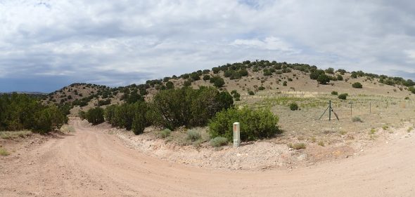
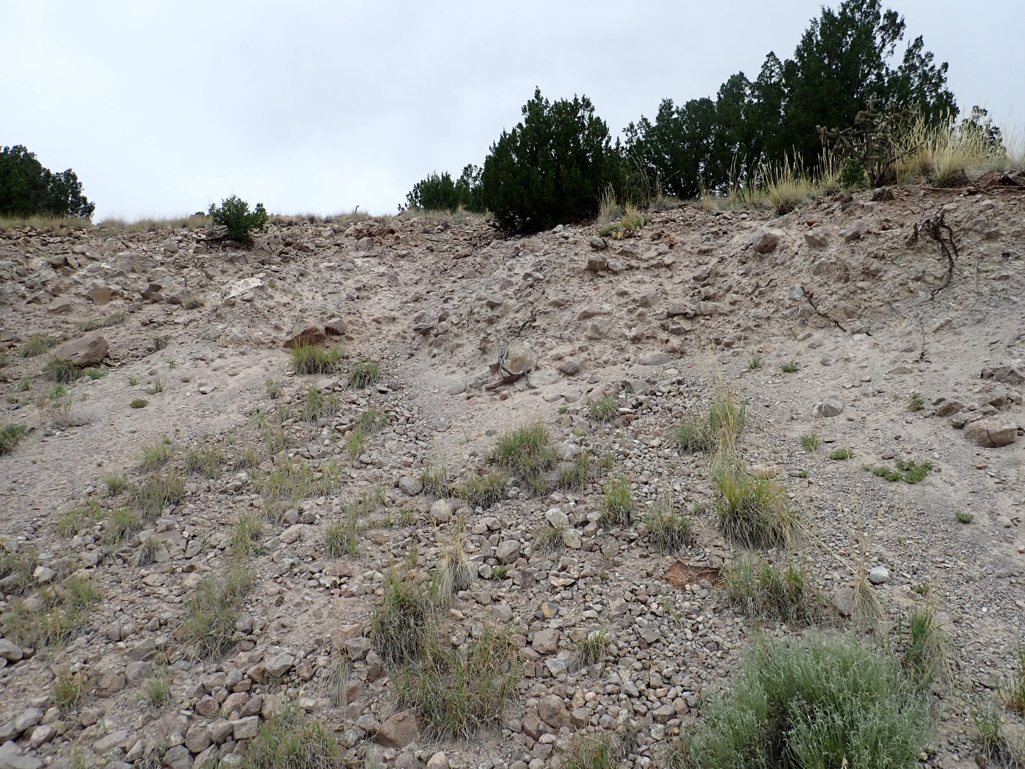
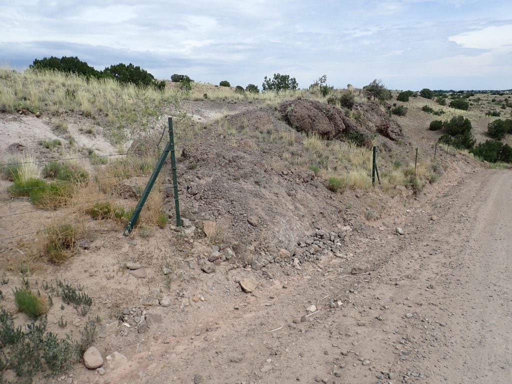
I briefly consider hiking to Cerro Seco, which is capped with the basanite, but as I drive past, I concluded that it is too long a hike. Also, being on top of a bare knob with a thunderstorm moving in sounds unhealthy. I turn left on Route 54A and look for a good place to park south of the two knolls mapped as basanite. Alas, the road proved quite narrow and I get to private property without finding a pullout. (The basanite knolls themselves are on BLM land, which is Federal public land.) I turn around, and stop halfway up the road at an interesting outcrop and also because I drank a lot of diet lemonade at lunch. I barely finish my other business and start to look at the outcrop when I hear vehicles coming down the road. Snow. It takes some maneuvering for us to get our cars past each other — fortunately, we all mind our manners — and I settle for the trail head parking some ways up the road. It will do me no harm to hike back down the road from there.
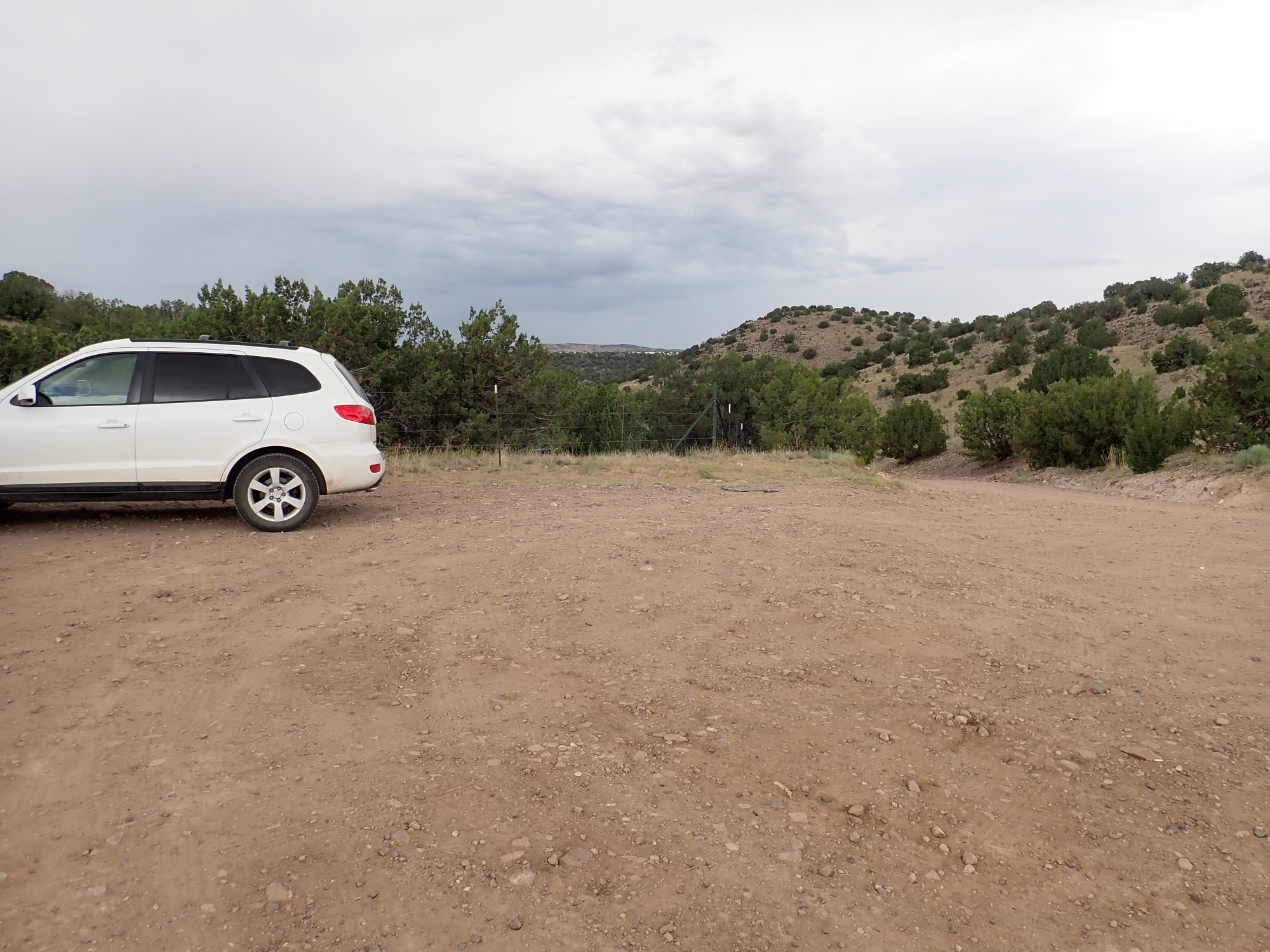
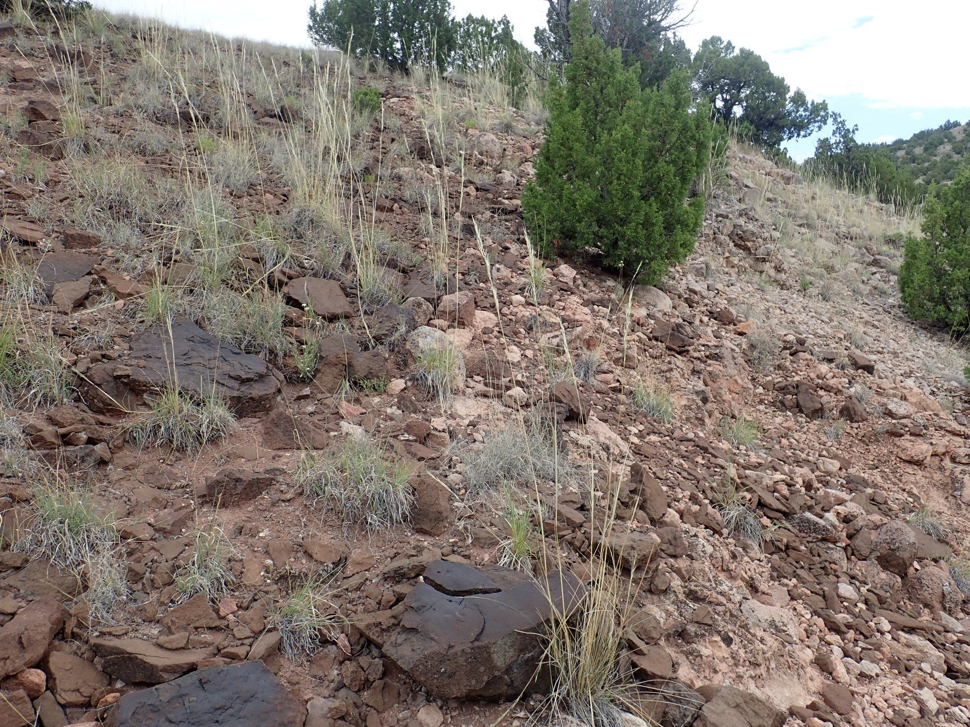
You can see that the weather is not terribly great. Still, I put on my hiking boots, turn on the SPOT tracker, and head out.
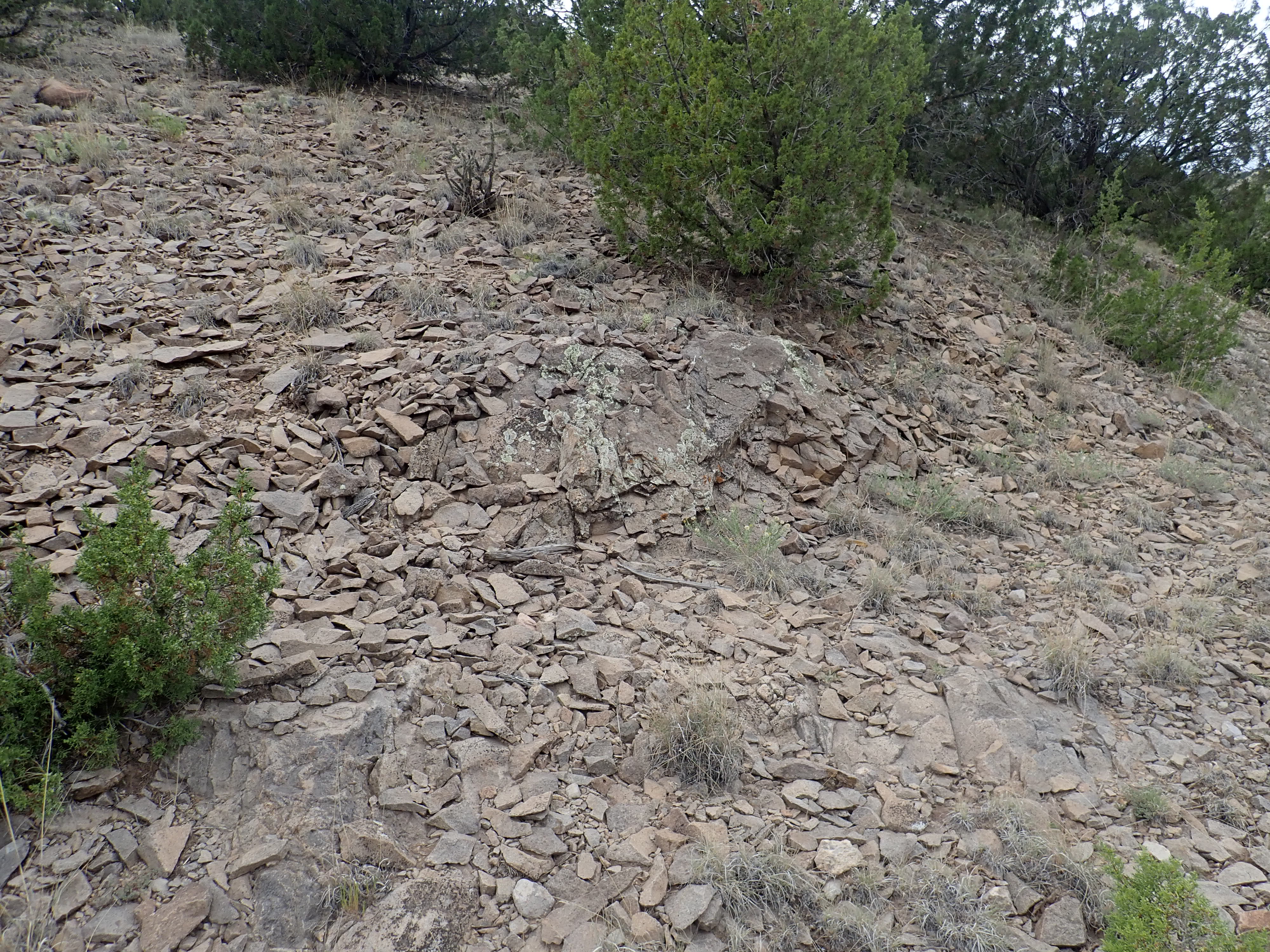
First stop in the road cut is what looks a little like monzonite to me.
In fact, this is more likely Espinaso Formation andesite. This is one of three formations that meet along this road. The Espinaso Formation likely came first in this area, though its age is poorly constrained; radimetric dating is all over the map. In most places it is thought to be younger than the 29 to 30 million year old Ortiz monzonite, but here the monzonite seems to dome up the overlying Espinaso beds, suggesting the Espinaso beds are older than the monzonite and the monzonite intruded the Espinaso beds. The third formation is of course the Cienegulla Basanite, with a good radiometric age of 25 million years. There’s little question the basanite is younger than the other two formations.
Next is what looks a little like basanite.

Alas, my GPS is jumping around. But this is more likely more Espinaso Formation. In fact, few of my pictures from the first part of the hike will be useful for the book, because I’m just not confident enough of the geologic map along this interesting road. There are places where the identification is unambiguous that I will use in the book instead. And there are a couple of mysteries along this road.
Next is an outcrop on the north side of the road that could be either monzonite or andesite.
But I can’t be sure. The map shows the road as just north of the boundary between Espinaso Formation and the monzonite forming the hill to the south, so this should be Espinaso Formation, but it looks just a little like monzonite.
Then, on the south side of the road:
The rock is coarse grained and looks just like other monzonites I’ve seen. Its location on the slopes of the hill to the south leaves no doubt of its identity. Monzonite is a moderate silica rock, not too different in composition from andesite, which crystallizes underground to form a roughly equal mixture of plagioclase and alkali feldspar with just a trace of quartz.
And it looks enough different from the previous that I think the previous must be Espinaso Formation, like the map says.
A little further down, and again on the north side of the road:

The contorted beds look very much like a lava flow. But the lower beds are solid and somewhat granular rock, looking a little like monzonite. The map says Espinaso Formation. After thinking it over, I am reasonably confident this is Espinaso Formation.
If you click to enlarge (as you can with almost all pictures at this site) you will see a couple of boreholes in the solid rock at lower left. Some geologist before me took interest in this outcrop. I’d love to know what his analysis said.
And this is a real mystery.
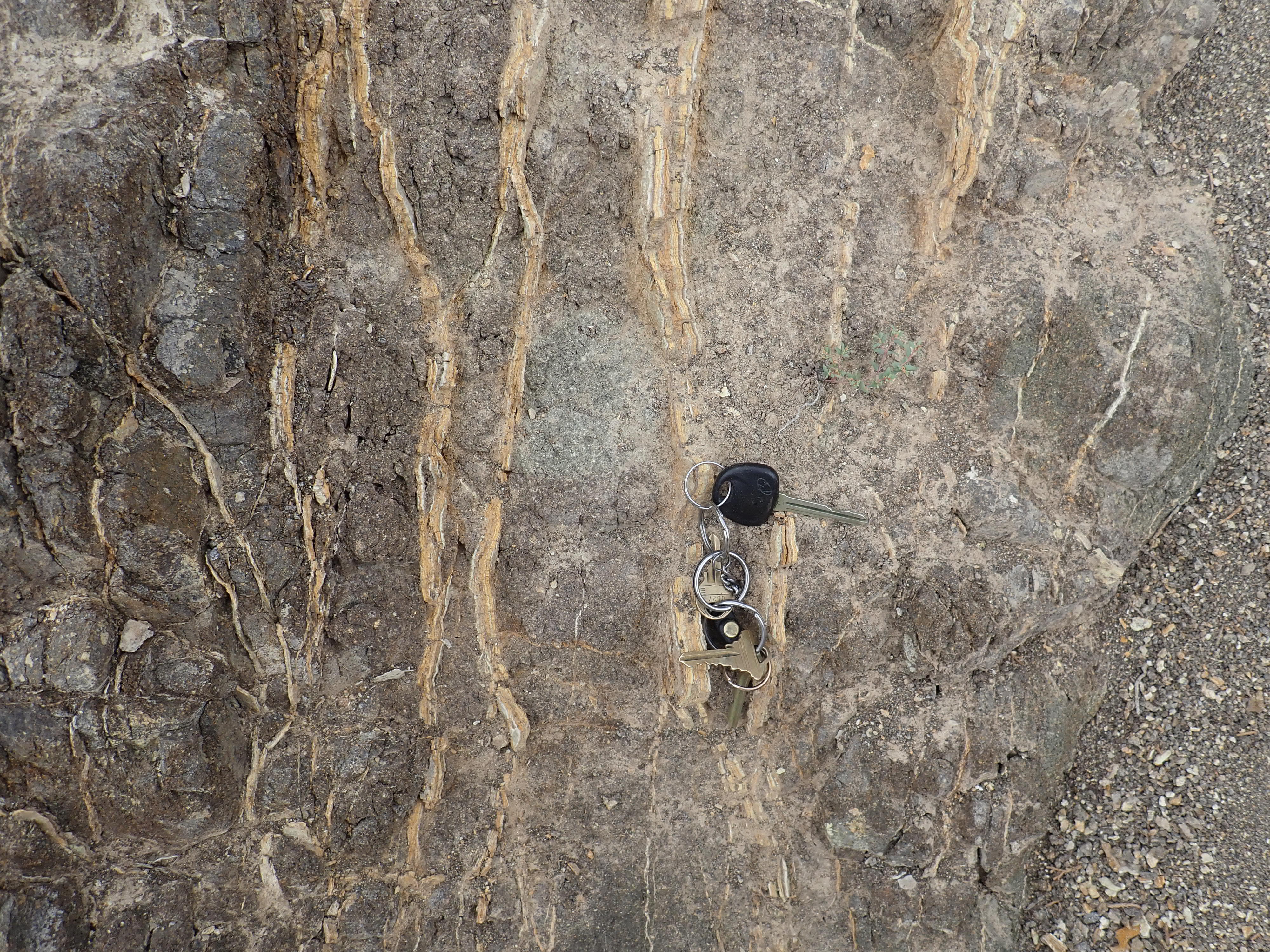
This looks an awful lot like a lamproite dike. These are produced by small volcanic eruptions that bring up magma very low in silica and rich in potassium — distant cousins of basanites. The veins look like calcite injected into the solidifying magma.
Samples:
This sample is highly magnified,to show the pinkish-orange rhombohedral crystals of what looks very much like potassium feldspar. The dark grains look like pyroxene. I do not see any mica. That suggests this is not a lamproite, but the variety of lamprophyre called vogesite. Like lamproite, this would be a low-silica, high-potassium rock. It definitely is igneous, not sedimentary.
The veins:
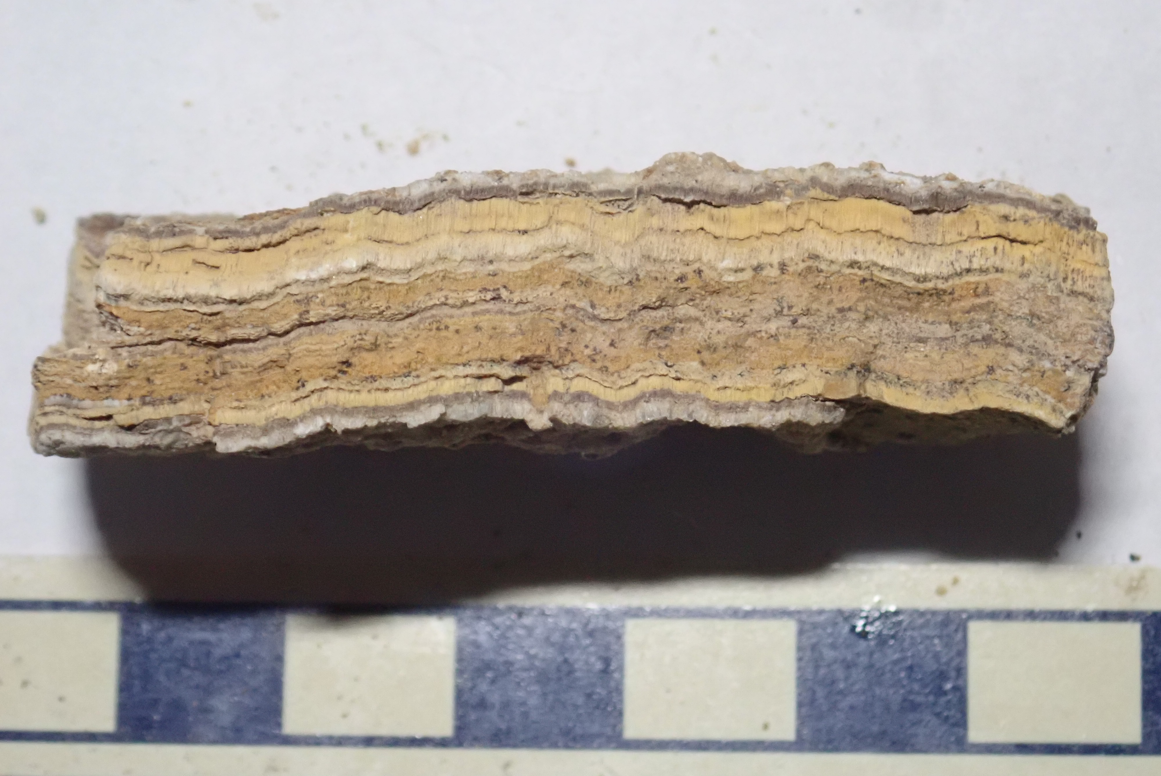
I first took this for calcite, but look at the columnar crystals at top and bottom. It isn’t calcite and it’s too hard to be gypsum. My very wild guess is a zeolite, of which there are numerous varieties. I’d expect something potassium-rich here.
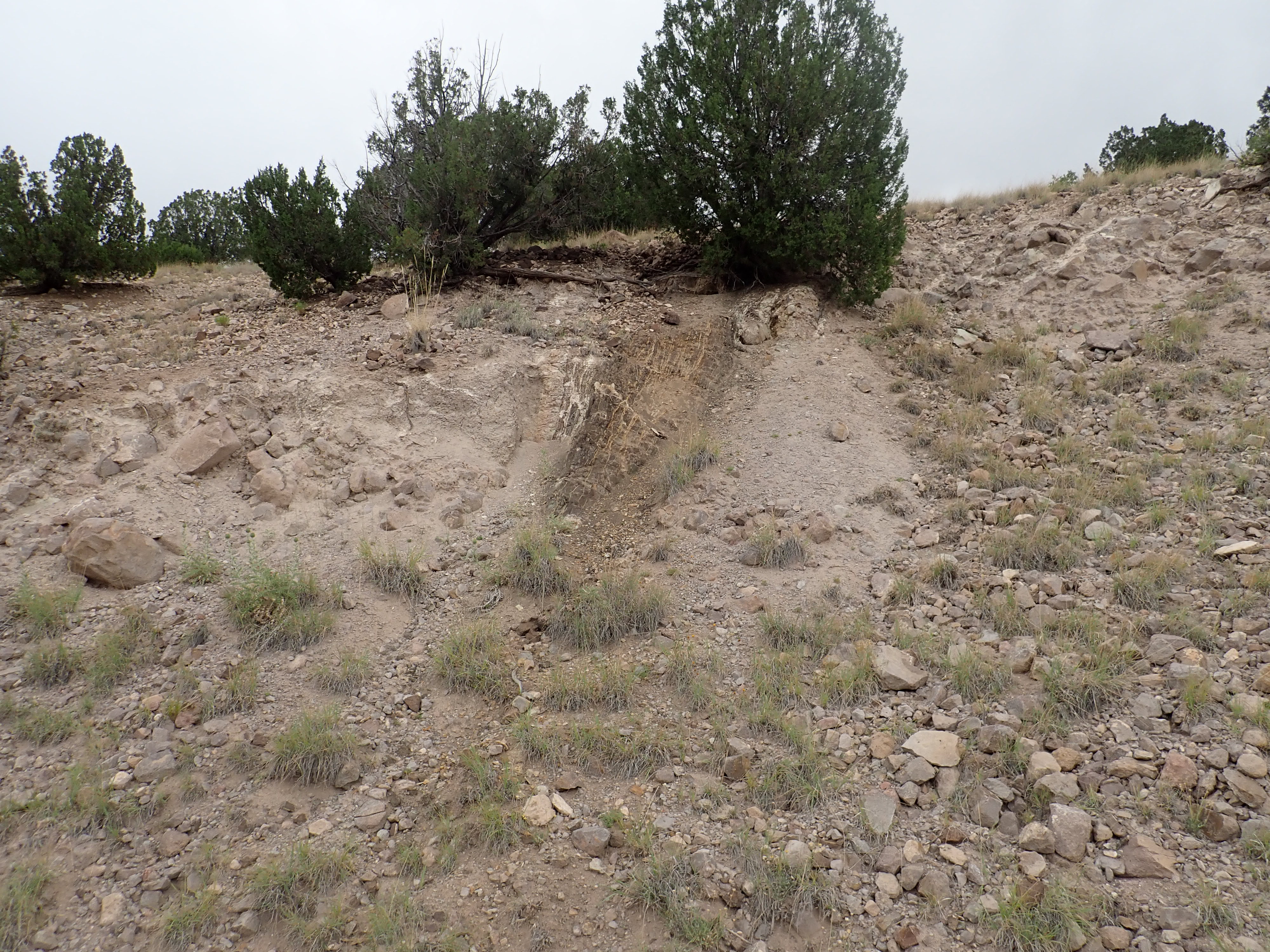
But here’s the thing. This dike looks very much like it’s intruding the sediments around it, which look like very young sediments, not more than a few million years old. The map maps these as such. I take a closer look.
This is a very boulder-rich sediment bed, looking like river deposits — the boulders are well-rounded and surprisingly well-sorted (roughly equal in size.) I find myself wondering if this might be a lot older than it looks, and get closer still.
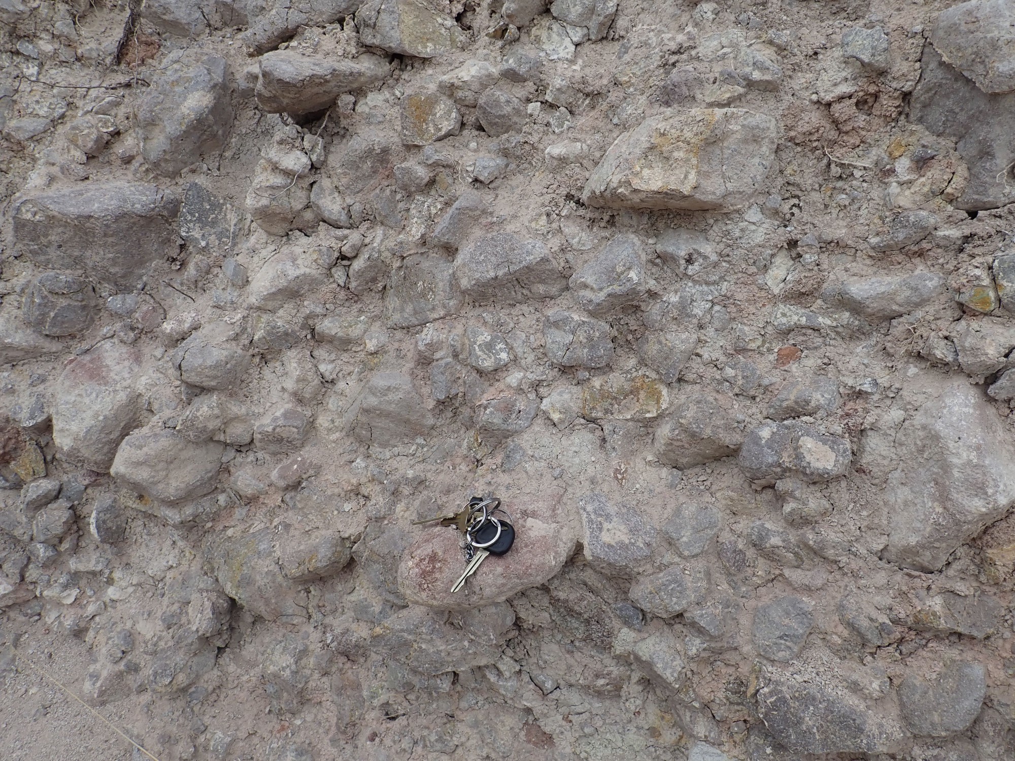
Okay, they’re somewhat angular, though the sharpest edges have been worn smooth. They’ve been moved, but not far. They look like Espinaso Formation clasts (rock fragments) but the muddy matrix around them is quite soft — this is not a cemented conglomerate of possibly great age. It really does look young.
So here’s the dilemma. We see a ultramafic (very low-silica) dike intruding what appears to be very young sediment beds. Either there was a low-volume ultramafic eruption here in the last few million years, unrelated to either the Cieneguilla Basanite or the nearby, decidedly sub-alkaline, Cerros del Rio Basalt, or the sediment beds are a lot older than they looks, or the dike is an old one that was eroded out in relief and subsequently buried in coarse sediments, or it’s not a dike at all. All these possibilities have problems: There are no other traces of a recent eruption in this location, though, to be sure, lamproite erodes rapidly; the boulder beds really look young; lamproite dikes tend not to erode out well, and the deposition of a mass of boulders on top would beat it to powder; and it sure looks like a dike. A great mystery.
It’s just remotely possible that this is not a dike at all, but fault gouge. There is a change in color on the hill opposite that could be a fault trace.
No fault is marked on the map, but it might have been missed. On the other hand, the dike doesn’t look at all like any fault gouge I’ve seen, and dikes tend to intrude along fault lines.
I hate mysteries, actually. I have too much hobbit in me: I am too fond of books full of things I already know, set out fair and square without contradictions.
And, further on, yet another mystery.

That looks for all the world like hydromagmatic beds, formed when magma intrudes wet sediments. Have I stumbled across a buried maar? If so, how old is it? Maars tend not to be preserved long in the geologic record, but there are some three-million-year-old maars preserved in the nearby Cerros del Rio.
The cement is not terribly hard, but it’s what I’d expect of weathered hydromagmatic beds.
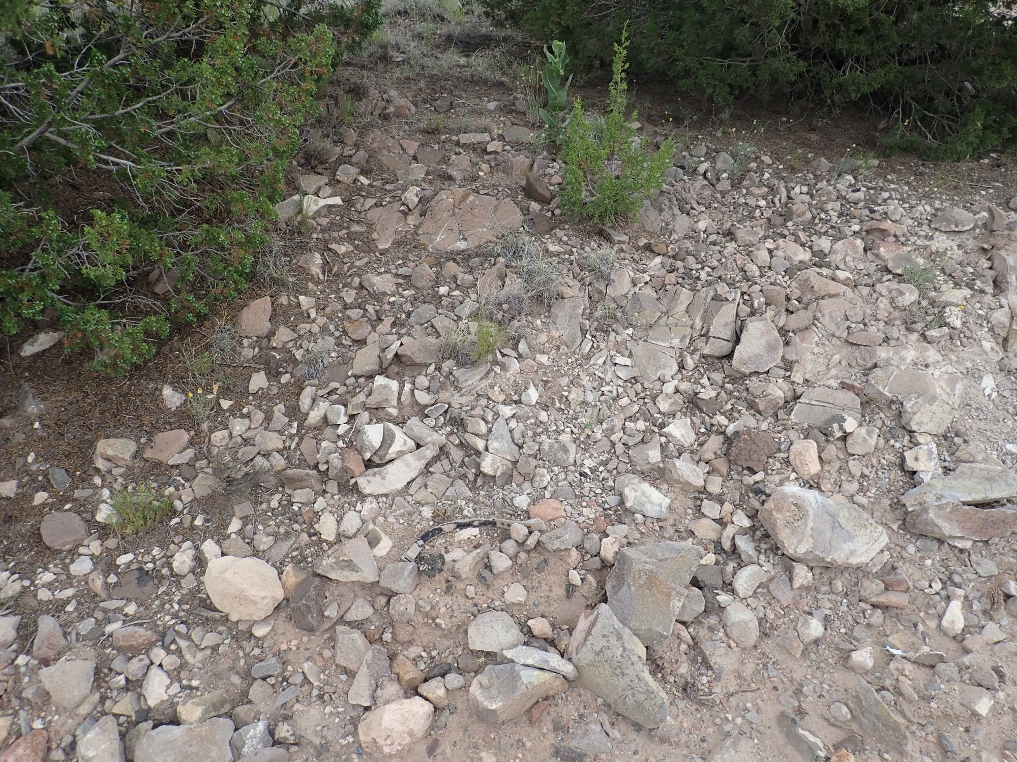
Further down, I start seeing what are definitely dark boulders of basanite in the road cut.

This area is mapped as young colluvium — sediments less than a couple of million years old — and these are probably not bedrock; just large boulders incorporated in the sediments.
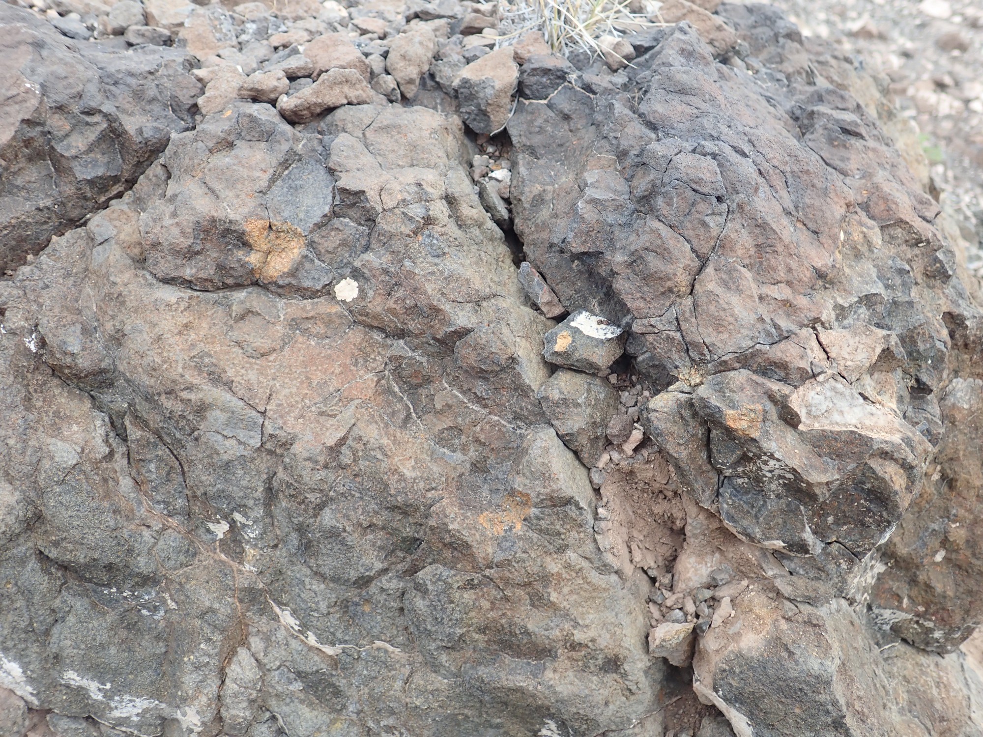
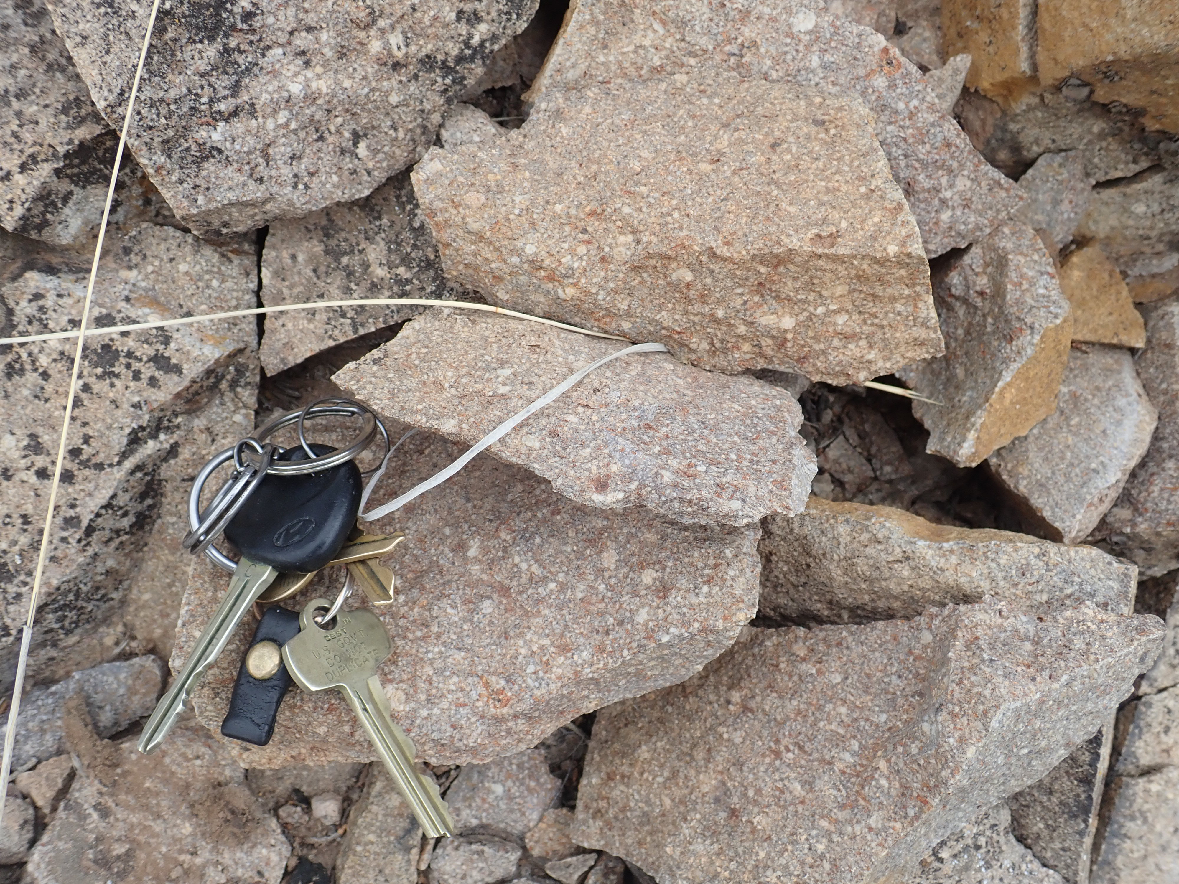
Somewhere along here I pick up a sample of basanite.
It’s a very uniform rock, for the most part, and very fine grained. But there are scattered rusty patches of iddingsite, from weathering of what was likely originally olivine. Olivine is a component of all basanites.
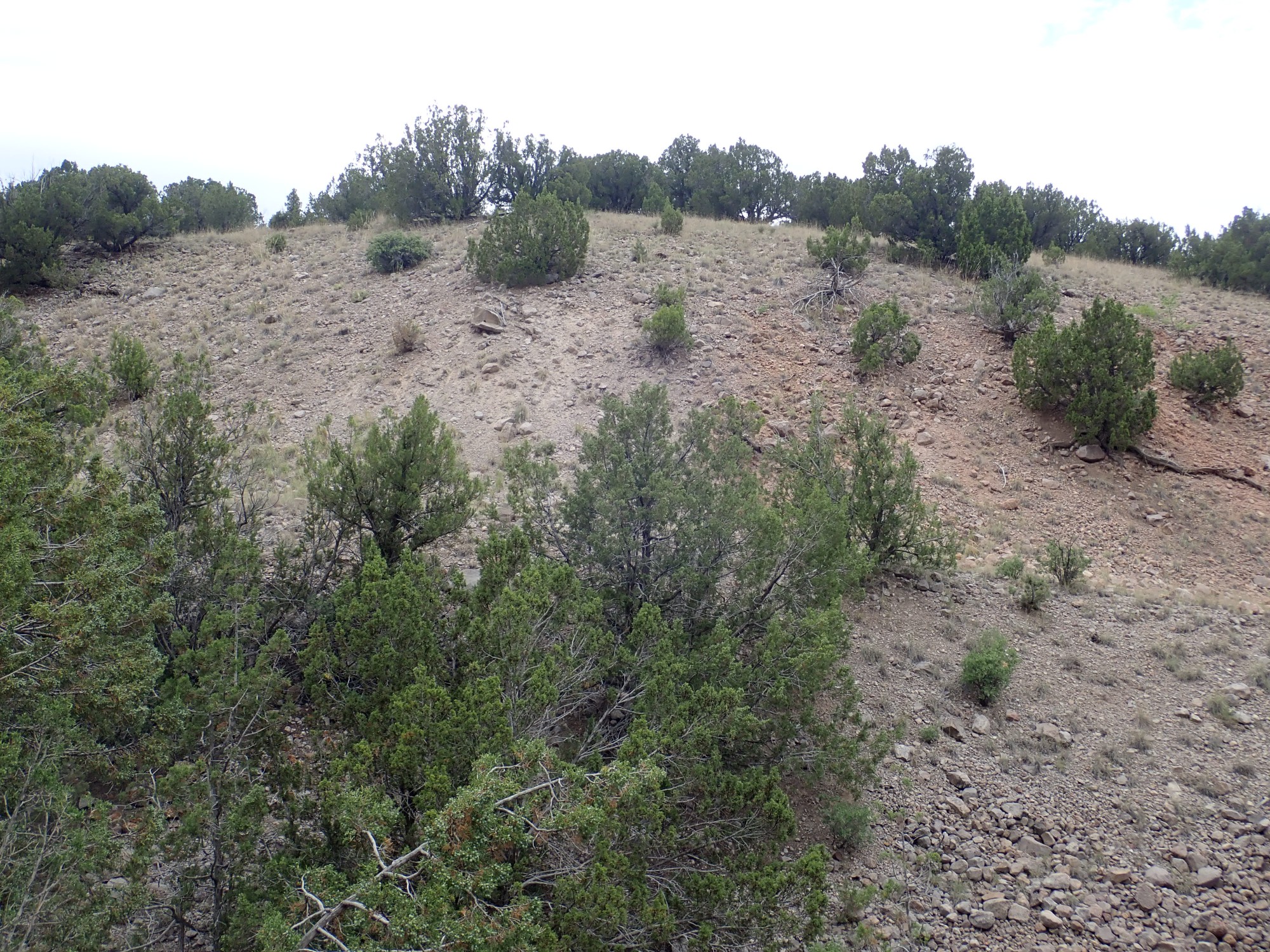
From here I turn up into the hills,where there is another striking color contrast suggesting some kind of contact.
My GPS has chosen this moment to lose all accuracy, but somewhere near here. The geologic map interprets this as the contact between dark basanite beds on the skyline and colluvium forming the pink slopes in the foreground and at right.
I start hunting in earnest for xenoliths, bits of foreign rock embedded in the basanite. Some of these may be harzburgite. Perhaps not this one:
This looks like granulite, a general term for coarse-grained, light-colored rocks from the deep crust. Maybe this:
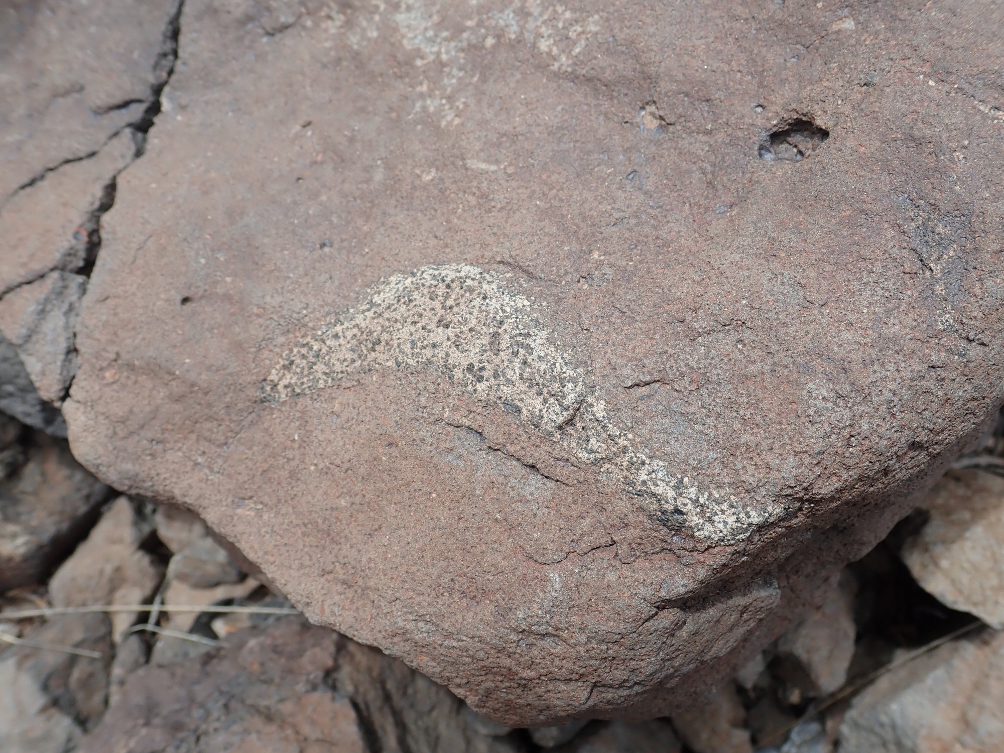
But this, too, looks like possibly a granulite. I’m looking for something that may have once been dark crystals of pyroxene mingled with green crystals of olivine, but the olivine tends to weather to a red rusty color.
And I manage to discover what flying rock shrapnel can do. I’m hammering on a rock when a fragment comes loose at high velocity and hits me in the shin. I get a pretty good lump from it.
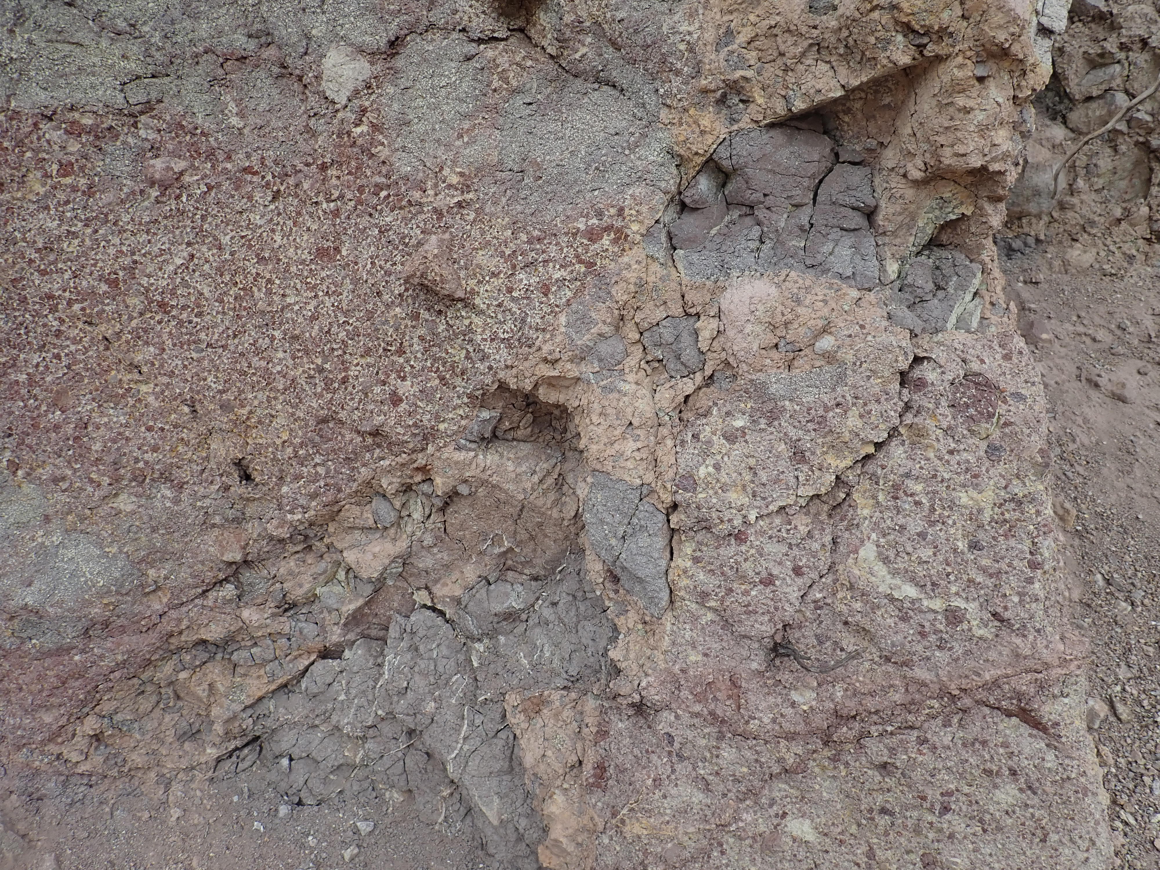
Somewhat frustrated, I walk up to the contact seen earlier. (And my GPS is finally locking again.)
It’s a pretty diffuse contact, consistent with colluvium lapping onto older basanite beds. Except:
The cement matrix is very hard around the rock fragments. It looks almost like another hydromagmatic bed. However, it could also just be well calicified, and that’s the guess I’ll go with.
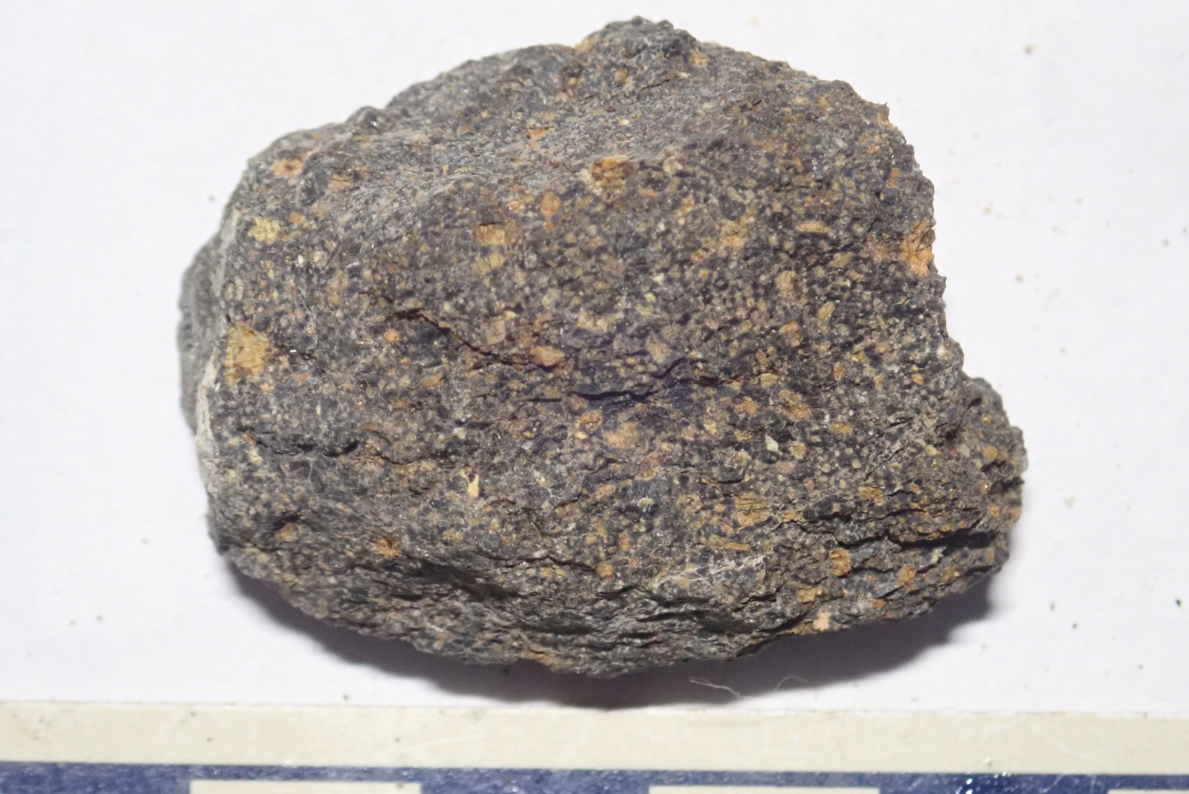
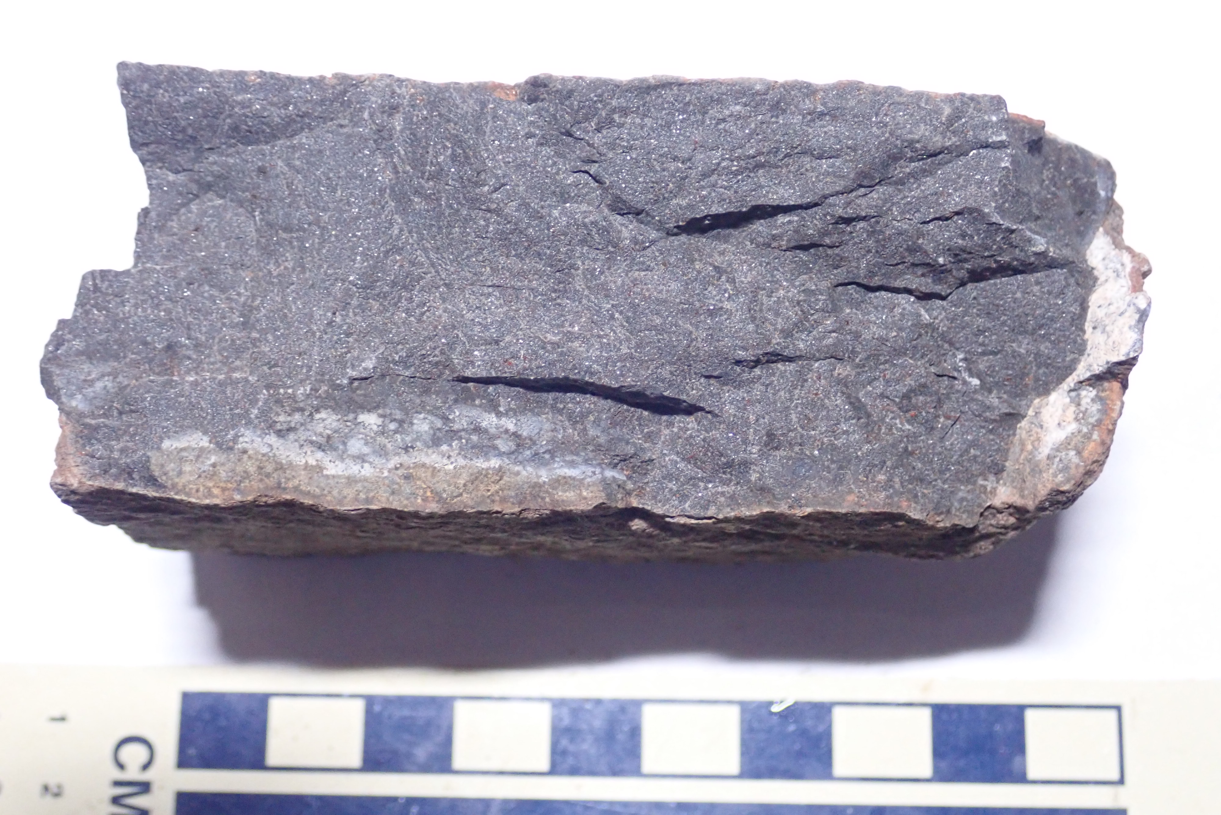
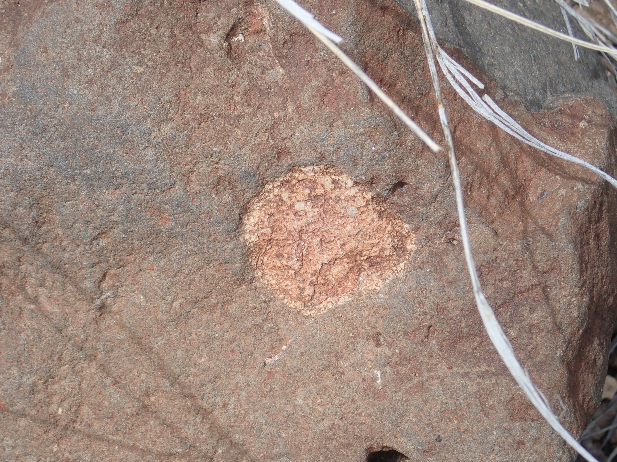
Climbing back down, I find my best candidate for a harzburgite xenolith of the day.
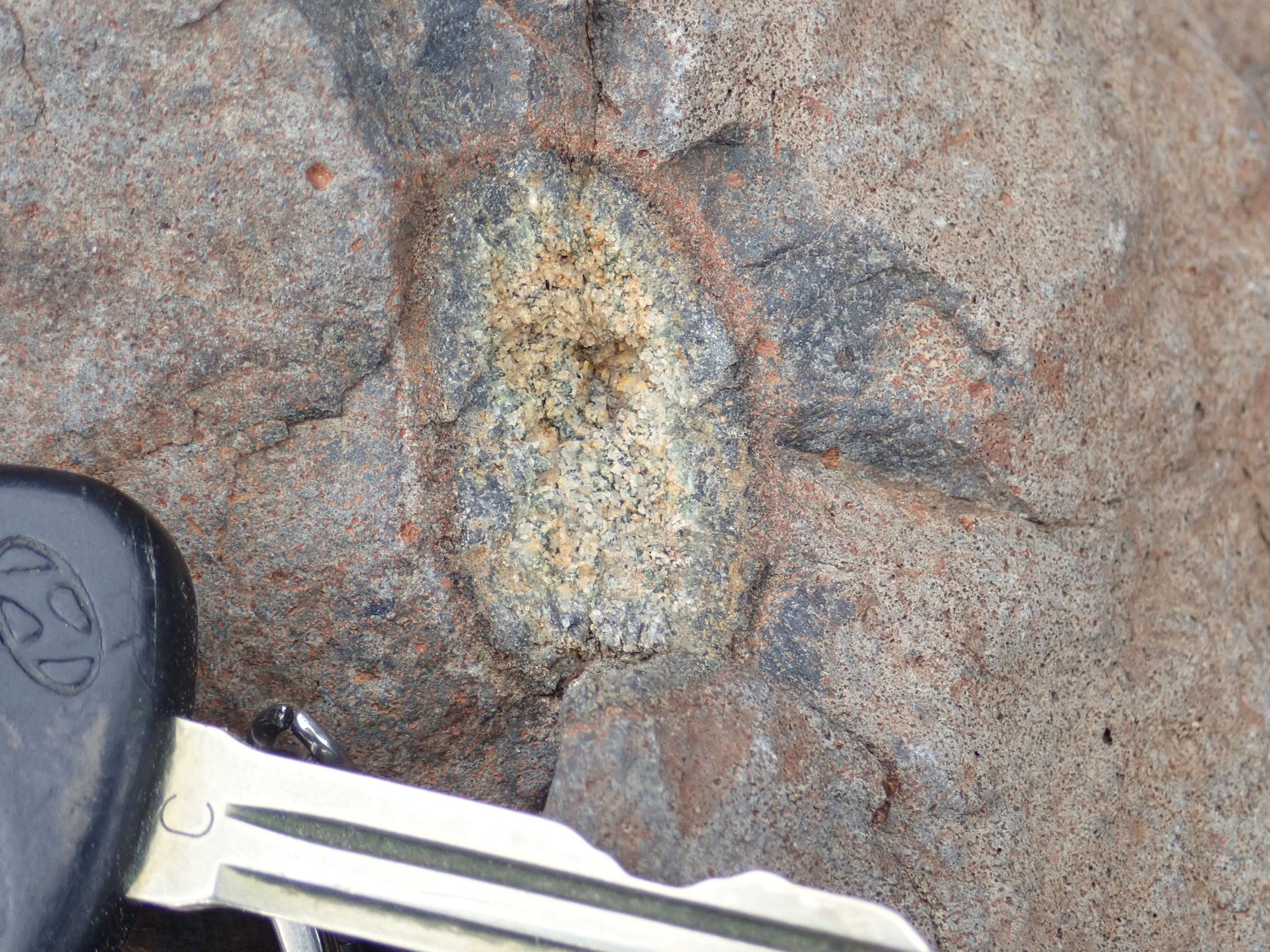
It does look like a mix of dark and greenish (weathering to rusty red) crystals, and the fact this is weathering faster than the basanite around it is also a good sign. Granulites tend to be almost as resistant as basanite, but harzburgite weathers quickly under surface conditions.
On the other hand, it may be a vug, a bubble in the rock in which crystals formed later. These could just be quartz crystals lining a vug, which is not uncool but also not harzburgite. But I never heard of a vug with dark crystals looking just like pyroxene mixed with the quartz, and there seems to be an un-vug-like reaction rim around the xenolith.
If I can get someone more expert to confirm this is harzburgite, then this will be one for the book.
No use trying to hammer it out. I consider taking the whole rock, but it’s as big as my head and pushes the definition of “hand sample”, which is what you can legally collect on BLM land.
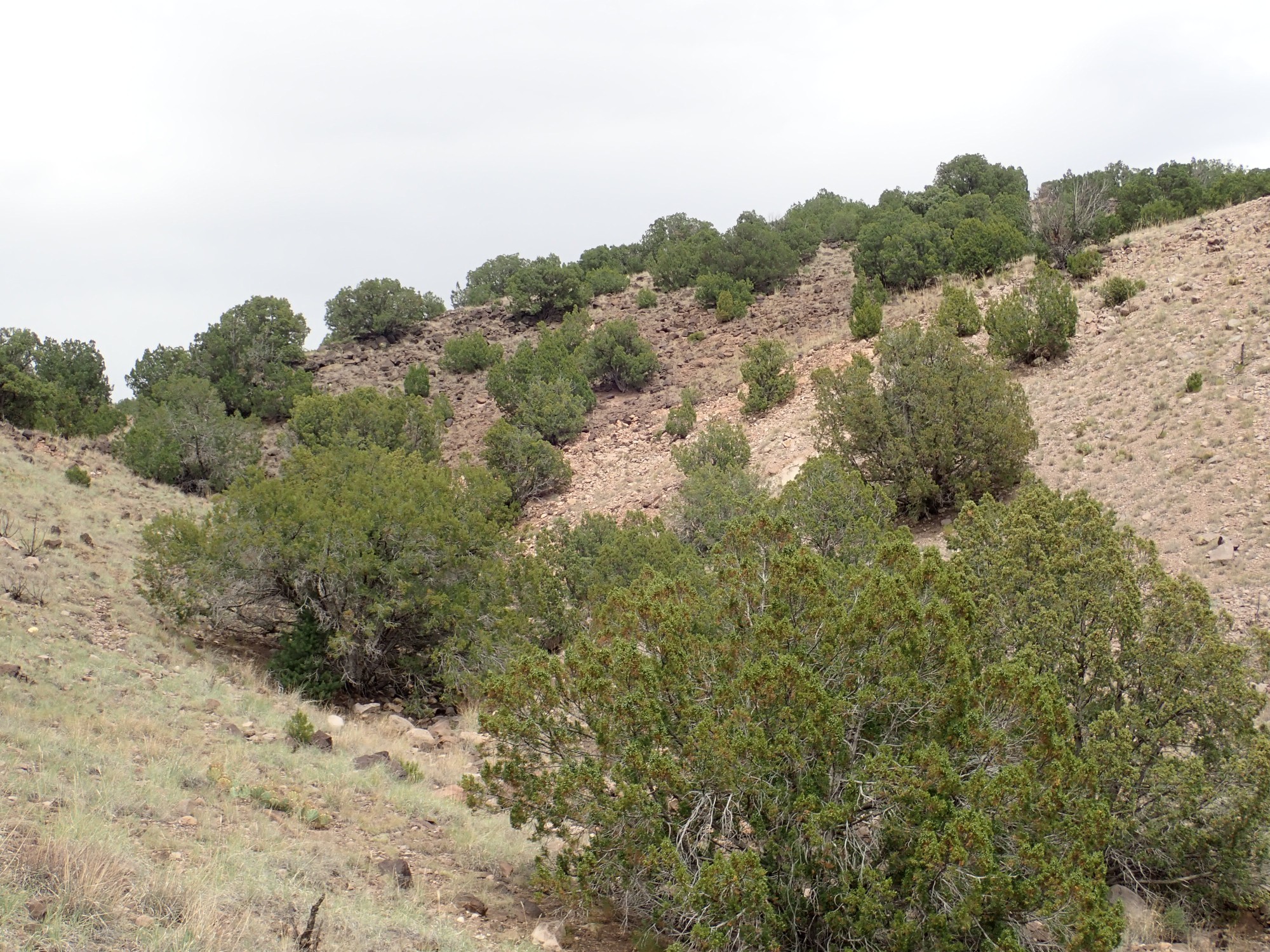
A final shot of the western basanite knoll.
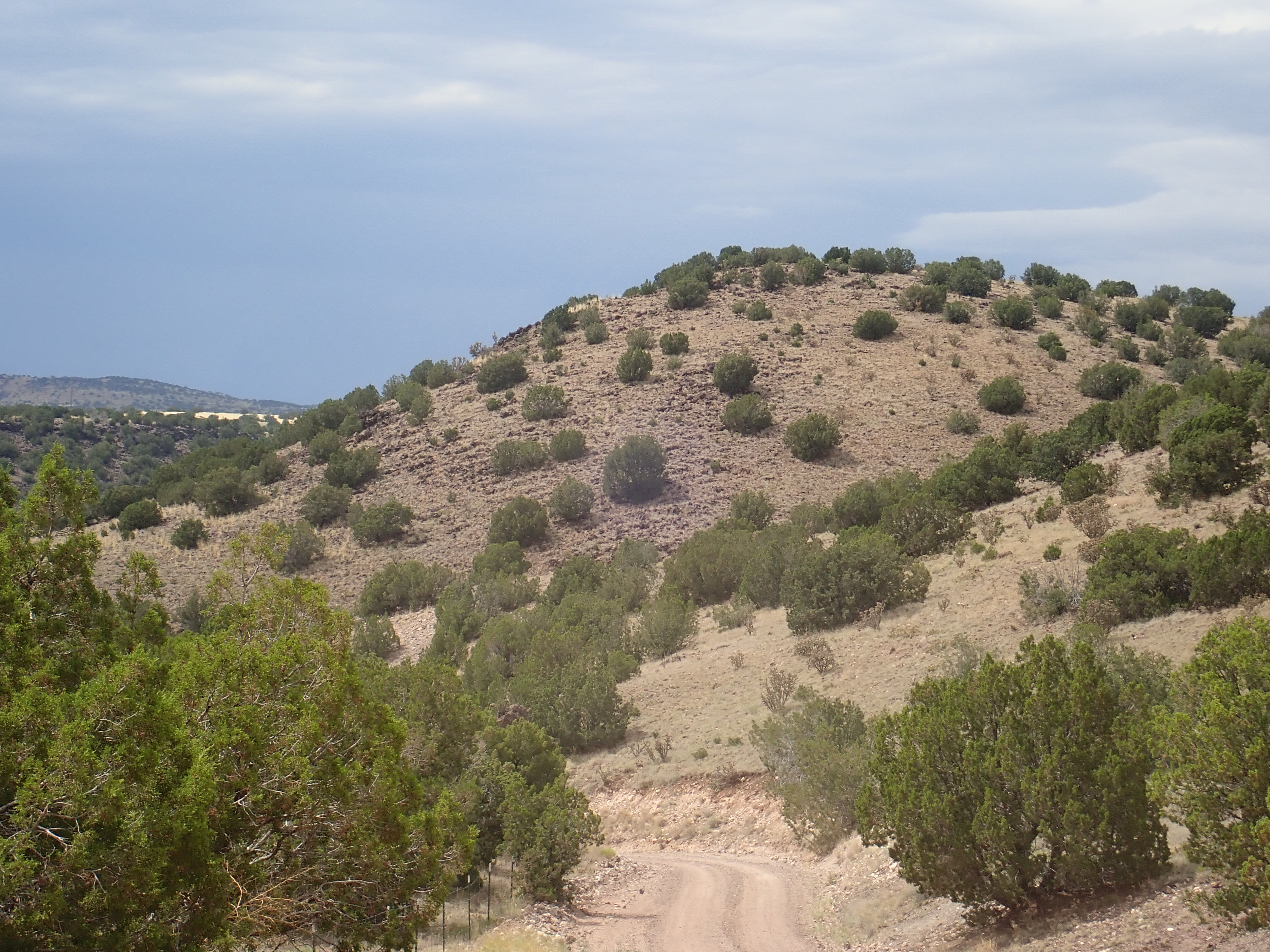
It looks very much to me like the beds dip about 15 degrees to the southwest. Oddly, the geologic report gives almost the opposite dip.
A final shot of both basanite knolls,and then I am on my way home.

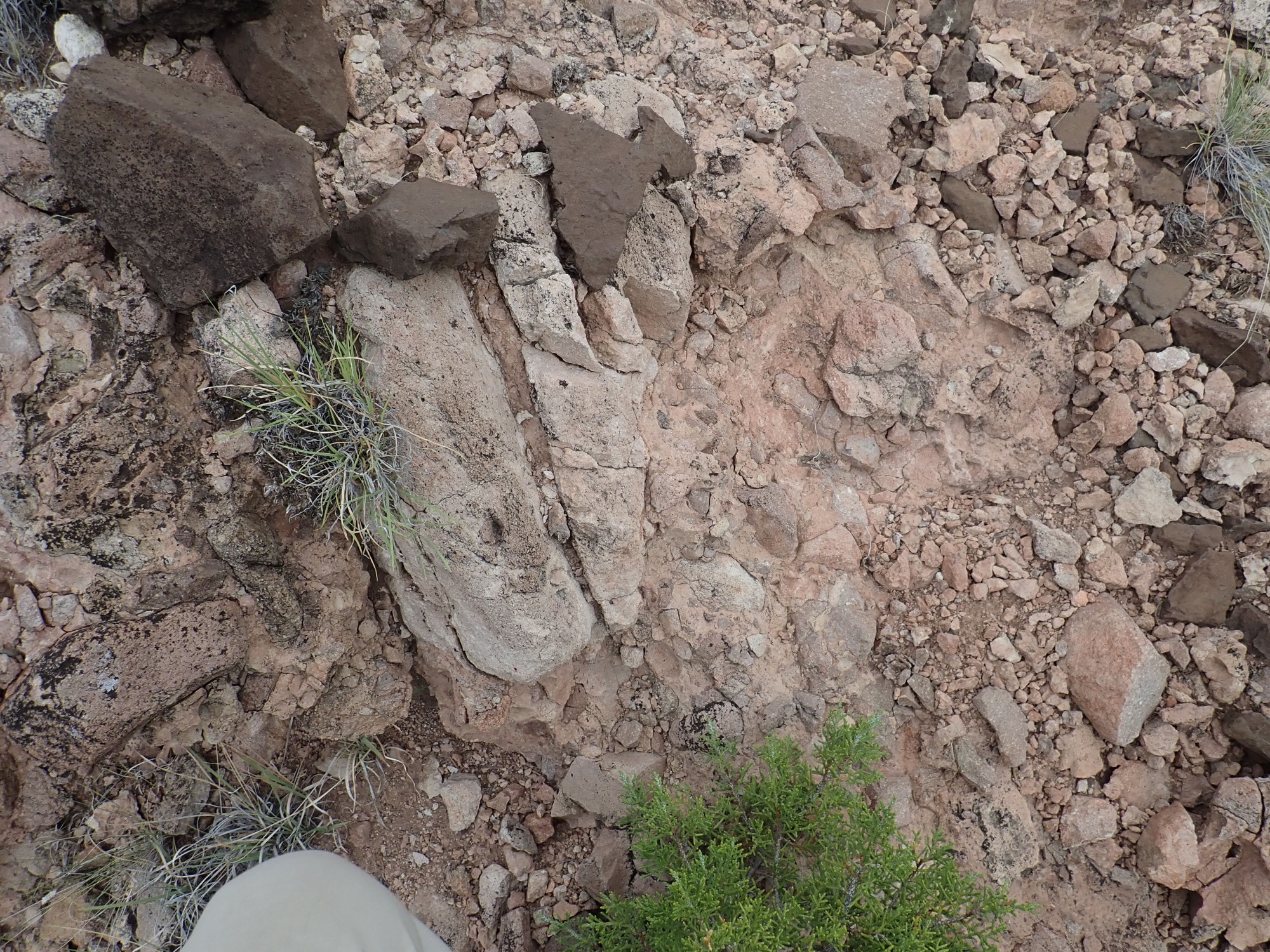
On the way out I stop at a known outcrop of Espinaso Formation, just to compare with what I’d seen earlier.
This is a brecciated andesite flow; that is, a flow of moderately viscous lava that broke into chunks as it cooled, which were still hot enough to meld back together. You can see this closer up:

Under the magnifier, it’s a very uniform, plain, fine-grained brown rock. Andesite or latite (the difference is that latite has slightly more quartz and potassium; but it would take laboratory analysis to know.)
From there, home.
The boreholes are likely where paleomag samples were taken. There are three sets of them in the area. We found them as part of a rock art recording project in the area