
Wanderlusting Clayton
This weekend was the 70th Annual New Mexico Geological Society Fall Field Conference. This is my first time to attend the event, though I’ve followed the conference series fairly closely and have often used their road logs. Gary Stradling came with me, and having a buddy on the road trip always makes it much more fun.
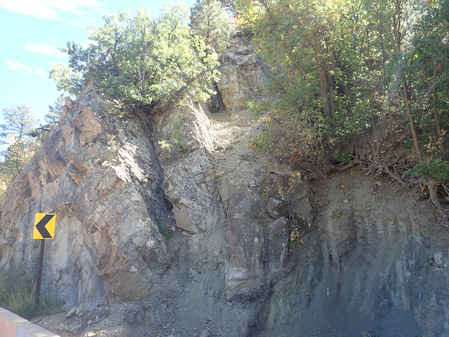
So Wednesday we packed up and headed out reasonably early (9:00 or so), planning to take the route from White Rock through Glorieta Pass, Las Vegas, and Raton to Clayton. The drive to Santa Fe is well-trodden ground, but I began to see new things of interest in Glorietta Pass. Such as this road cut:

(For new readers: Almost all images at this site can be clicked for a higher resolution version. Also, most blue links will take you to the map location being discussed.)
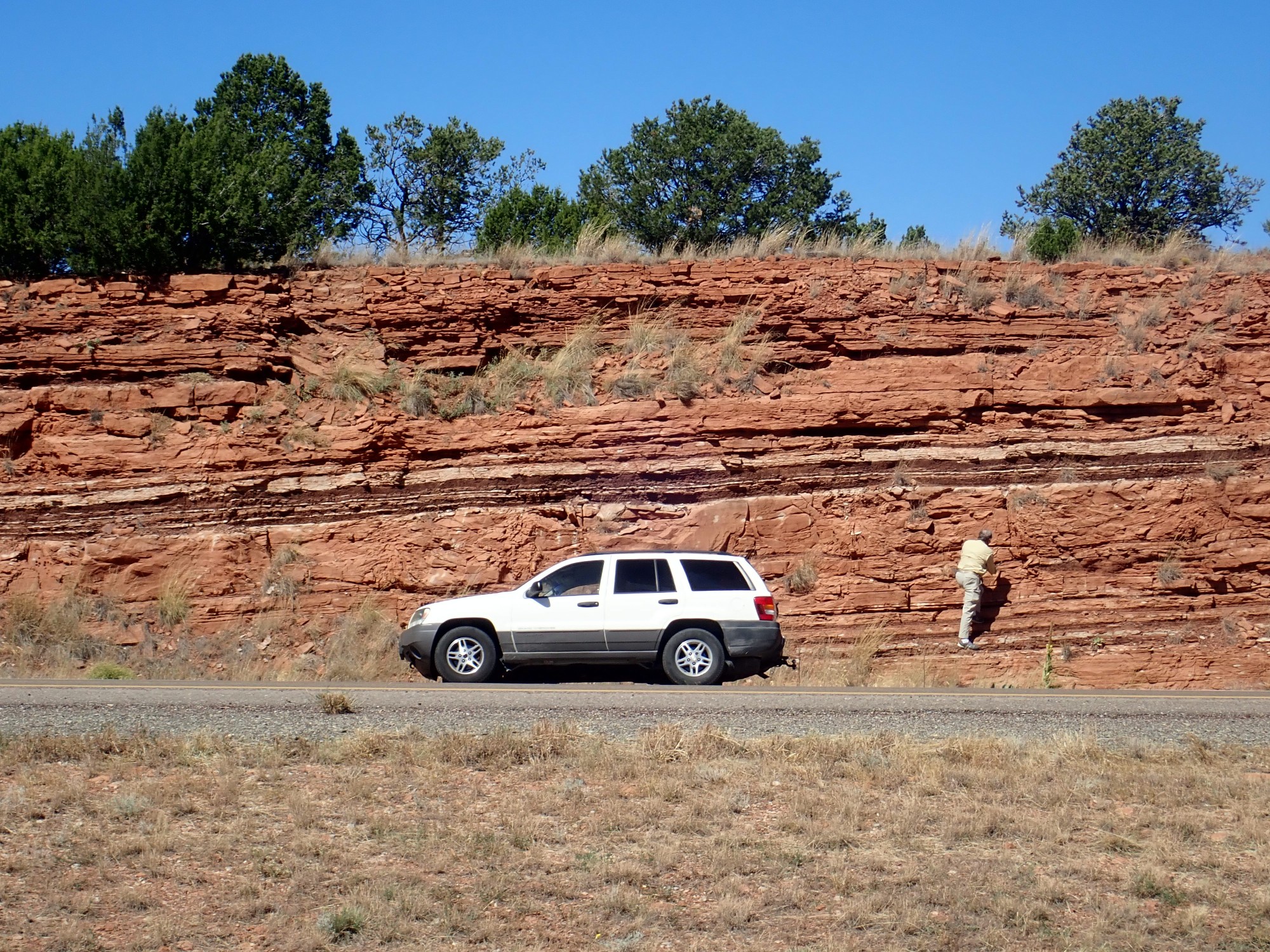
These red beds are just too pretty to not stop and admire. According to my geologic map for this area (which is admittedly somewhat dated), these are beds of the Yeso Formation. This is a lower Permian eolian sandstone.
Let’s unpack that. The Permian is a period of geologic time extending from 299 million years ago to 254 million years ago. It is the last period of the Paleozoic (“ancient life”) Era, and a time when reptile-like animals had just begun to diversify into the groups that would later become the dinosaurs and mammals. The lower Permian means the older beds during this interval of time. Since older beds usually lie below younger beds, it is common to speak of the lower, middle, or upper part of a period of geologic time, meaning the oldest, intermediate, and youngest beds of that period.
An eolian sandstone is one formed from sand transported by wind. It has a number of distinctive features, including well-rounded quartz grains of nearly equal size (well-sorted grains) that are frosted. In other words, their surfaces are not polished smooth, but are covered with very fine pits produced by collisions with other airborne grains. Sand transported by water does not show a frosted surface, because water cushions the blow when grains collide.
The Yeso seems to have been deposted near the seashore in an arid climate. The portions furthest north, at our latitude, show features of sand dunes. Further south, gypsum appears in the beds, indicating rapid evaporation from seawater-soaked sand flats in a sabkha environment. Sabkhas are found today in areas like the Persian Gulf. Still further south, the beds include limestone indicating a shallow marine environment.
Next stop is the hogback that runs along the eastern margin of the Sangre de Cristo mountain range.
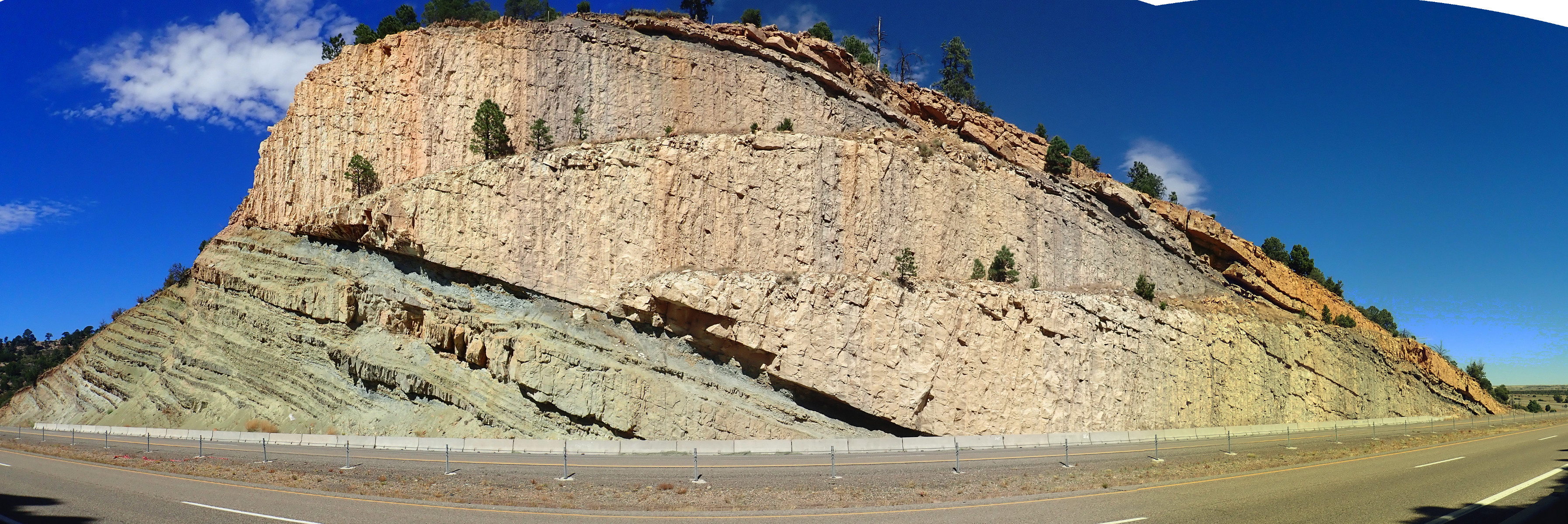
Although this outside my stomping grounds, I take a stab at identifying the top massive sandstone beds as Dakota Formation and the alternating mud and sandstone beds beneath as Burro Canyon Formation or some other local equivalent. Alas, I don’t have a good geologic map for this area, and my small-scale map only identifies these as Cretaceous beds.
Gary examines the beds more closely while I walk back up the road to look at the next section of the hogback.
Again, my map shows only that this is Jurassic. My guess at the time is Morrison Formation, with less resistant Morrison beds eroded away to form the valley between the two hogbacks. A map of a neighboring quadrangle shows part of the hogback, and although it is preliminary, it maps the two resistant portions here as Dakota and Morrison. So my guess is a good one.
Gary notices that part of the Dakota here is very dirty sandstone.
This is unusual. Dakota Sandstone is usually quite clean, though often highly bioturbated (stirred up by burrowing organisms.) There are also some thin lenses of pebble conglomerate here.
And here is a bed with a great deal of organic matter, a not-quite-coal bed.
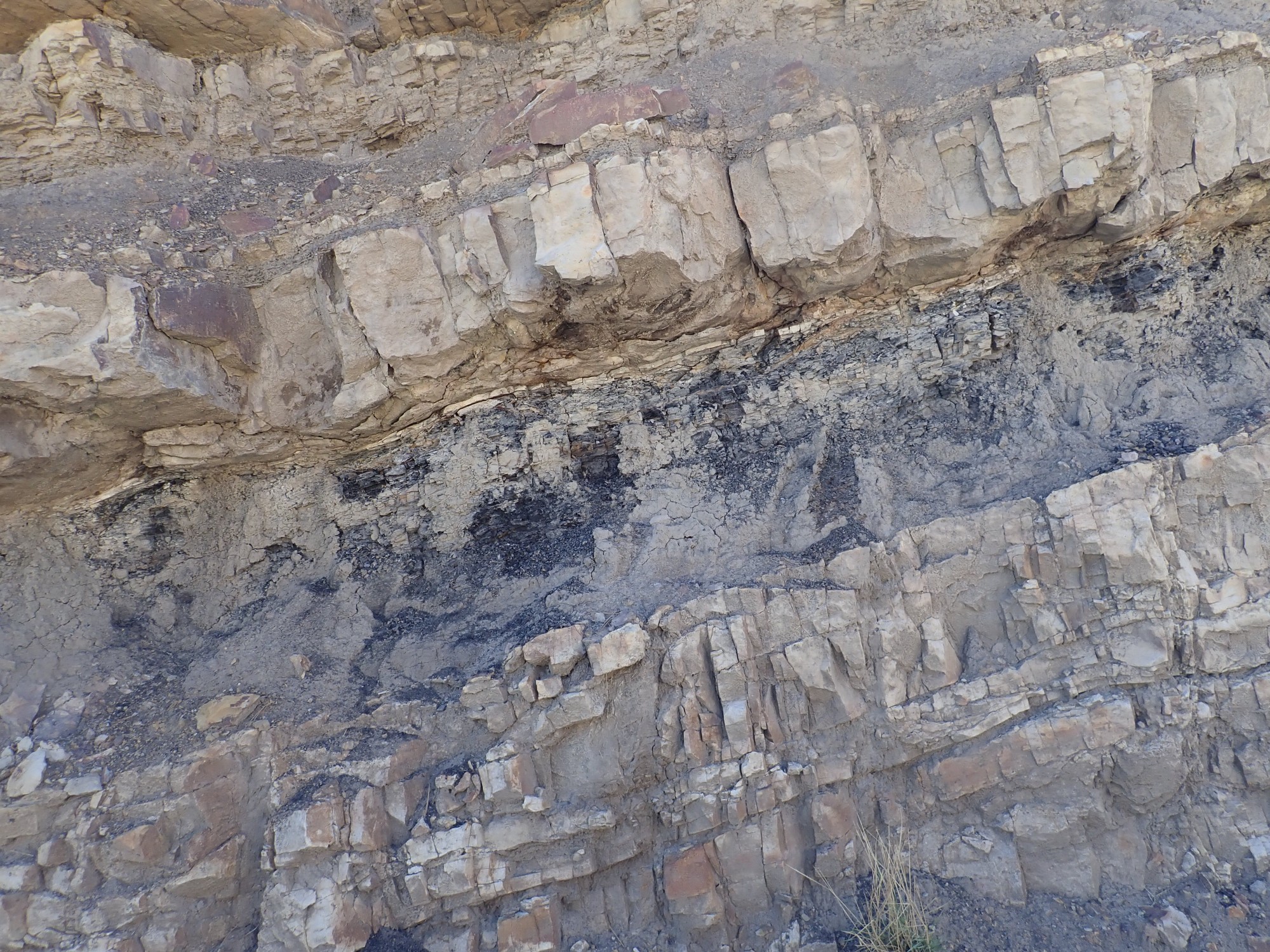
The Dakota is usually interpreted as shoreline sands associated with the advance of the Western Interior Seaway into this area, some 105 million years ago. Mountain building to the west put enough weight on the North American Plate that it was forced down into the underlying mantle, producing a large foreland basin covering most of what is now the Rocky Mountains and High Plains with a shallow ocean, known as the Cretaceous Sea or the Western Interior Seaway. The organic-rich beds seen here record a brief retreat of the sea that left behind muddy swamps in which not-quite-coal was deposited.
The older Morrison Formation, like the Dakota Formation, is a widespread formation mapped across much of the Rocky Mountains and adjacent areas. It was formed in an environment of meandering rivers and mud flats and is famous for its dinosaur fossil beds.
Just to the south of the highway is a gap in the hogback, an example of a water gap. There is a dry streambed running through the hogback, which was likely a substantial creek during the wetter climate of the last glaciation. This cut down through the hogback as it was exhumed to form the water gap. The gap was previously exploited by the Santa Fe Railroad and its frontage road, and the gap is wide enough to accomodate the modern interstate as well through the western hogback ridge; but the gap is narrow enough in the eastern hogback ridge that there was no room to put the interstate alongside the railroad, and the highway engineers were compelled to blast a path through the ridge.
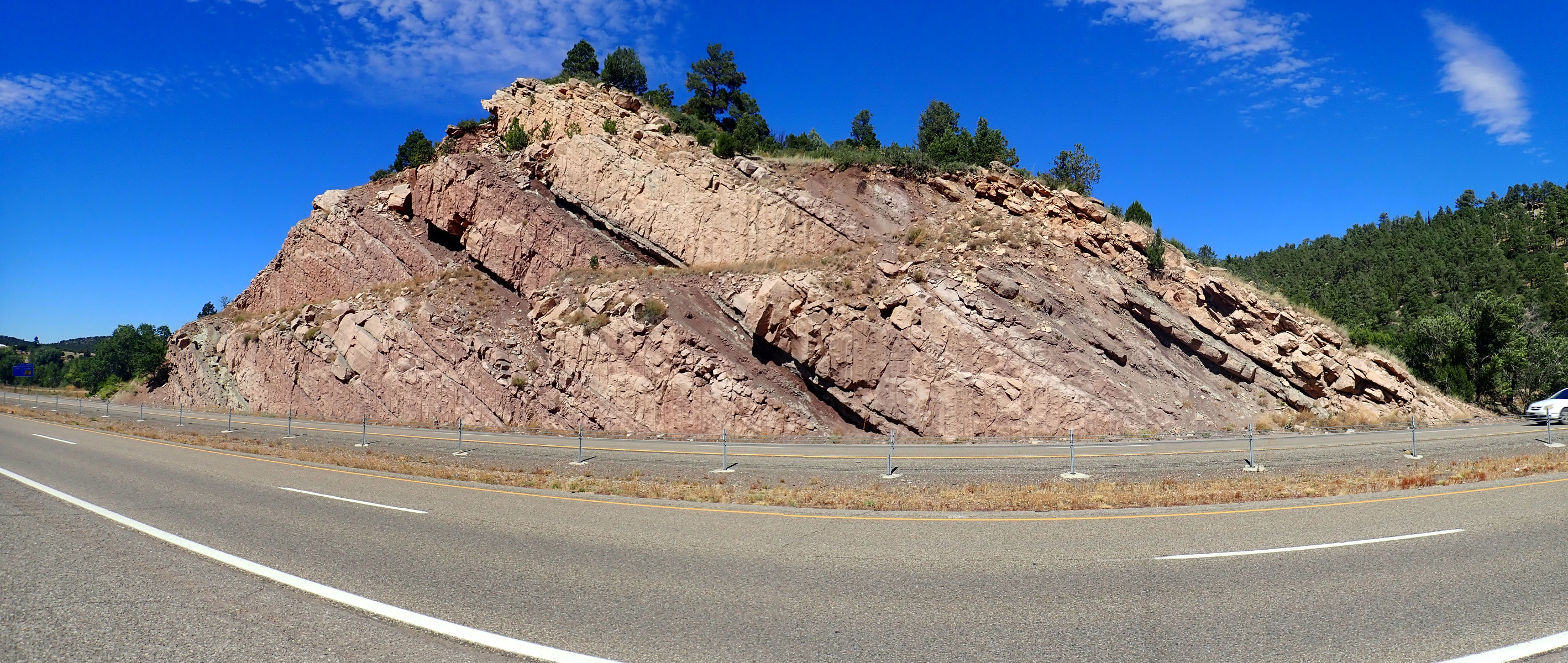
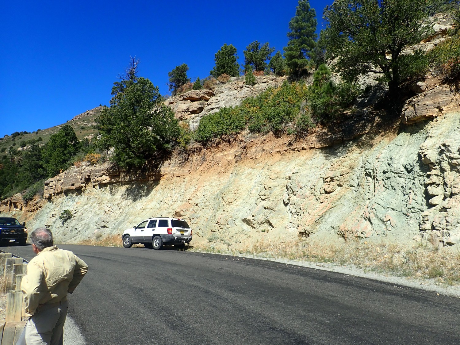
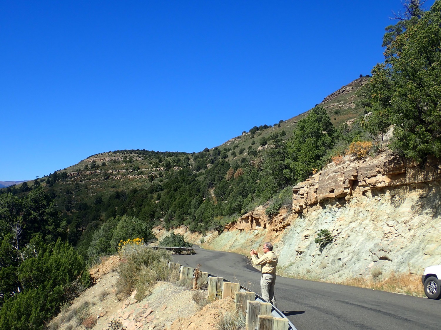
We head north to Montezuma, where the road follows another water gap through the hogback. Here the hogback is nearly vertical and the ages roll by as one drives along a stretch of about 200 yards of road. Alas, this stretch, too, lacks a modern large-scale geologic map and I have to work with a map that only shows period designations.
We park and work our way upwards in time, beginning with what I think is probably Agua Zarca Sandstone of the Chinle Formation.
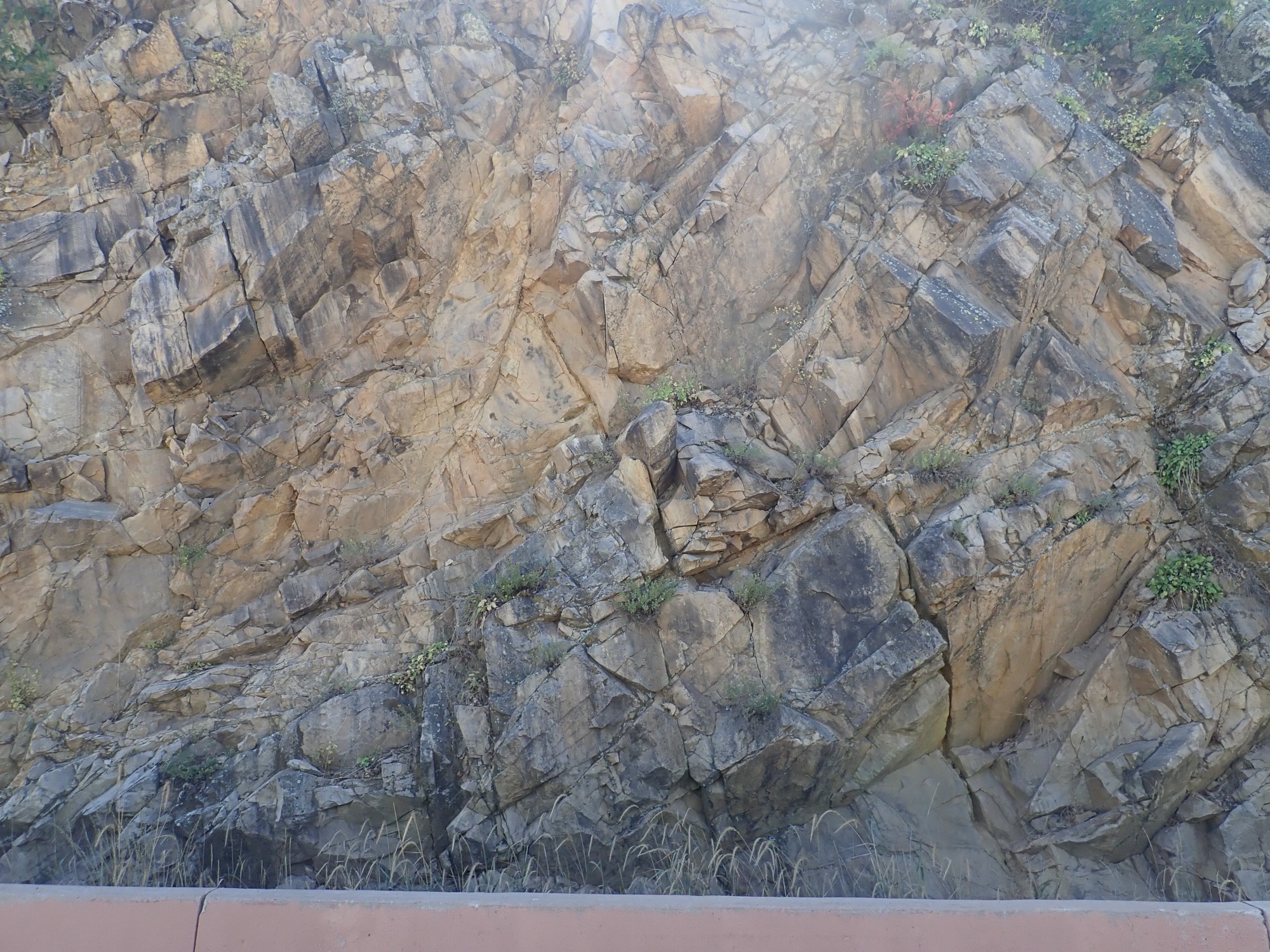
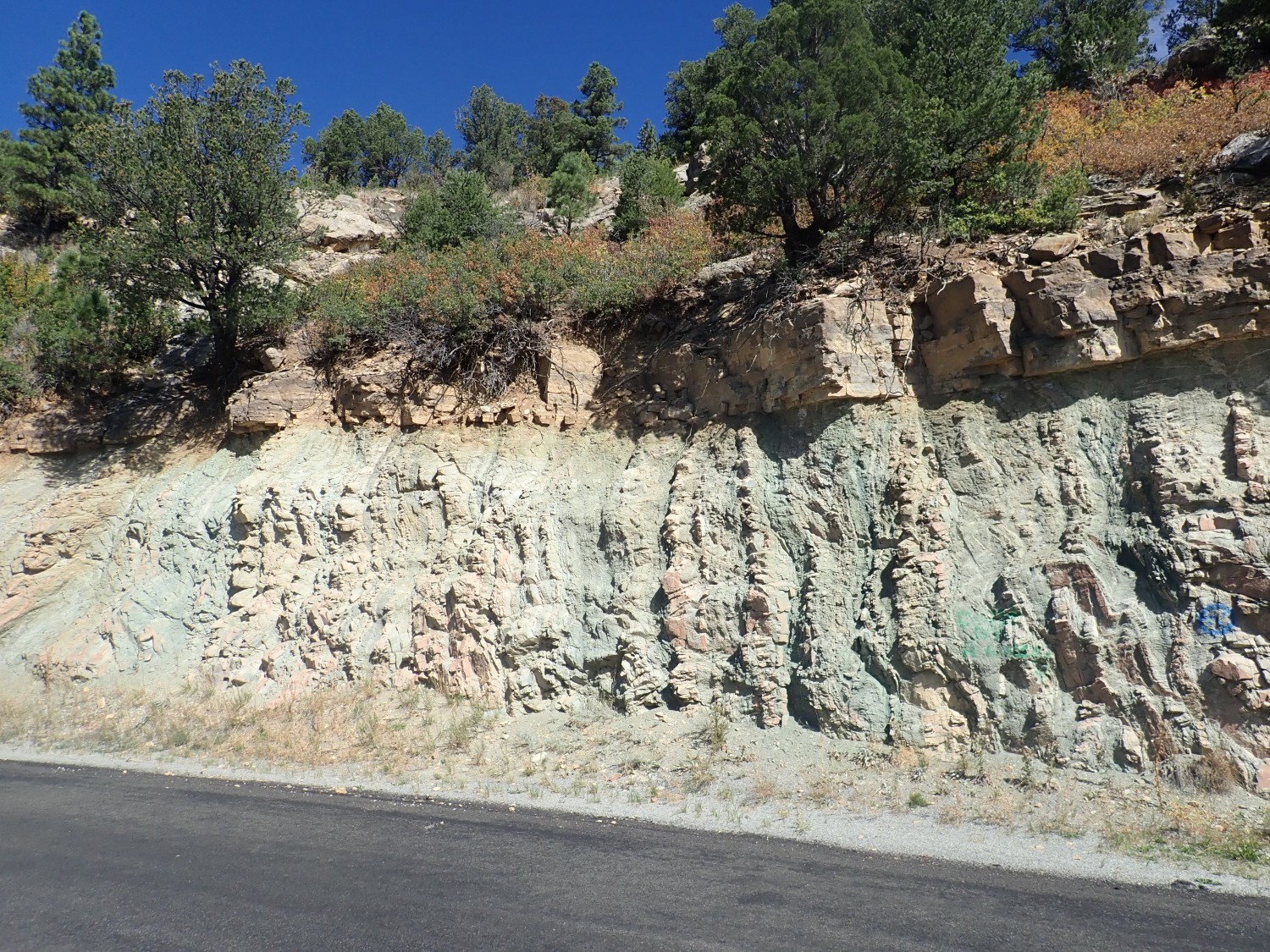
The beds are actually tilted past vertical here. They lean to the left but the older beds are to the right. This extreme deformation reflects a deep fault in the basement rocks associated with the upthrust of the Sangre de Cristo Mountains just west of here. My guess of the bed identification is just that, a guess; the map only says this approximate area is Chinle Group.
The Chinle Group is upper Triassic in age, about 230 million years old, and likely is river channel and delta deposits associated with the mighty Chinle River, which flowed from the southern Appalachians (then a high and rugged range) to the Pacific coast in what is now central Nevada. It contains sandstone, conglomerate, and mudstone beds.
Here we see a distinctive form of bioturbation.
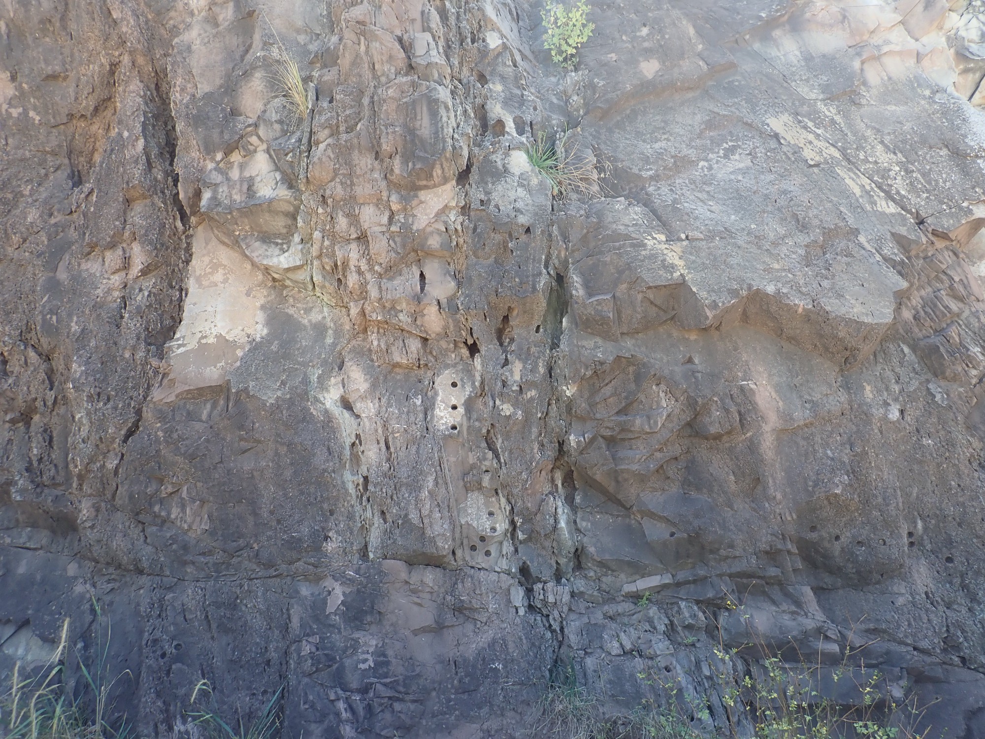
The boreholes are almost certainly from geologists taking samples of the outcrop.
This is just cool.
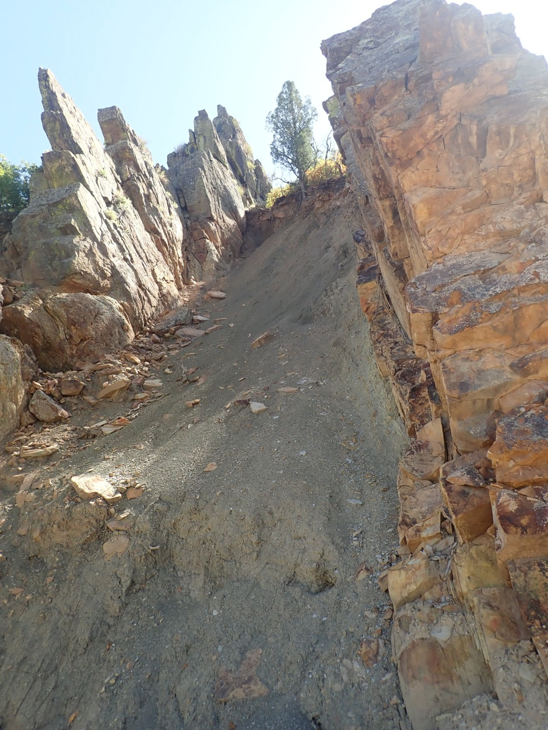
The mudstone between two sandstone beds has been eroded to create this spectacular feature. The geologic map has this at the base of the Jurassic, but I can’t make a more specific formation identification.
Again, the Jurassic beds are tilted to the point where they are slightly overturned.

Here the warping is very obvious.
We drive up the road into the mountains, crossing the fault responsible for this hogback (whose trace is hidden under river sediments) to reach Precambrian basement. Basement is crystalline rock, either intrusive igneous rock or heavily metamorphosed rock, that is devoid of fossils and (generally) older than the start of the Cambrian Period, 540 million years ago. Prior to the invention of radiometric dating, when geologists could only assign relative dates to rocks based on their fossils, this basement was indecipherable.
The invention of radiometric dating allowed geologists to begin to work out the history of basement rock. The rocks here have been dated as Paleoproterozoic Era rocks, the first era of the Proterozoic (“earliest life”) Eon. They are between about 1.8 and 1.6 billion years in age, the typical oldest age of rocks in northern New Mexico. I see granites and tonalites on the drive into the hills; the tonalites of the Sangre de Cristo stand out for their rounded, eroded character, due to a high mica content that makes then poorly resistant to erosion.
And then we hit the Great Unconformity.
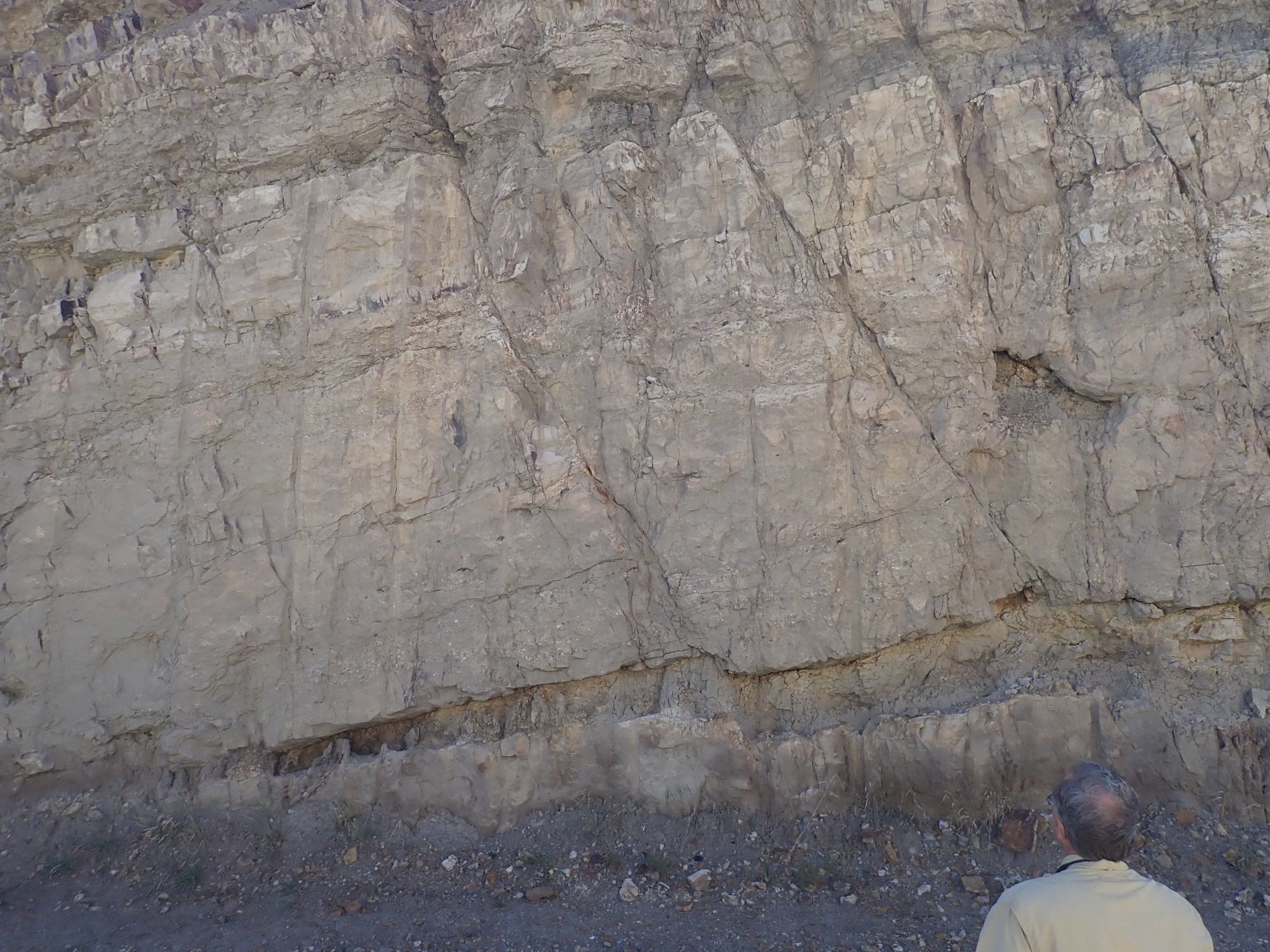
The lower part of the road cut is Precambrian rock, looking rather like sedimentary beds of sandstone and mudstone than have been metamorphosed into quartzite and schist. (I should have examined them more closely.) These are tilted nearly vertically, making a strong contrast with the nearly level Mississippian beds above. Again, my map identifies these only as Mississippian, but they are likely sandstone beds of the Del Padre Sandstone Member of the Espiritu Santo Formation of the Arroyo Peñasco Group. Formations are the basic unit of stratigraphy, the classification of rock beds in a region by age, but formations can be divided into members and combined into groups where this is useful.
This spectacular unconformity, where over a billion years of geologic history has been erased (from over 1.6 billion years ago to 350 million years ago) is known as the Great Unconformity, and it is present throughout western North America. It varies somewhat in its range, with sediments beginning to be deposited again in late Proterozoic time in the Grand Canyon area, but in northern New Mexico the Great Unconformity ends in the Mississippian. The Mississippian sediments appear to have been deposited on a peneplain, a surface that was eroded nearly flat, with nothing more than occasional quartzite ridges a few meters high over an area hundreds of miles across.
So what created the peneplain? A long period of tectonic quiescence, with no mountain building, combined with the great Varangian glaciation 700 million years ago. New Mexico was deep in the southern hemisphere at the time, and glaciers eroded the continent flat in a way quite similar to the Canadian Shield we see exposed today. This period of glaciation was so severe that it has been described as “Snowball Earth”, with evidence of glaciation at sea level near the equator of that time. The mystery is how life on Earth survived the Earth being nearly frozen over.
Above the Great Unconformity is a thick sequence of mostly marine sedimentary rocks of Mississippian and Pennsylvanian age.
The upper slopes are limestone beds of the Madera Formation, the dominant Pennsylvanian formation of northern New Mexico. There have been many proposals to promote the Madera to group status and divide it into more local formations, but the proposals are still being debated. Between the Madera and the Mississippian beds are earlier Pennsylvanian beds, probably similar to the Sandia Formation, but I don’t know the local area well and my map is too small-scale.
From Las Vegas we have a long drive across mostly flat ground to Raton. There is no time for side trips to look at interesting geology until we reach Raton itself. I calculate that there is enough time for a quick trip to the K-T boundary, while still leaving enough time to set up camp near Clayton and make it to the evening icebreaker that will kick off the fall field conference.
The K-T boundary is helpfully labeled near the base of the Raton Formation.
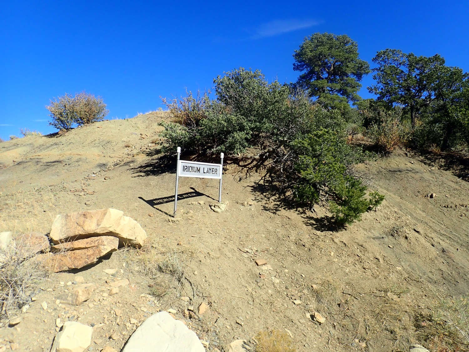
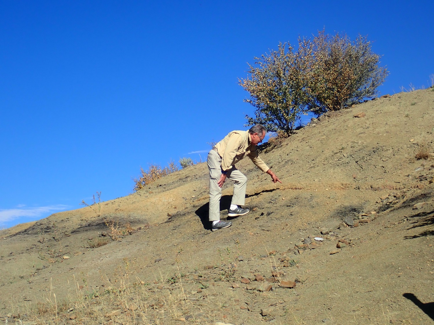
The exact boundary is hidden under soil in most spots, but the tree near the sign overhangs a clearer exposure.
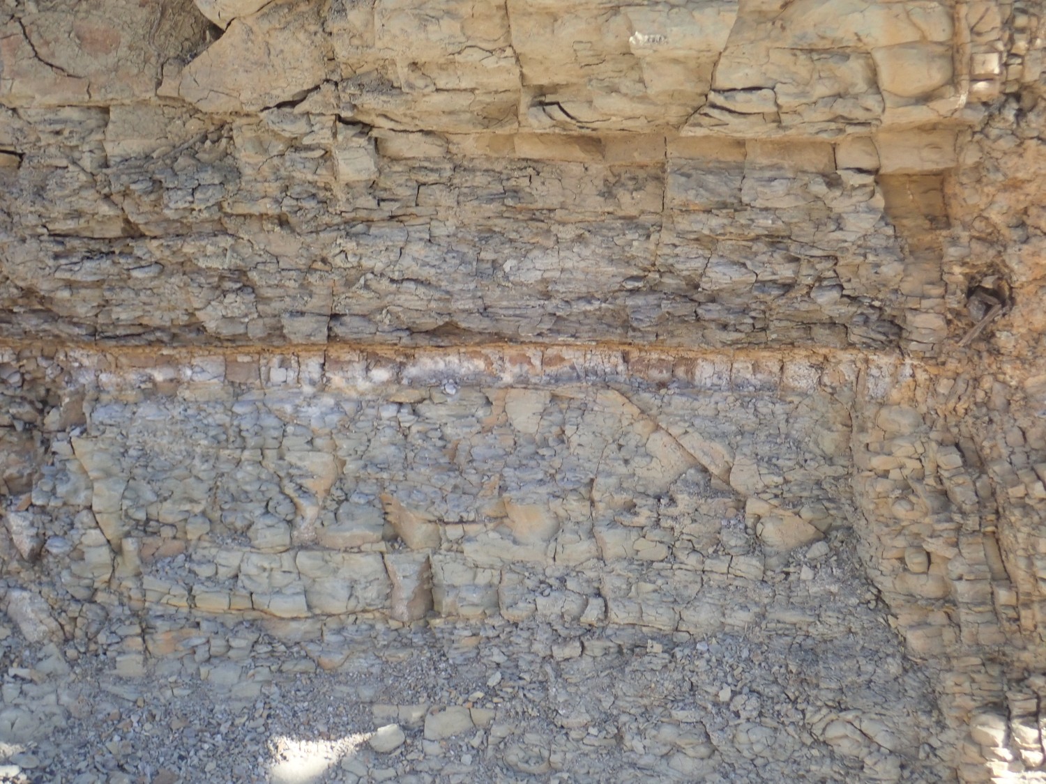
At least, I think that’s it. The K-T boundary marks the exact end of the Cretaceous Period and start of the Tertiary. (Though nowadays “Tertiary” is deprecated in favor of Paleogene and Neogene, making this the K-Pg boundary.) This is also the boundary between the Mesozoic (“middle life”) Era and Cenozoid (“young life”) Era. And it is the moment when a large asteroid hit the Earth in the northern Yucatan Peninsula, laying down a thin layer of iridium-rich clay around the world that I think is what we are seeing here. The impact is widely if not universally held to have wiped out all the families of dinosaurs except those that evolved into modern birds.
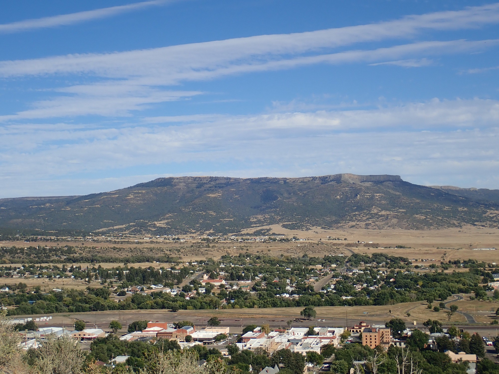
The K-T Trail Park has some nice views. To the north, hills with Trinidad Sandstone:
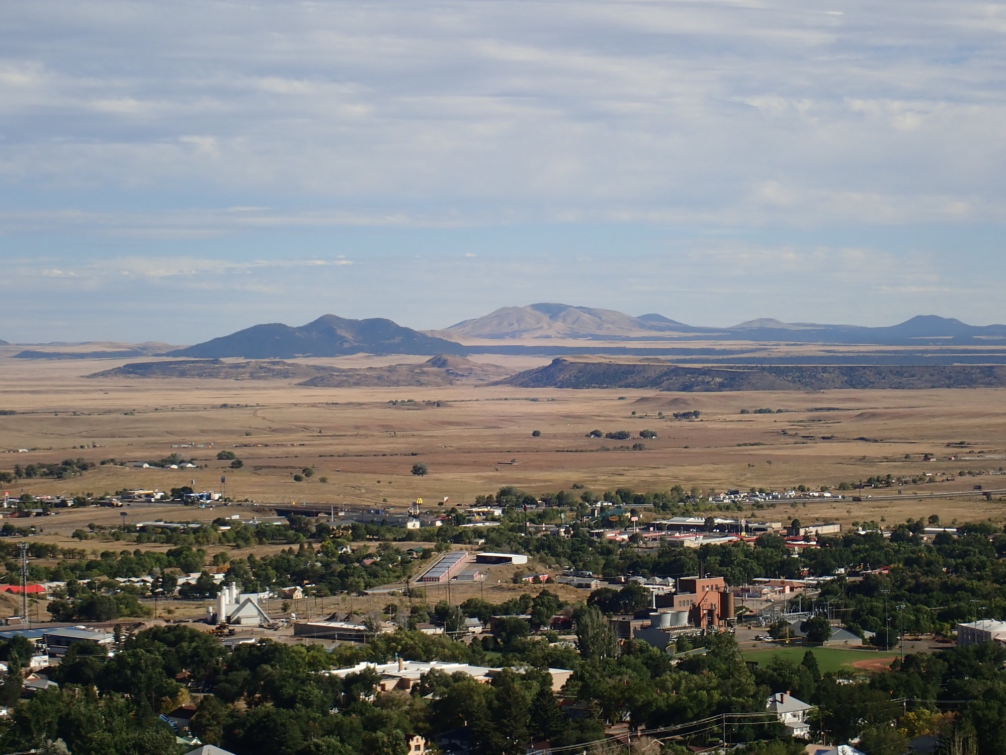
To the east, the Clayton-Raton volcanic field that is one of the major focuses of the conference:

This is one of the largest known volcanic fields, covering an area of 7500 square miles. Like other volcanic fields of its kind, it consists of numerous small volcanoes, lava flows, and cinder cones, rather than a single large volcano. Each vent in the field erupts only a few times (a monogenetic volcanic field) and then activity shifts to a different location.
The field is located at the northeastern end of the Jemez Lineament, a line of volcanic fields stretching from central Arizona to the Clayton area. The Lineament has approximately the length and direction of the Yellowstone hot spot trace, which includes the Snake River Plain and ends in the very young volcanism of Yellowstone National Park. It is believed that the Yellowstone hot spot is a local upwelling in the mantle — a mantle plume — over which the North American Plate is drifting to produce successively younger fields to the northeast. However, the idea that the Jemez Lineament is a hot spot trace similar to Yellowstone and that Clayon is the current location of the plume is an idea that really needs to be put to bed. Whereas there is a clear progression in age along the Yellowstone trace, there is no progression in age along the Jemez Lineament. Volcanism broke out in the Jemez Mountains around 15 million years ago and quickly spread northeast and southwest, quite unlike a hot spot trace. It is more likely that the Jemez Lineament marks a hydrous subduction scar where an island arc collided with North America 1.7 billion years ago, during the assembly of the continent. This left a permanent zone of weakness in the lower crust and upper mantle, rich in hydrous minerals that easily melt to produce magma.
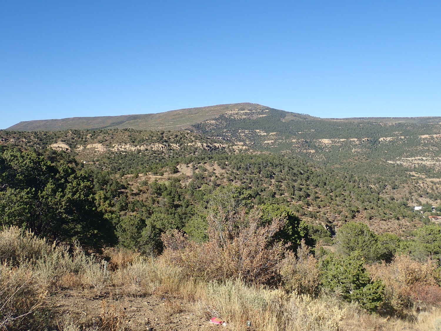
Directly east is Johnson Mesa.
Johnson Mesa is capped with thick basalts and basanites of the Raton phase of the Raton-Capulin volcanic field. This is one of three main eruptive pulses in the field, and lasted from about 9 to 3.5 million years ago. It was characterized by bimodal volcanism, a fairly common but not entirely understood feature of volcanic fields.
Vulcanologists find that volcanic rock shows a wide range of silica content, from 45% for the most silica-poor common volcanic rocks to over 70% for the most silica-rich. There is also a range of alkali metal content (potassium and sodium) from as low as 1% to over 15%. A single volcanic field can have a broad range of compositions, but typically a plot of alkali content versus silica shows a definite trend, with alkali increasing with silica. There are similar trends in other chemical elements that characterize the field, and these often differ from volcanic pulse to volcanic pulse in a distinctive way. In bimodal volcanism, a volcanic field shows a gap where little lava erupts with silica in a certain range. In the case of the Raton phase of the Raton-Capulin field, there is quite a lot of low-silica lava (basanite, basalt, and basaltic andesite) and a fair amount of fairly high silica lava (dacite and rhyodacite), but little intermediate-silica lava (such as andesite). We do not have a complete explanation of why this happens. One possibility is that high-silica magma separates from low-silica magma the way oil separates from water (phase separation) but laboratory evidence that this actually happens is rather weak. Another is that hot, silica-poor magma from the mantle melts surrounding high-silica crust without mixing, so that both pockets of low-silica and high-silica magma are produced that erupt separately. There is some supporting evidence for this idea, but it is not yet conclusive.
The basalt capping Johnson Mesa is low in silica (around 50%), but there are several plugs of higher-silicate dacite (around 70% silica) that erupted through the mesa cap. These are assigned to the Red Mountain Dacite. Laughlin Peak to the southeast is also composed of Red Mountain Dacite.
The subsequent phases of the Raton-Clayton field are the Clayton phase (3 to 2.25 million years ago) and the Capulin phase (1.7 million years to less than 40,000 years). There were thus pauses in volcanism around 3.25 million years ago and 2 million years ago. We’ll see volcanic features associated with these phases later in the conference.
Time is growing short, and we hurry on to Clayton. We are planning to camp at Clayton Lake State Park (Gary likes camping and I’m a tightwad) and find a suitable spot.
We meet a fellow camper, Jim, who warns us that a large and hungry raccoon has been active in the camping area, and is adept at finding food supplies. I’m in the habit of keeping all food locked in the car anyway, but we take note.
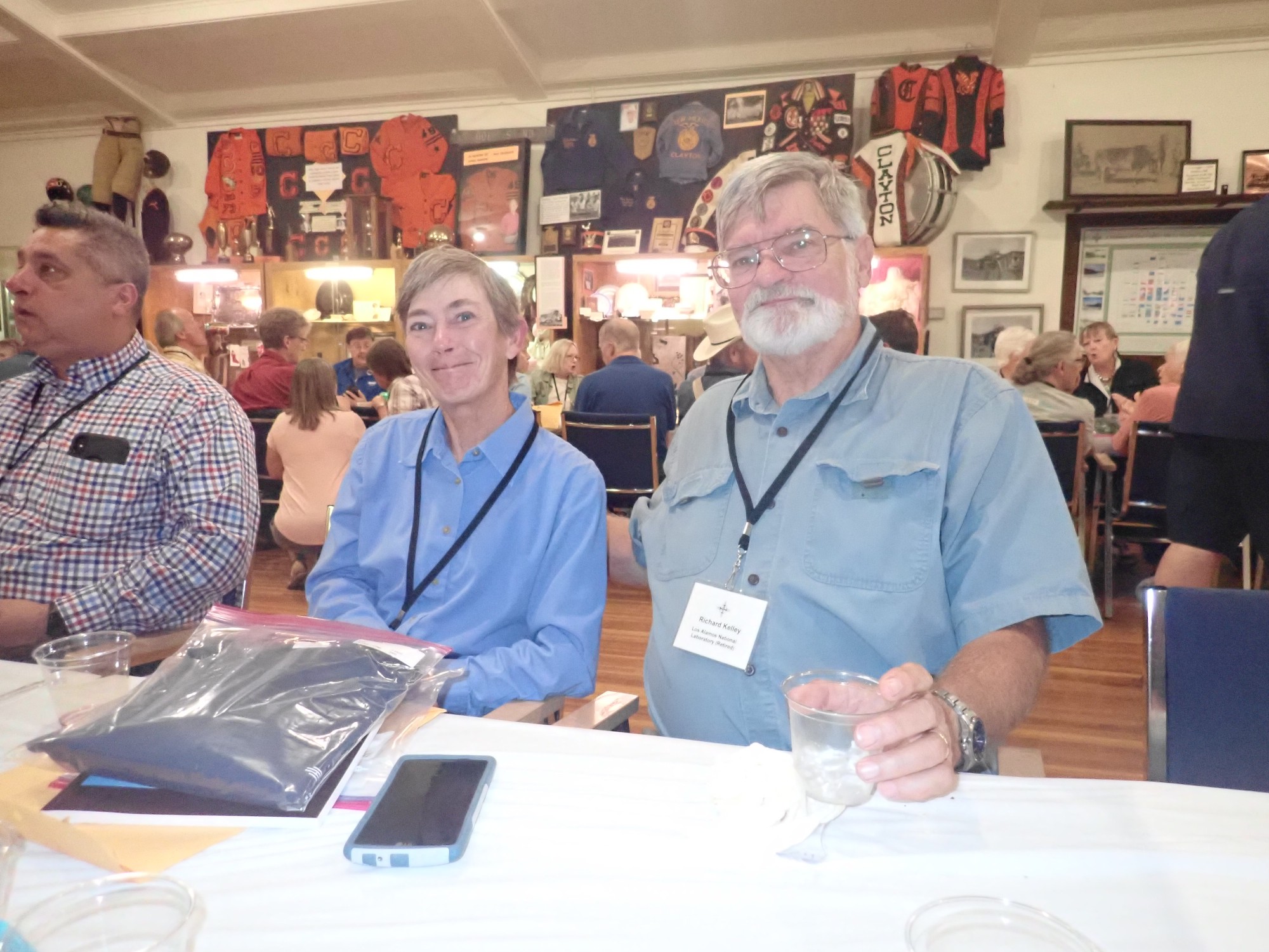
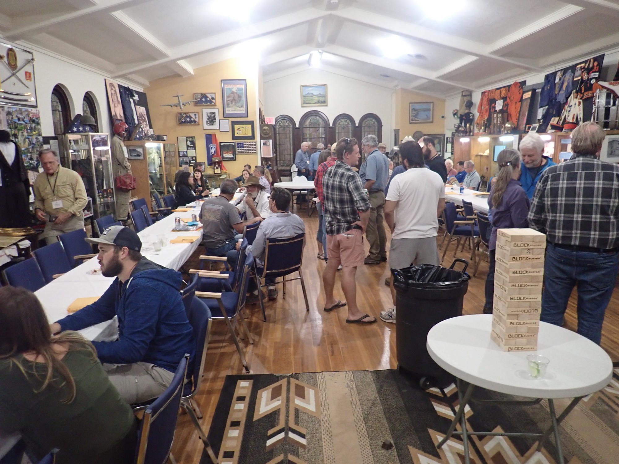
With the tent up, we head back to the Herzstein Memorial Museum, one of the hosts for the conference, for the opening icebreaker.
I am somewhat nervous, not knowing exactly what to expect and feeling a bit self-conscious as a serious, but nonetheless amateur, geologist* at a conference full of professionals. However, I am put at ease when I spot Rick and Shari Kelley. Rick is a regular attendee at Los Alamos Geological Society events who is wonderfully tolerant of my amateur enthusiasm, and Shari has led some excellent hikes for LAGS, and seeing them here helps me feel more at home.
The room fills.
The Herzsteins, who founded the museum, were a successful local couple whose teenage son was killed by outlaw “Black Jack” Ketchum. I am examining the display on his history when a museum guide materializes and tells us the story. It sounds like Black Jack was a genuine psychopath. He was wounded and captured while trying to rob a train, lost an arm, and then was sentenced to hang. Clayton had never had a hanging before (and never would again) and the hanging was botched; Black Jack had gained considerable weight, the rope was improperly stretched, and the drop was miscalculated, resulting in his head being snapped off. I suppose that was as quick and merciful an execution as if it had been done correctly, but a little tough on the spectators.
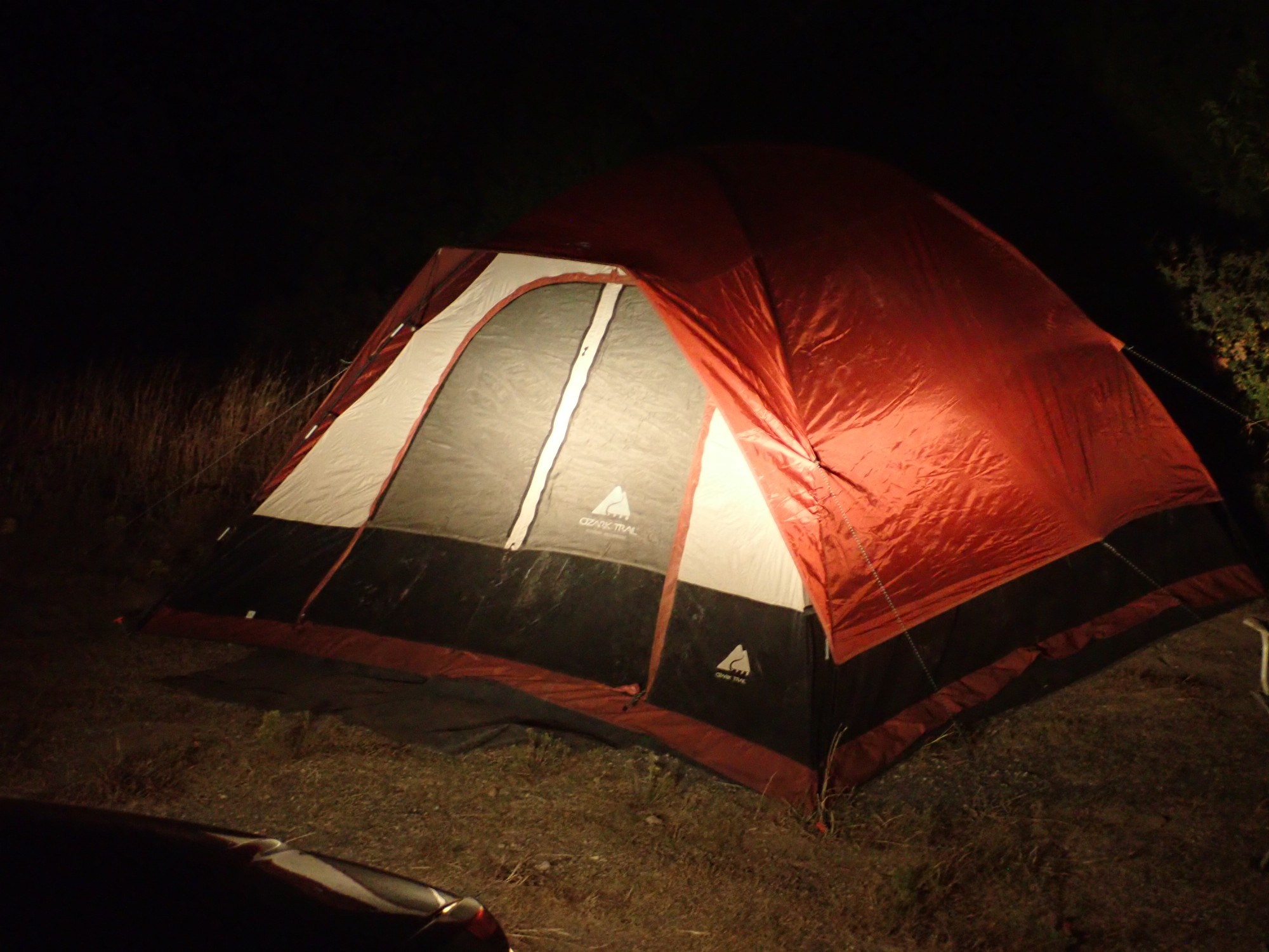
Tent sweet tent.
I sleep reasonably well, considering that I’ve once again forgotten a pillow and must use my sweater. It’s not too cold a night and I have no particular problem keeping warm.
*I am not entirely amateur. I spent about a year at Sandia National Laboratories a couple of decades ago working on ground water modelling for WIPP certification. However, that was a long time ago, and I’m an astronomer by training and a computational physicist by current vocation.
Next: Primitive vulcanology
Love the photos!
Pingback: Wanderlusting Mount Taylor, Day 1 | Wanderlusting the Jemez
Pingback: Wanderlusting Mount Taylor, Day 3 | Wanderlusting the Jemez