Wanderlusting lower Ancho Canyon
We’re in the midst of the monsoon season, but the monsoon here typically has breaks of a few days of quite dry weather. One such was forecast for this weekend, and naturally I had to take advantage of it.
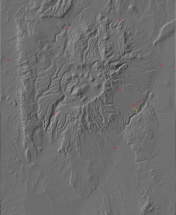
I was torn between a number of options. I would like to go back to the Rito de las Perchas and explore southwest rather than northeast, to get to a real exposure of the very ancient metagabbro, but I dropped that idea rather quickly; it’s a long drive and I’m a bit tired of the area after two recent long visits. I would like to hike the trail from near St. Peters Dome to Cerro Picacho, but that would be an awful place to be caught by even a small local thunderstorm. I very nearly decided on Obsidian Ridge, although it’s a touch exposed, but decided to save it for hiking with a friend since it’s a moderate hike (4 miles round trip) on an easy trail with cool obsidian guaranteed at the far point. That left the Ancho Springs Trail, which I’ve sniffed around several times but never taken.
So I pack up a trail lunch, three bottles of water (barely enough, as it turned out), my cell phone, GPS, and camera, hammer, loupe, other sundries; slathered myself with protected polyphenols against sun and bugs; and drove the short distance to the trail head.
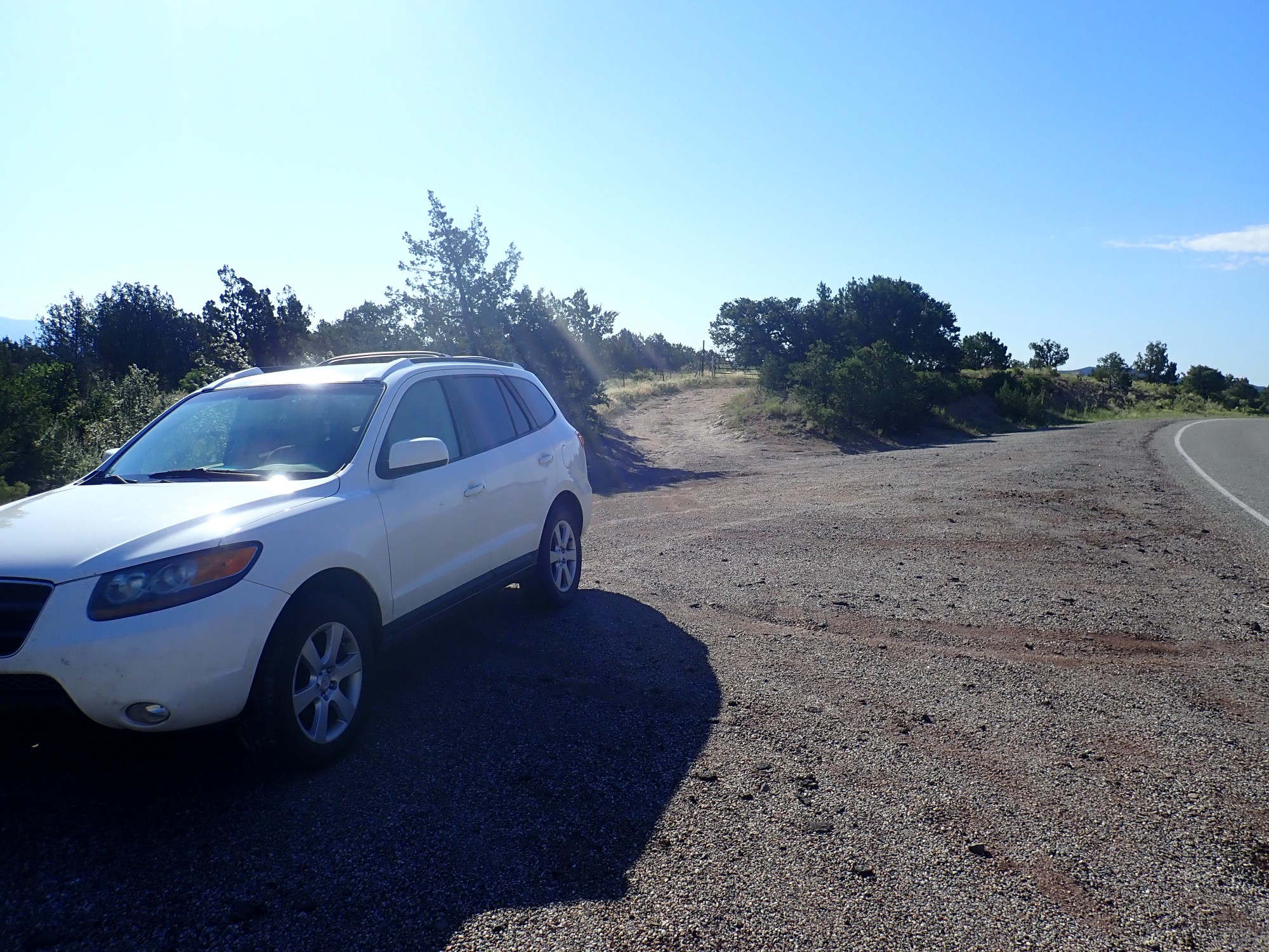
Except this was the wrong trailhead; Knife Edge Trail. A fine enough trail but not the one I had intended. The trail heads are much alike, but you’d think I could tell them apart by now. I head back north and get to the right trail head.
Because I’ve hiked the Powerline Trail many times before, I pause for a photograph only once before reaching the turnoff to Ancho Springs Trail.
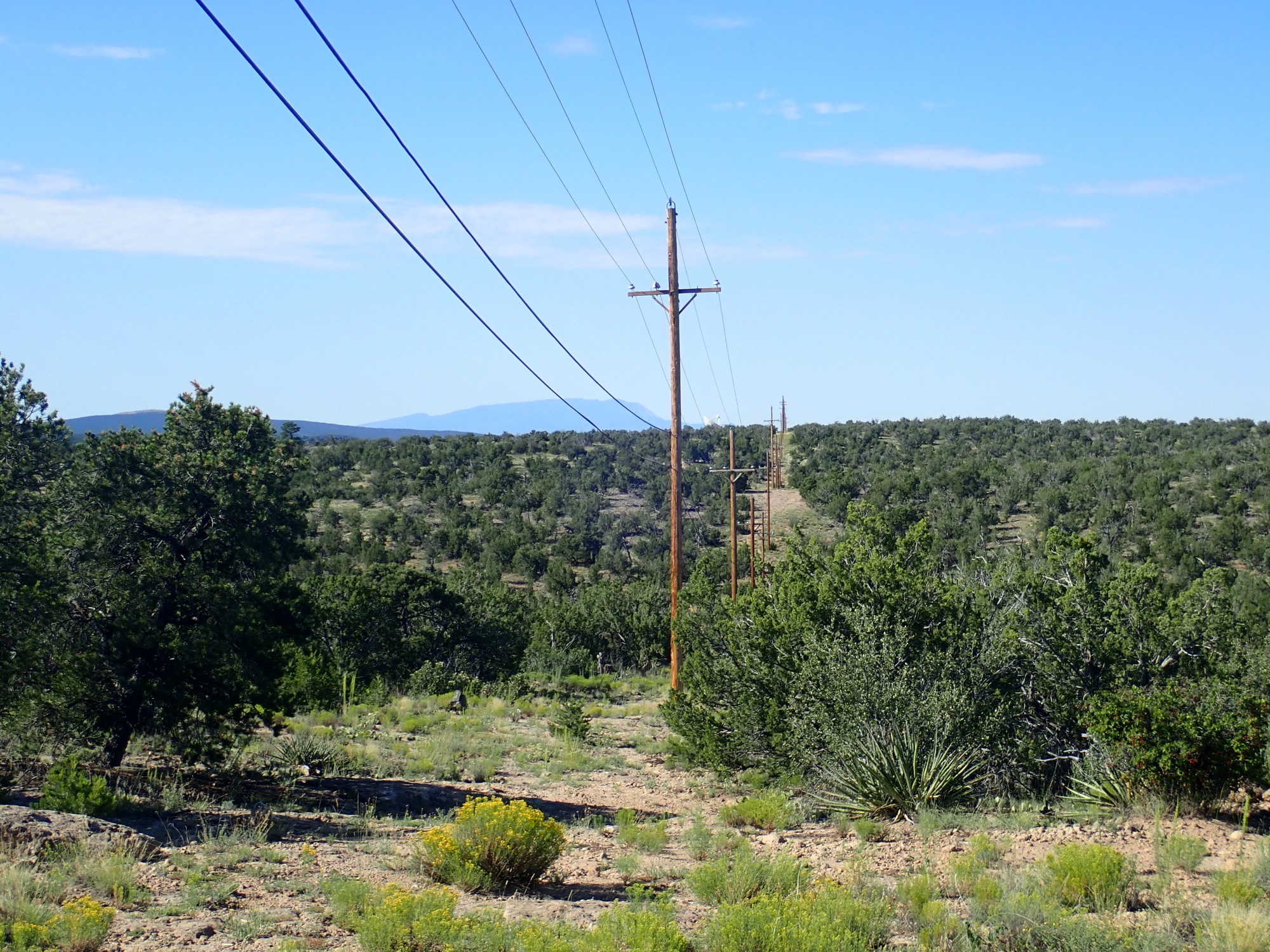
I dunno. With the power lines trailing to the south, and the VLA antenna just to the left, and Sandia Crest left of that, it seemed vaguely artistic.
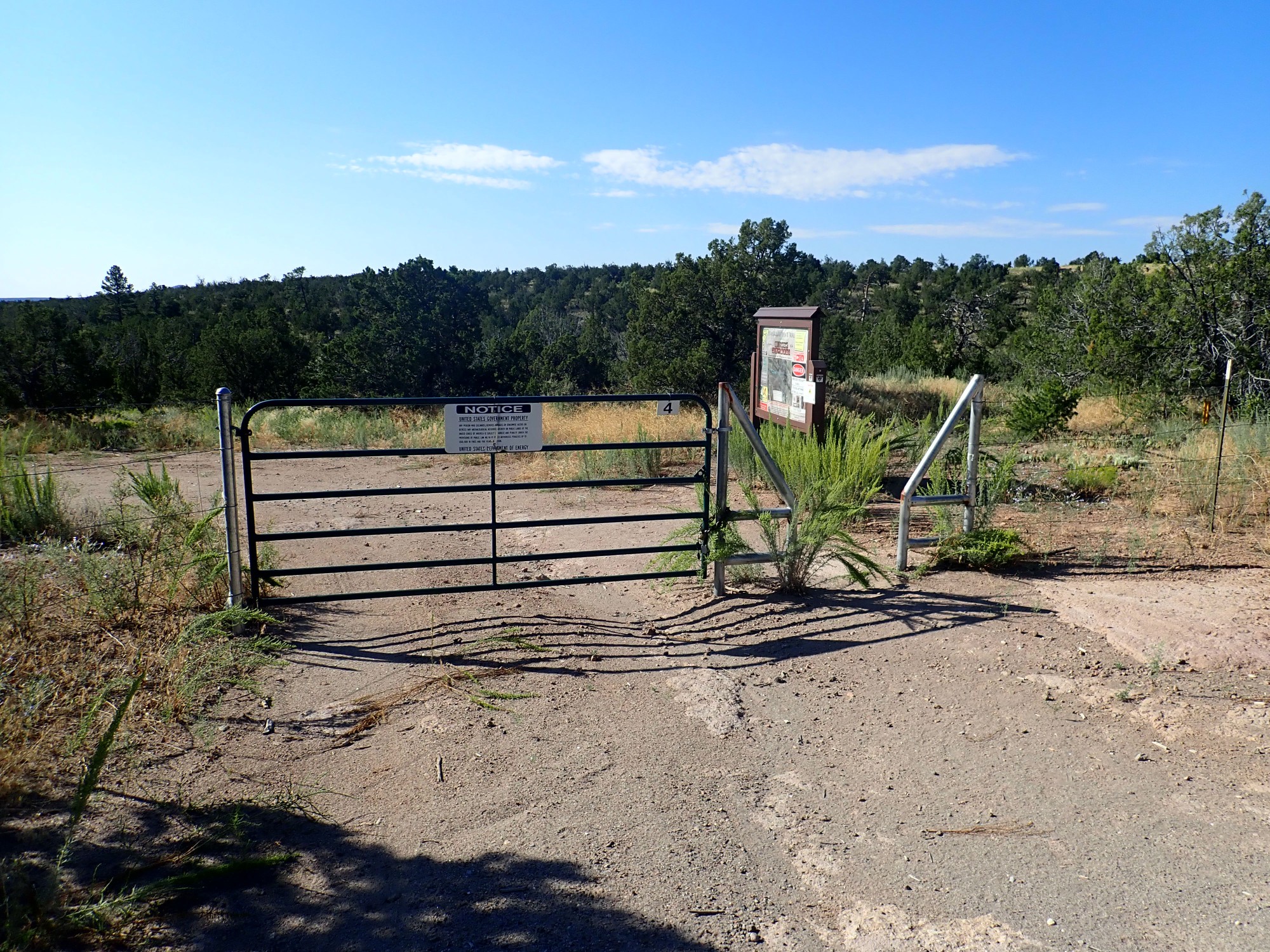
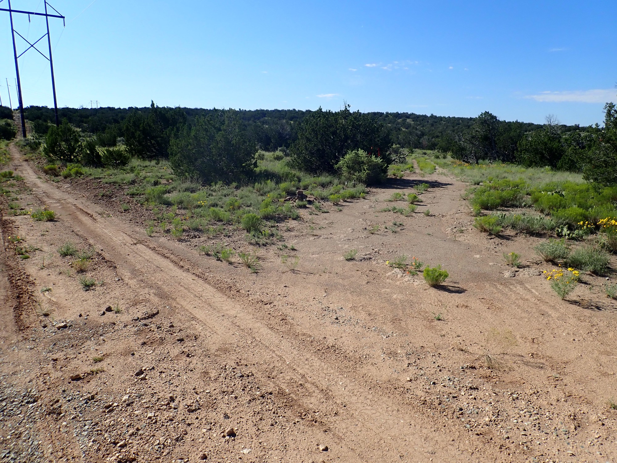
The turnoff to Ancho Springs Trail.
The entire trail to this point has been on the upper surface of the Tsherige Member of the Bandelier Tuff. For those who have not heard this spiel many times before: The Bandelier Tuff is the most prominent formation of the Pajarito Plateau, and consists of ignimbrites from two massive caldera eruptions from the central Jemez Mountains. The first, at 1.62 million years ago, is known as the Toledo Event and produced the lower or Otowi Member of the Bandelier Tuff. A second eruption 1.25 million years ago is known as the Valles Event and produced the present Valles Caldera, while laying down the Tsherige Member of the Bandelier Tuff.
In both cases, vast quantities of highly viscous high-silica magma disintegrated under the pressure of their own dissolved gases to produce a red-hot mixture of tiny fragments of volcanic glass and gas that poured out across the landscape for miles in all directions (pyroclastic flows), destroying everything in its path, before settling to the surface and consolidating into the hard rock of the Bandelier Tuff.
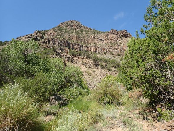
The hill just ahead in the photograph is a ridge of a somewhat older rock, basaltic andesite of the Cerros del Rio Formation. This formation underlies the Cerros del Rio southeast of White Rock across the Rio Grande, but it also extends across the west side of the river beneath the Bandelier Tuff — probably for a considerable distance.
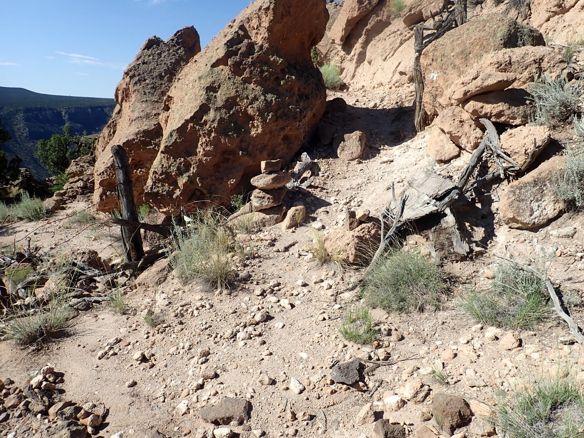
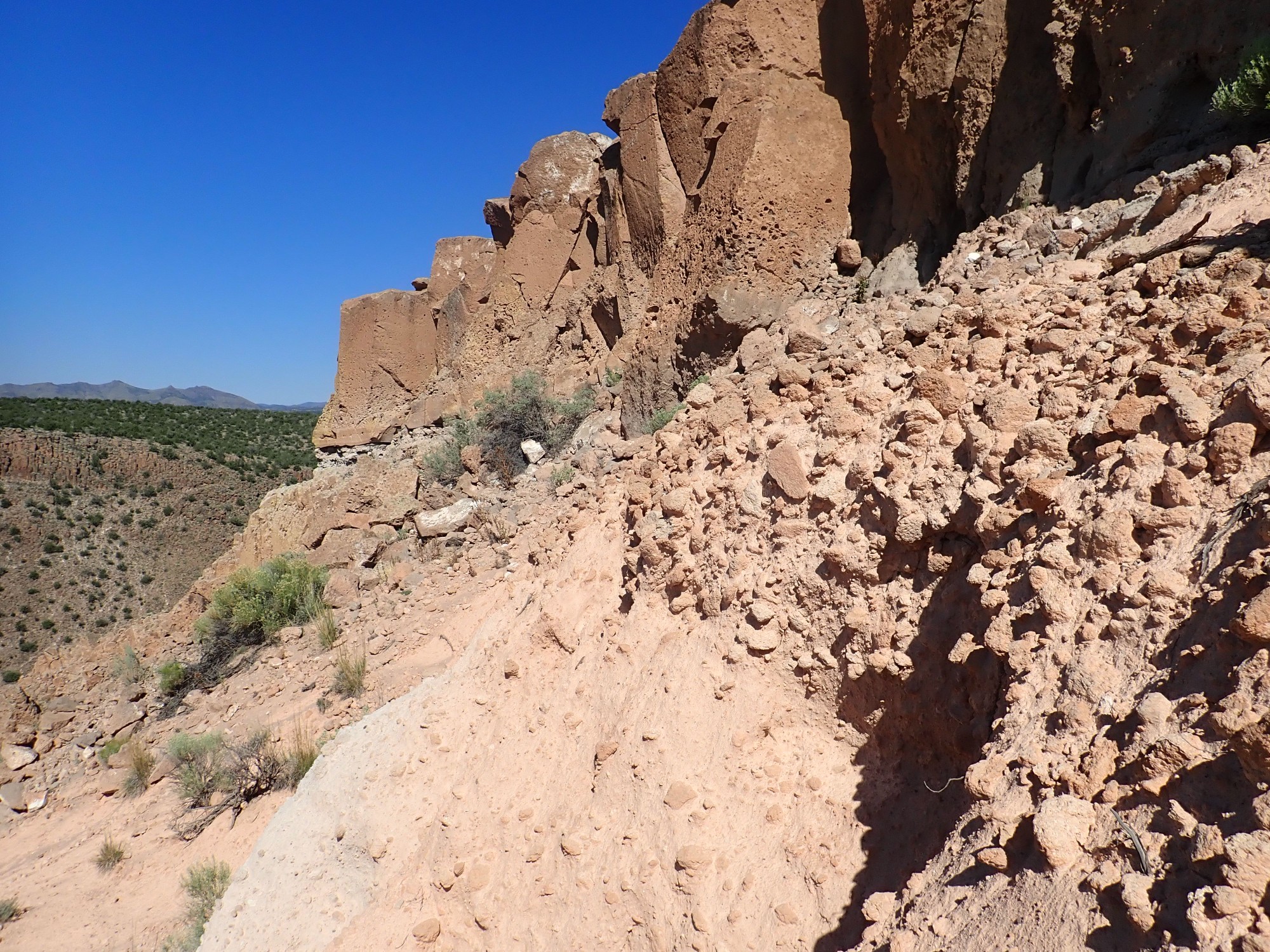
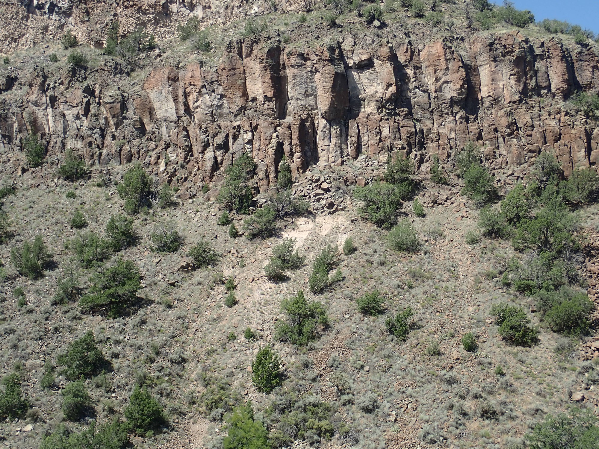
I turn right and follow the trail to the canyon rim. It’s easy to take a wrong turn here; there are two trails to the left that are not the right trail. The right trail is marked with cairns and goes up a small knoll, threading its way through boulders of the distinctively salmon-colored Tsherige Member.
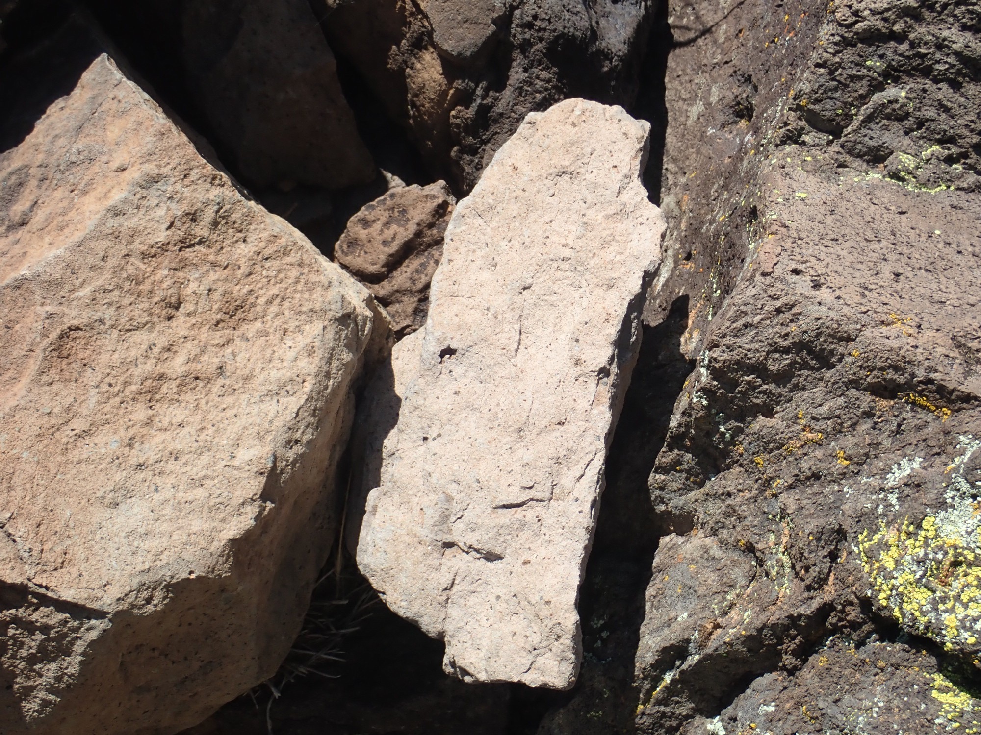
This part of the rim is really quite intriguing geologically. I paused here for some time to try to work out the story the rocks are telling. This begins with the observation that there is a great deal of large chunks of pumice in the area, some of which are entrained in the lowermost part of the Tsherige Member flow unit here.
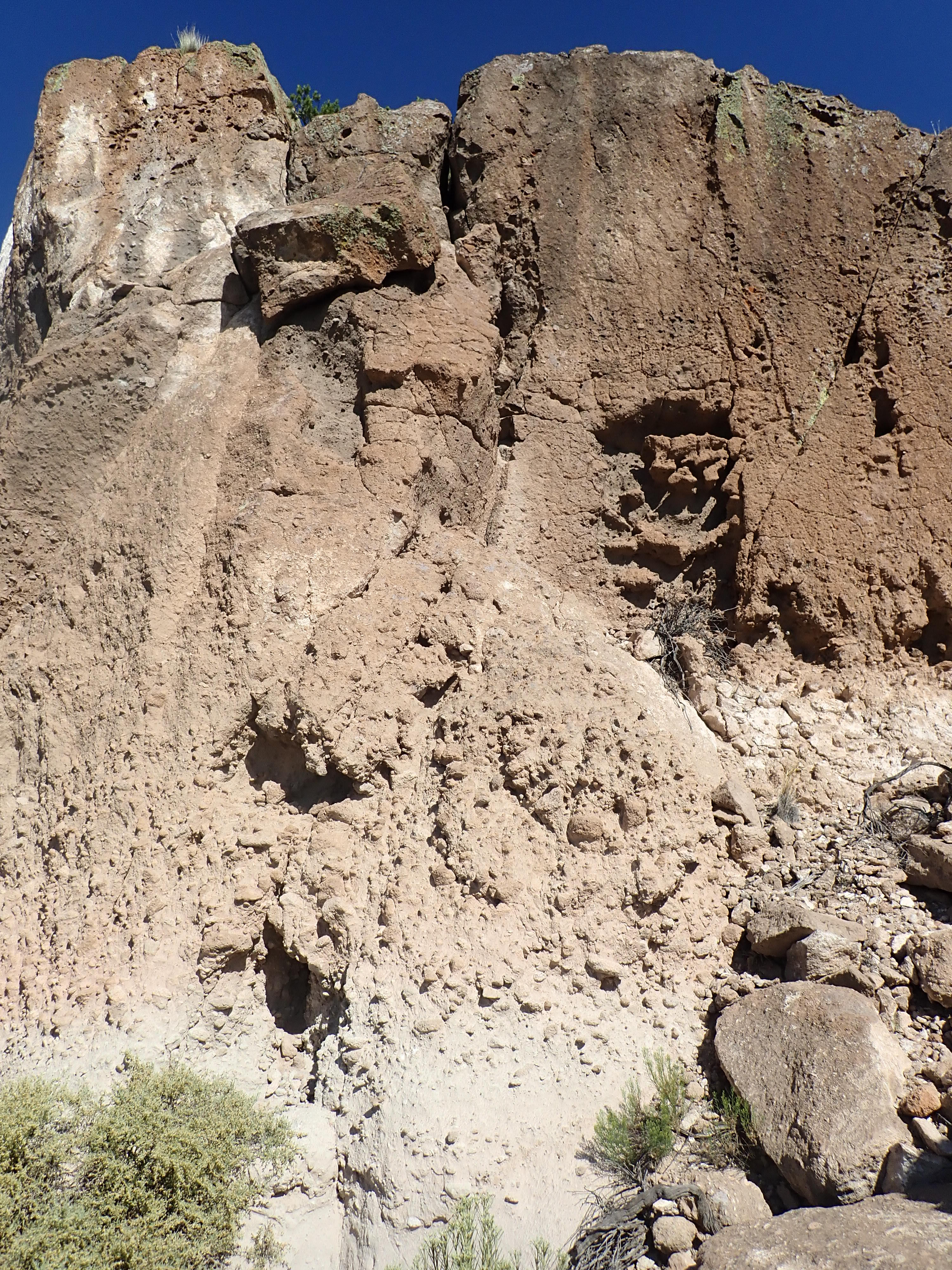
The upper part of the cliff is massive ignimbrite, but the lower part is rich in large pumice clasts. I know of nowhere else this is the case with the Tsherige Member. (It has zones rich in pumice in other places, but not the big clasts you see here.)
Okay, let’s unpack some of that. Pumice: This is volcanic rock formed from very viscous magma thick with dissolved gas that expands at the surface to form a kind of glassy foam. This hardens into a very light (but surprisingly strong) rock. It’s resistant enough, despite its foamy structure, to weather out of the solid ignimbrite more or less intact. Entrained: Caught up in the pyroclastic flow before it settled to the surface and solidified.
This had me puzzled.
At left you see a gray bed separating two sections of Tsherige Member. This is found elsewhere in the Pajarito Plateau and is describe as a “sandy parting” in some geologic papers. It almost certainly marks a boundary between two separate pulses of pyroclastic activity during the Valles eruption. But it pretty much disappears to the right, where there is this bed of pumice below the upper unit. Is the pink stuff in the foreground reworked tuff, eroded off the cliff and recemented as a kind of sedimentary rock, with the pumice also eroded out of the base of the flow?
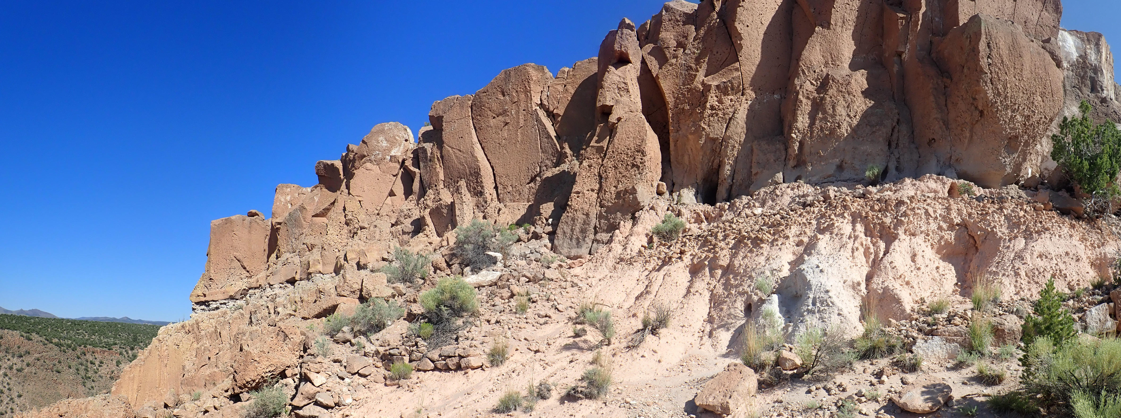
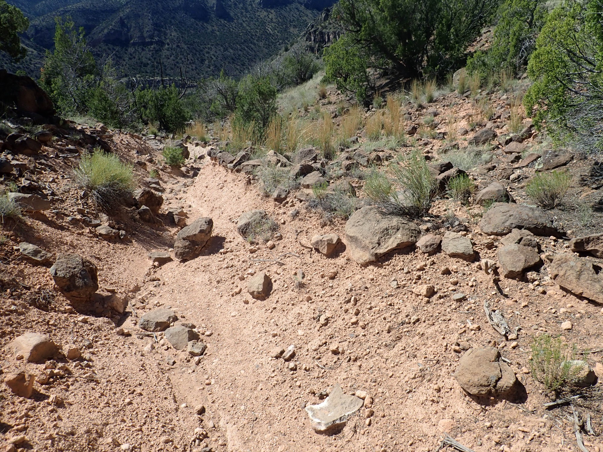
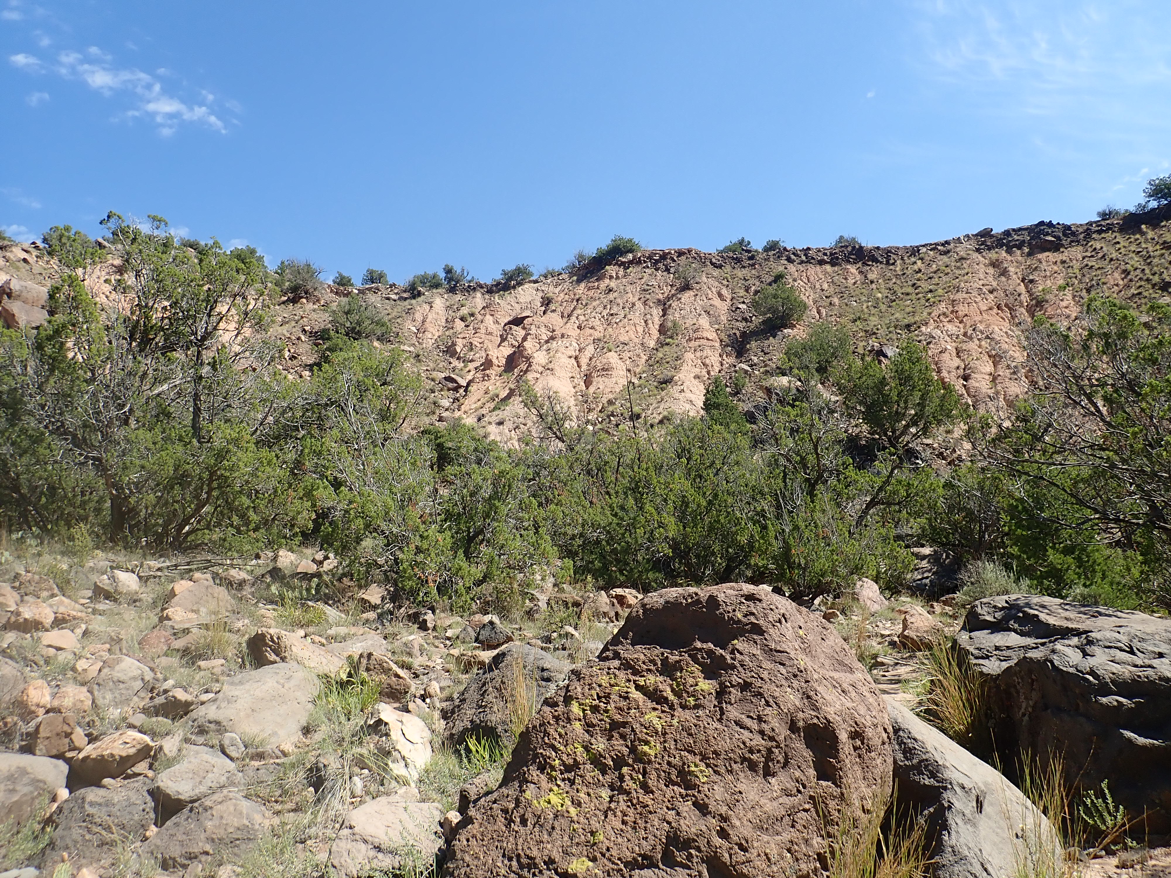
This is also the most indistinct part of the trail. I have to look sharp for where the switchbacks down the mountain begin, but they’re clear enough once located a few feet further down. This also gives me a little better view of what is going on at the canyon rim.
You can click to get a higher-resolution image, as with most images at this site.
I’m beginning to get the shape of a story in my head. I already know that the Rio Grande, or one of its tributaries, likely once passed to the west of this location (left in the photograph). The area at lower right in the photograph might have been part of the east rim of this ancestral White Rock Canyon, rather than west of the canyon as it is today. Pumice accumulated on the rim; it’s impossible to be sure without laboratory analysis, but this is likely similar to the pumice near Overlook Park, which is thought to be part of a lake bar from when White Rock Canyon was blocked by flows of the Otowi Member and a lake formed to the north. The blockage was eroded through, the lake receded, and then the Valles Event filled the ancestral White Rock Canyon with Tsherige Member to the rim (the lower section to the left), there was a pause, and then a second pulse overtopped the rim, entraining big chunks of pumice from the old lake bar on the rim top, at right.
It’s a pretty good story. There’s even a pretty good chance it’s true.
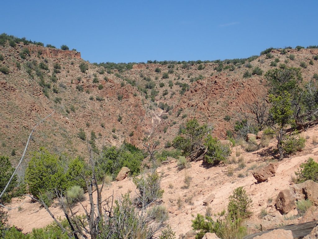
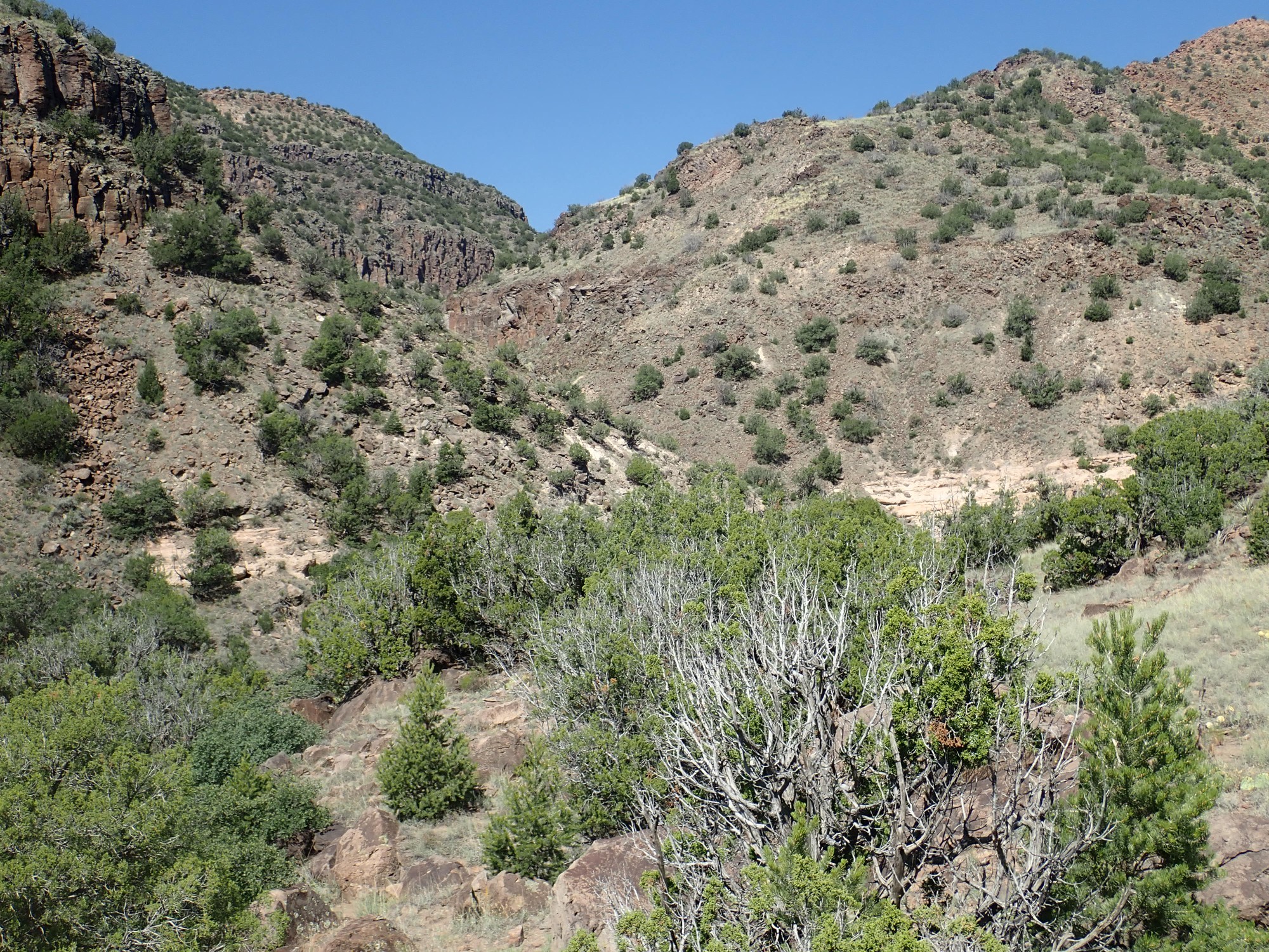
Further down, I turn my gaze to the south and southwest, across Ancho Canyon.

At left is White Rock Canyon, with the Rio Grande visible at its bottom. The mountain on the skyline is Montoso Peak, underlain by basalt of the Cerros del Rio Formation. The tributary canyon at its feet is Montoso Maar, which I visited some years ago. On this side of White Rock Canyon, there is a butte of dark basaltic andesite of the Cerros del Rio, with more beds of basalt and basaltic andesite to the right with a thin cap of Tsherige Member. Here Ancho Canyon emerges from beyond the massive cliffs of Tsherige Member crossing most of the right side of the panorama; the canyon immediately in front of us is unnamed on the geologic map.
Note how thick the Tsherige Member is across the unnamed canyon. It is well below the level of the older Cerros del Rio flows beyond. Here the Tsherige Member filled a deep paleocanyon, possibly the main canyon of the ancestral Rio Grande itself, and we are likely looking at a longitudinal section of that paleocanyon.
I descend far enough down the switchbacks to see up into a tributary of the modern unnamed canyon to the northwest.
Much volcanic rock forms cooling columns as it solidifies; you see it in both the Cerros del Rio basalts and the Bandelier Tuff, otherwise quite different volcanic rock, though it is not a universal feature of volcanic flows. The columns to the right are tilted to the south. Since such columns tend to form perpendicular to whatever surface the flow is resting on, this suggests there was a sloped surface to the right when the Tsherige Member drowned this area in red-hot ash.
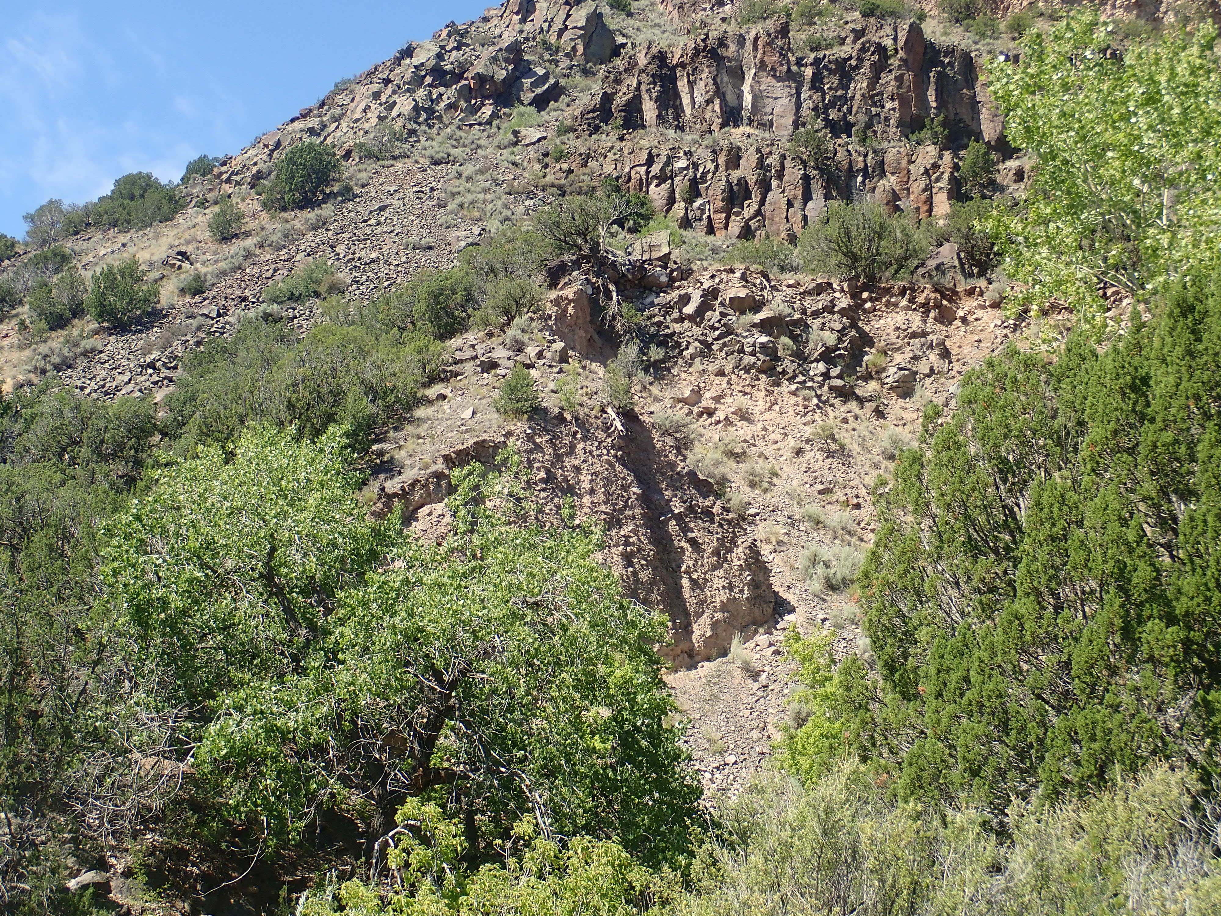
Looking back up at the trail above.
The mass of dark rock to the right is Cerros del Rio basaltic andesite. If I’ve worked out the story right, this was the east rim of the ancestral White Rock Canyon, and the first pulse of the Tsherige Member filled the canyon to the left. Then a second pulse capped the area and entrained pumice from atop the former canyon rim.
At this level, the rock along the trail all looks like basaltic andesite eroded from above.
Some of this rock has a very dark coating of desert varnish, but the clast (broken rock fragment) at center is more pristine and show the original basaltic andesite was medium gray, with visible crystals of black hornblende and a few light crystals of plagioclase feldspar. This is pretty typical of a basaltic andesite,which is mostly composed of pyroxene and plagioclase feldspar. Hornblende is a hydrated version of pyroxene.
Further down I cross a Cerros del Rio flow that has quite different character.

The geologic map does not distinguish this flow, which is part of a confused area of landslides that has messed up the original rock layers. But this looks like a true basalt with plenty of vesicles (gas bubbles) but no visible crystals.
And here I cross a very young volcanic deposit.
The canyon is deep enough here that my GPS locks are uncertain, but this is likely reworked El Cajete pumice. The El Cajete eruption came from a vent south of Redondo Peak that I’ve visited a couple of times, and is part of the youngest eruption sequence in the Jemez. This erupted domes of obsidian close to the vent along with a great deal of pumice, which blanketed much of the southern Jemez and can be found as far east as the Cerros del Rio. The eruptions also produced Battleship Rock and Banco Bonito.
The eruptions were so recent that the usual radiometric dating methods don’t work, telling us only that it was less than a quarter million years ago; while archaeological dating methods are equally uncertain, telling us only that it was more than 30,000 years ago. Recently the new radiometric dating laboratory at New Mexico Institute of Mining and Technology used high-precision methods to get a reasonably accurate age of 73,000 years. That is very long ago in human terms, but just a blink of an eye in geologic terms — the Jemez are still a potentially active volcanic field and will almost certainly erupt again, though likely not in our lifetime.
Approaching the mouth of Ancho Canyon.

You can see that the thick beds of Cerros del Rio Basalt extend well up into Ancho Canyon at left. At right the thick beds of Tsherige Member filled the paleocanyon discusssed earlier. And at right is the east rim of that paleocanyon that I descended earlier in the hike.
This area is characterized by platy basalt from an early flow of the Cerros del Rio.

I’m still in the area mapped as landslide block, but this looks like an intact outcrop. However, White Rock Canyon is famous for its toreva block landslides, and this could be an area of coherent slumping that leaves even fragile rock like this intact.
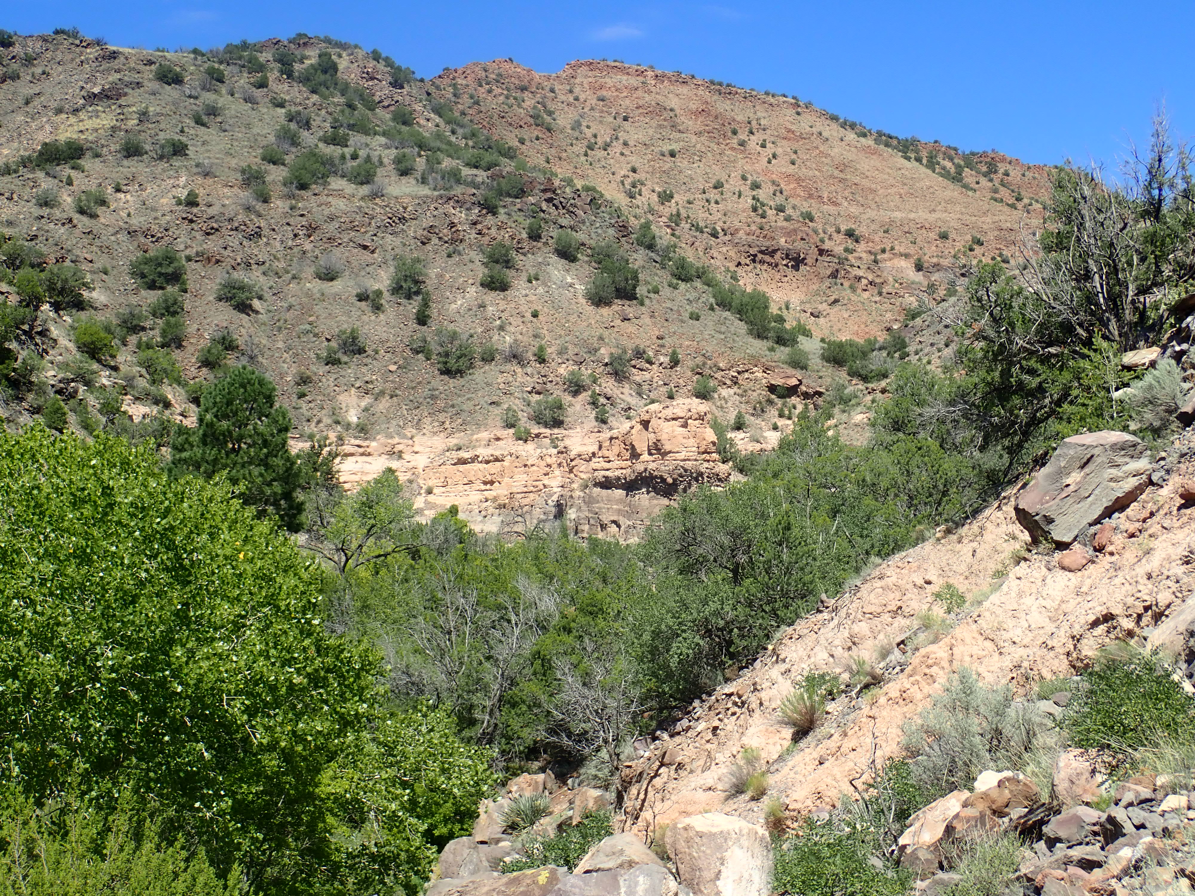
Finally approaching Ancho Canyon.
The Cerros del Rio basalt is very thick here,suggesting it filled an even earlier ancestral White Rock Canyon. But we are finally at the base of the flows,and can see light beds of sediments beneath. The geologic map identifies these as Puye Formation, formed around 5 million years ago from volcanic ash-rich material eroded from the Sierra de los Valles that forms the skyline west of Los Alamos. These were active volcanoes at that time.
The second photo shows two basalt flows that cooled at different rates, judgting from the size of the cooling columns.
I pass by an erosion scarp.
This is mapped as Vallito Member, Chamita Formation, Santa Fe Group. The Santa Fe Group is rift fill sediments, eroded off nearby higher ground to fill the Rio Grande Rift, the great crack in the earth’s crust extending from central Colorado to the El Paso area. This is where tectonic forces are pulling the Colorado Plateau away from the central craton (stable contintental crust) of North America. The Rift first began opening around 30 million years ago, then picked up the pace around 12 million years ago. Rifting became more focused in the area just west of the modern Rio Grande, and the sediments here are assigned to the Chamita Formation. The Vallito Member is mostly floodplain deposits of the ancestral Rio Grande.
Across the canyon is a bed of coarse river gravel of the Totavi Lentil.
The Totavi Lentil is found at the base of the Puye Formation and is usually regarded as part of that formation. However, since it is distinct in character and origin, there is a proposal to raise it to formation status. It’s mostly nonvolcanic gravel laid down by the ancestral Rio Grande, while the Puye Formation is volcanic debris eroded off the mountains to the west.
In this area, the trail becomes quite indistinct in places; I take some looks back, to help fix in my head where the trail will be when I return. Part of it may be that this is the Ancho Spring Trail and Ancho Spring is actually up the canyon to the west; but there is no obvious trail that way, either, and I am not actually interested in visiting the springs.
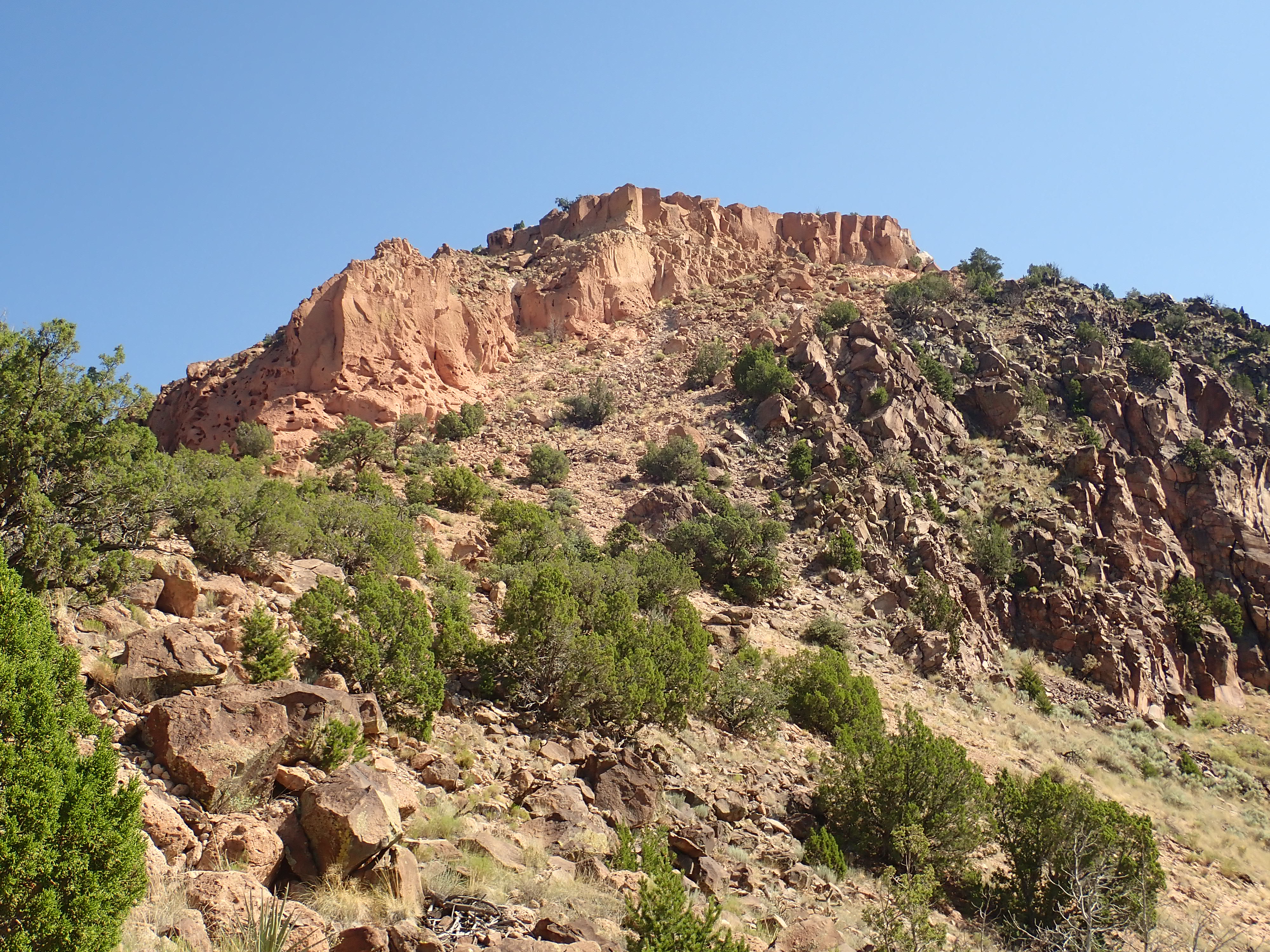
I can’t resist a photo of the mountain above, with its many basalt flows.

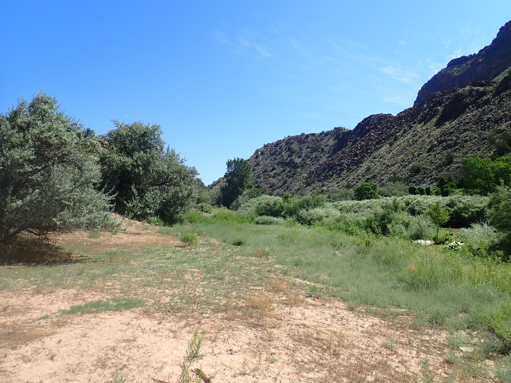
And then I am on the delta of Ancho Creek.
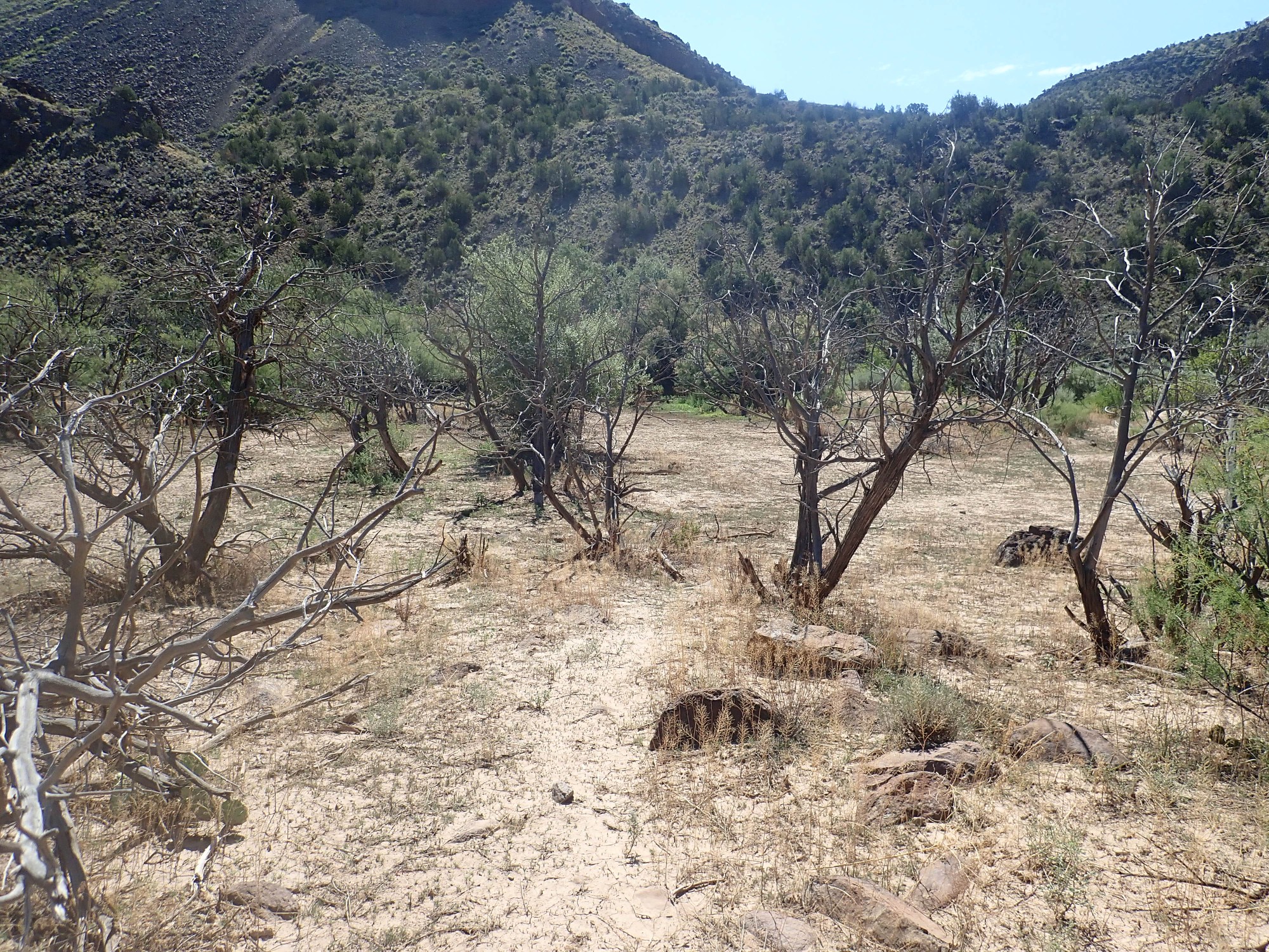
Ancho Spring is a productive enough to feed a small creek that is close to perennial (present all year.) However, in the cooler, wetter past of the so-called Ice Ages (Quaternary Glaciation, to geologists), there was probably a substantial river coming through Ancho Canyon that laid down this delta. And there is likely periodic flooding in the canyon, every few years in the spring, that continues to build it up.
And according to the geologic map, the engineers of Cochiti Dam optimistically assumed a high-water level that would put this entire area under water. And perhaps it has actually been underwater in a few choice years, judging from the dead trees. But not often, judging from the live ones.
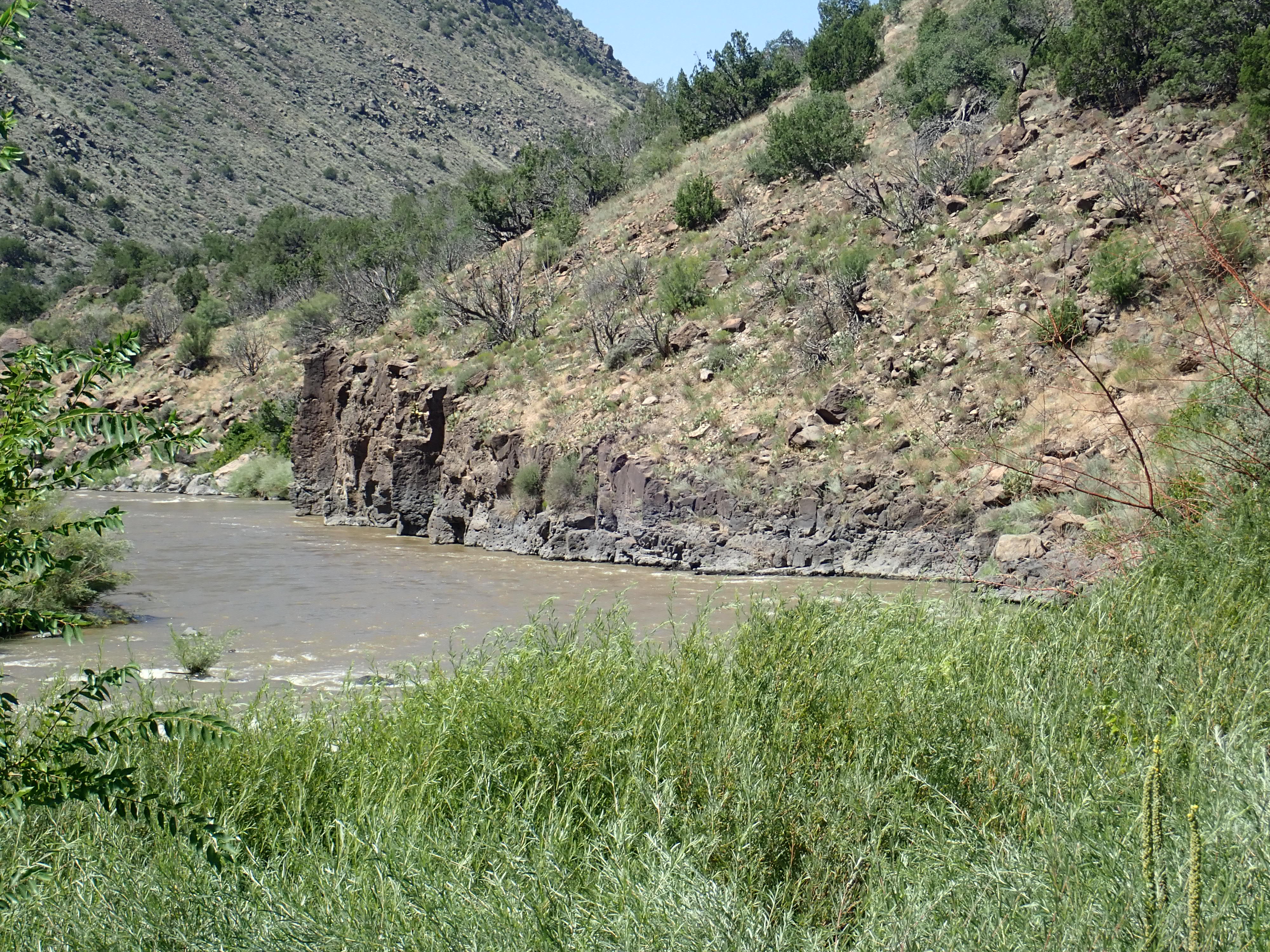
The river, at last.
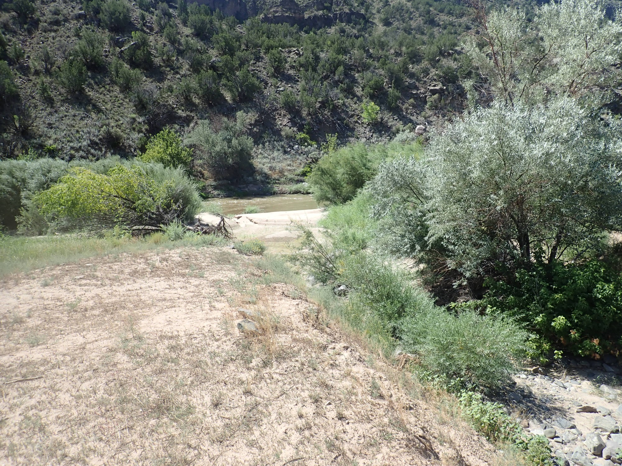
I don’t bother to go down to the actual bank. I don’t like getting my feet wet. In fact, while I’m a competent swimmer, I don’t actually like getting in water much.
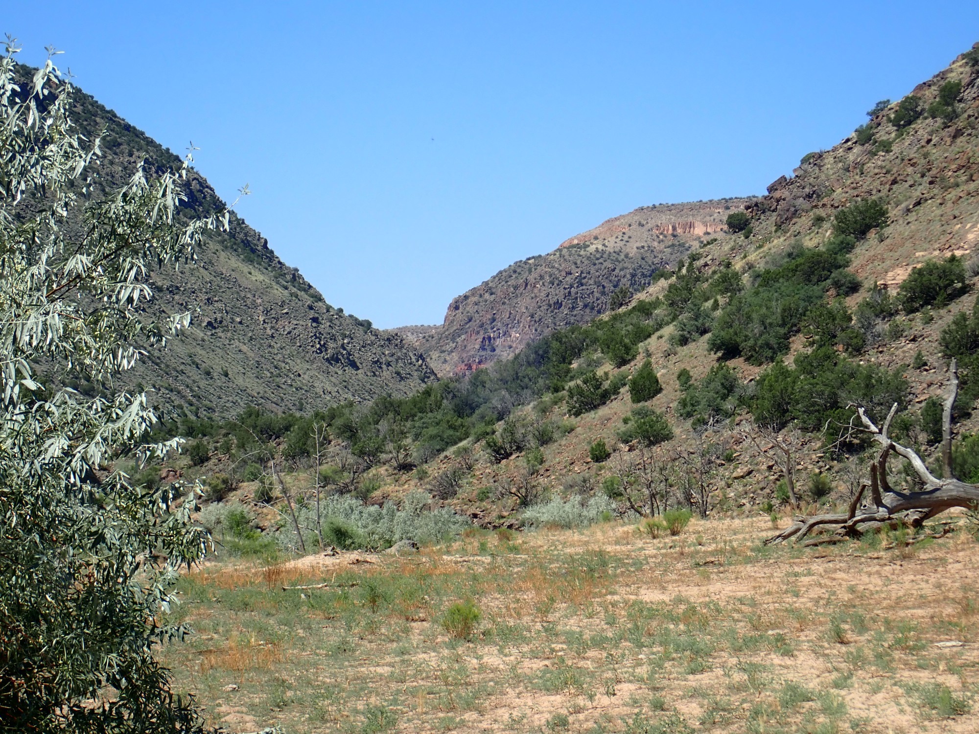
Looking northeast up the canyon.
And southeast down the canyon.
South is more interesting. We see the south wall of Chaquehui Canyon, which enters the Rio Grande from the west (right), where there is a great thickness of basaltic andesite. Below, just visible, are red beds of phreatomagmatic cinder — lava that came into contact with ground water to produce steam explosions and thick beds of mixed lava fragments and fragments of the rock through which the lava erupted. These extend further south to Frijoles Canyon, where they are spectacularly visible around Upper Falls.
Wildflower.
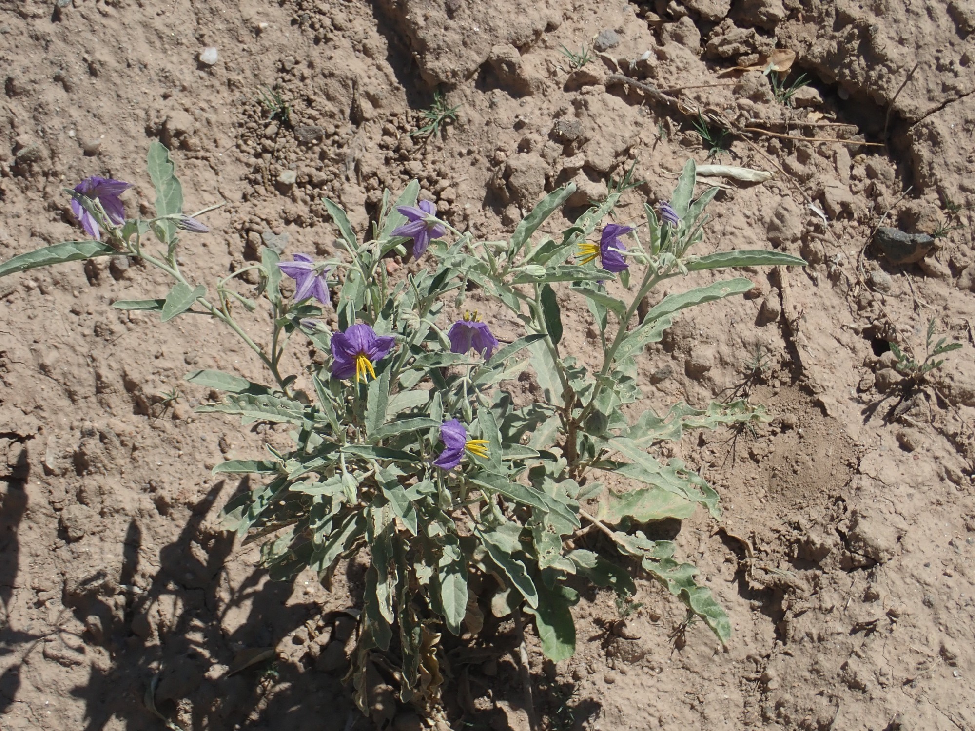
There’s quite a lot of this blooming. The flowers, leaves, and fruit shout “solanum family” and when I look it up, it looks to be silverleaf nighshade, Solanum eleagnifolium. Very toxic.
And my putative goal this hike:
This basalt flow, located right down at river level, is perhaps the oldest known flow of the Cerros del Rio Formation.
I look for a way to get close, but there’s not much hope. It’s exposed along the river with no bank at all and no safe approach from above.
It’s not yet noon, but I anticipate a grueling climb back up. And I’m a little worried whether I can pick up the trail again. Fortunately, I find there is helpful cairnage.
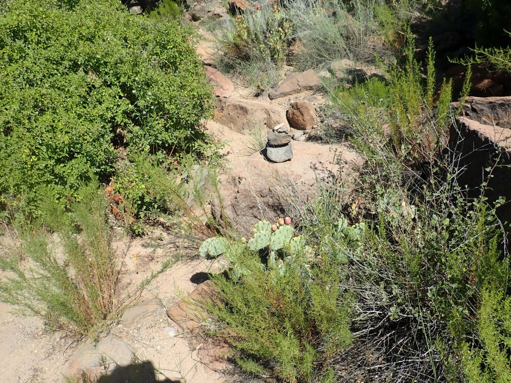
And I really can’t go wrong just following Ancho Creek, at least for a while. At times, my own footsteps coming down are visible and help me retrace.
I pause for a better photo of the Puye Formation beds.
This also gives a nice view of the Tsherige Member beyond, apparently lapping up against the south wall of the ancestral White Rock Canyon.
There is some basalt near here that show definite signs of hydrothermal alteration.
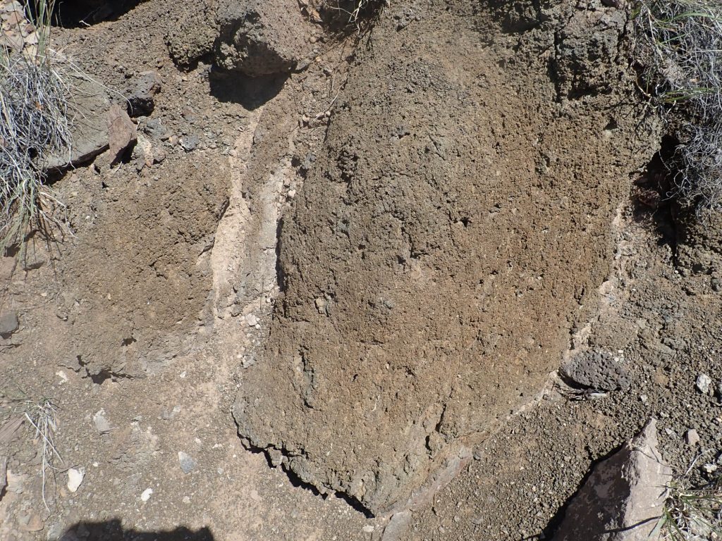
The rock has been reduced to a spongy texture, easily crumbling to the touch and with indications of alteration minerals filling its voids. This is low enough in the Cerros del Rio Formation that this could be an early eruption through water-saturated sediments that produced enough residual steam to alter the rock.
The climb up is indeed grueling, and there a couple of awkward moments trying to find the right trail. I pause for lunch and one last photograph, just before noon, at what may be the last shady spot for a while.

The light’s not ideal, but you can see into Montoso Maar at right, where the beds of cinder are clearly visible. At far left across the canyon is a plug of rock that geologists have identified as a body of basalt that cooled underground. I suspect it has unusually coarse texture and would be interesting to get a sample of … but getting to it safely is a bit of a problem.
I continue the climb out of the canyon. It’s grueling. I’m stopping to catch my breath about every thirty feet on the switchbacks just below the rim, but my heart doesn’t give out and I make it. (And it’s reassuring to push my endurance this much and not have any obvious heart symptoms; I think my heart is still in good shape at the moment. Though this is not the safest form of stress test …)
On the way out, I come across a British couple who hiked to the rim, did not like the look of the trail down, and decided they were good for the day. The hike to the rim alone is certainly worthwhile; the view is wonderful and it’s a good four miles round trip. They ask for recommendations of other trails and I give them some.
And then home, where I find myself quite exhausted but recover with air conditioning and diet root beer.